
 A SCHOLARLY BOOK REPOSITORY
25 start with D start with D
Combining scientific curiosity with travel and adventure, Dancing at the Dead Sea takes the reader on an intimate tour through the world's environmental hotspots. Readers join Mitchell as she tracks the spectacular biodiversity of regions as extraordinary as the island of Madagascar, the rain forests of Suriname, the parched oases of Jordan, the Arctic desert of Banks Island, the volcanic crests of Iceland, and, ultimately, the Galapagos archipelago, where Darwin conducted his famous research. Along the way, Mitchell introduces us to the numerous scientists and conservationists who are working to protect these endangered places. She also chronicles the courageous efforts of everyday men and women in these regions as they try to convince governments to turn the world's hotspots into environmentally protected areas.
Ultimately, Mitchell's travels around the world compel her to ponder our shelf life as a species in the grand evolutionary scheme of the planet. She wonders what Darwin would make of the profound ecological destruction she witnesses. Is the human race suicidal? What can help our species avert extinction? Posing tough and cutting questions such as these, Dancing at the Dead Sea is a must-read for aficionados of good science writing and travel literature alike.
Today, we know more than ever before about the powerful forces that can cause catastrophe, but significant questions remain. Why can’t we better predict some natural disasters? What do scientists know about them already? What do they wish they knew? In Dangerous Earth, marine scientist and science communicator Ellen Prager explores the science of investigating volcanoes, earthquakes, tsunamis, hurricanes, landslides, rip currents, and—maybe the most perilous hazard of all—climate change. Each chapter considers a specific hazard, begins with a game-changing historical event (like the 1980 eruption of Mt. St. Helens or the landfall and impacts of Hurricane Harvey), and highlights what remains unknown about these dynamic phenomena. Along the way, we hear from scientists trying to read Earth’s warning signs, pass its messages along to the rest of us, and prevent catastrophic loss.
A sweeping tour of some of the most awesome forces on our planet—many tragic, yet nonetheless awe-inspiring—Dangerous Earth is an illuminating journey through the undiscovered, unresolved, and in some cases unimagined mysteries that continue to frustrate and fascinate the world’s leading scientists: the “wish-we-knews” that ignite both our curiosity and global change.
Drawing on his own ambitious research in Darwin’s manuscripts and at the Beagle’s remotest ports of call, Sponsel takes us from the ocean to the Origin and beyond. He provides a vivid new picture of Darwin’s career as a voyaging naturalist and metropolitan author, and in doing so makes a bold argument about how we should understand the history of scientific theories.

The Columbus Day Storm of 1962 was a freak of nature, a weather outlier with deadly winds topping one hundred miles per hour. The storm killed dozens, injured hundreds, damaged more than fifty thousand homes, and leveled enough timber to build one million homes. To find an equally ferocious storm of its kind, fast-forward fifty years and cross the continent to Superstorm Sandy’s 2012 attack on the East Coast. While Superstorm Sandy was predicted days in advance, the Columbus Day Storm caught ill-equipped weather forecasters by surprise.
This unrivalled West Coast windstorm fueled the Asian log export market, helped give birth to the Oregon wine industry, and influenced the 1962 World Series. It remains a cautionary tale and the Pacific Northwest benchmark for severe windstorms in this era of climate change and weather uncertainty. From its genesis in the Marshall Islands to its final hours on Vancouver Island, British Columbia, the storm plowed an unparalleled path of destruction.
In A Deadly Wind, veteran journalist John Dodge tells a compelling story spiced with human drama, Cold War tension, and Pacific Northwest history. This is a must-read for the tens of thousands of storm survivors, for history buffs, and for anyone interested in the intersection of severe weather events and climate change.
These essays, originally delivered as the 2010 Kenneth Nebenzahl, Jr., Lectures in the History of Cartography at the Newberry Library, encompass more than two centuries and three continents—Latin America, Africa, and Asia. Ranging from the late eighteenth century through the mid-twentieth, contributors study topics from mapping and national identity in late colonial Mexico to the enduring complications created by the partition of British India and the racialized organization of space in apartheid and post-apartheid South Africa. A vital contribution to studies of both colonization and cartography, Decolonizing the Map is the first book to systematically and comprehensively examine the engagement of mapping in the long—and clearly unfinished—parallel processes of decolonization and nation building in the modern world.
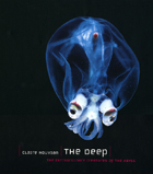
On dry land, most organisms are confined to the surface, or at most to altitudes of a hundred meters—the height of the tallest trees. In the oceans, though, living space has both vertical and horizontal dimensions: with an average depth of 3800 meters, the oceans offer 99% of the space on Earth where life can develop. And the deep sea, which has been immersed in total darkness since the dawn of time, occupies 85% of ocean space, forming the planet’s largest habitat. Yet these depths abound with mystery. The deep sea is mostly uncharted—only about 5 percent of the seafloor has been mapped with any reasonable degree of detail—and we know very little about the creatures that call it home. Current estimates about the number of species yet to be found vary between ten and thirty million. The deep sea no longer has anything to prove; it is without doubt Earth’s largest reservoir of life.
Combining the latest scientific discoveries with astonishing color imagery, The Deep takes readers on a voyage into the darkest realms of the ocean. Revealing nature’s oddest and most mesmerizing creatures in crystalline detail, The Deep features more than two hundred color photographs of terrifying sea monsters, living fossils, and ethereal bioluminescent creatures, some photographed here for the very first time. Accompanying these breathtaking photographs are contributions from some of the world’s most respected researchers that examine the biology of deep-sea organisms, the ecology of deep-sea habitats, and the history of deep-sea exploration.
An unforgettable visual and scientific tour of the teeming abyss, The Deep celebrates the incredible diversity of life on Earth and will captivate anyone intrigued by the unseen—and unimaginable—creatures of the deep sea.
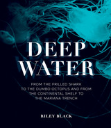
What lies beneath the surface of the ocean has mystified humankind for millennia. Today, we have explored more of the surface of the Moon than we have the deep sea. What thrives in these mysterious depths, how did these life-forms evolve from ancient life, and how has this environment changed over time as our planet has developed?
Introducing us to the ancient, complex, and fascinating life-forms that have evolved into the marine life we recognize today—from stromatolites, structures created by some of the earliest life billions of years ago and still found today, to yeti crabs, bioluminescent firefly squid, and giant jellyfish—Deep Water is an eye-opening journey into the world far beneath the waves. Our guide, brilliant science communicator and self-described “fossil fanatic” Riley Black, has studied marine biology and paleontology, and she brings her vast knowledge and inimitable voice to our voyage. Through text and image, Black leads us further and further into the depths to reveal how this unique and largely unexplored habitat came into being, what lives there and why, how it has evolved, and what the future will bring in this dark and mysterious environment.
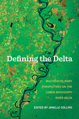
Here are essays examining the Delta’s physical properties, boundaries, and climate from a geologist, archeologist, and environmental historian. The Delta is also viewed through the lens of the social sciences and humanities—historians, folklorists, and others studying the connection between the land and its people, in particular the importance of agriculture and the culture of the area, especially music, literature, and food.
Every turn of the page reveals another way of seeing the seven-state region that is bisected by and dependent on the Mississippi River, suggesting ultimately that there are myriad ways of looking at, and defining, the Delta.
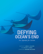
If humankind were given a mandate to do everything in our power to undermine the earth's functioning, we could hardly do a better job than we have in the past thirty years on the world's oceans, both by what we are putting into it-millions of tons of trash and toxic materials-and by what we are taking out of it-millions of tons of wildlife. Yet only recently have we begun to understand the scale of those impacts.
Defying Ocean's End is the result of an unprecedented effort among the world's largest environmental organizations, scientists, the business community, media, and international governments to address these marine issues. In June 2003, in the culmination of a year-long effort, they met specifically to develop a comprehensive and achievable agenda to reverse the decline in health of the world's oceans.
As conservation organizations begin to expand their focus from land issues to include a major focus on preservation of the sea, it is increasingly apparent that we have to approach marine conservation differently and at much larger scale than we have to date. What's also clear is the magnitude and immediacy of the growing ocean concerns are such that no one organization can handle the job alone.
Defying Ocean's End is a bold step in bringing the resources needed to bear on this vast problem before it is too late. It offers a broad strategy, a practical plan with priorities and costs, aimed at mobilizing the forces needed to bring about a "sea change" of favorable attitudes, actions, and outcomes for the oceans-and for all of us.
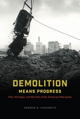
In one of the most comprehensive works yet written on the history of inequality and metropolitan development in modern America, Andrew R. Highsmith uses the case of Flint to explain how the perennial quest for urban renewal—even more than white flight, corporate abandonment, and other forces—contributed to mass suburbanization, racial and economic division, deindustrialization, and political fragmentation. Challenging much of the conventional wisdom about structural inequality and the roots of the nation’s “urban crisis,” Demolition Means Progress shows in vivid detail how public policies and programs designed to revitalize the Flint area ultimately led to the hardening of social divisions.
In recent years, the number of presidential declarations of “major disasters” has skyrocketed. Such declarations make stricken areas eligible for federal emergency relief funds that greatly reduce their costs. But is federalizing the costs of disasters helping to lighten the overall burden of disasters or is it making matters worse? Does it remove incentives for individuals and local communities to take measures to protect themselves? Are people more likely to invest in property in hazardous locations in the belief that, if worse comes to worst, the federal government will bail them out?
Disasters and Democracy addresses the political response to natural disasters, focusing specifically on the changing role of the federal government from distant observer to immediate responder and principal financier of disaster costs.
The award-winning book is now revised and expanded.
In 2001 an international panel of distinguished climate scientists announced that the world was warming at a rate without precedent during at least the last ten millennia, and that warming was caused by the buildup of greenhouse gases from human activity. The story of how scientists reached that conclusion—by way of unexpected twists and turns—was the story Spencer Weart told in The Discovery of Global Warming. Now he brings his award-winning account up to date, revised throughout to reflect the latest science and with a new conclusion that shows how the scientific consensus caught fire among the general world public, and how a new understanding of the human meaning of climate change spurred individuals and governments to action.
In the seventeenth century, a map of the plague suggested a radical idea—that the disease was carried and spread by humans. In the nineteenth century, maps of cholera cases were used to prove its waterborne nature. More recently, maps charting the swine flu pandemic caused worldwide panic and sent shockwaves through the medical community. In Disease Maps, Tom Koch contends that to understand epidemics and their history we need to think about maps of varying scale, from the individual body to shared symptoms evidenced across cities, nations, and the world.
Disease Maps begins with a brief review of epidemic mapping today and a detailed example of its power. Koch then traces the early history of medical cartography, including pandemics such as European plague and yellow fever, and the advancements in anatomy, printing, and world atlases that paved the way for their mapping. Moving on to the scourge of the nineteenth century—cholera—Koch considers the many choleras argued into existence by the maps of the day, including a new perspective on John Snow’s science and legacy. Finally, Koch addresses contemporary outbreaks such as AIDS, cancer, and H1N1, and reaches into the future, toward the coming epidemics. Ultimately, Disease Maps redefines conventional medical history with new surgical precision, revealing that only in maps do patterns emerge that allow disease theories to be proposed, hypotheses tested, and treatments advanced.
Using a wide variety of primary texts and historical maps to show how the idea of the Middle East came into being, Dislocating the Orient will interest historians of the Middle East, the British empire, cultural geography, and cartography.
Based on fieldwork with Palestinian and Syrian refugees in Jordan, Displacing Territory explores how the lived realities of refugees are deeply affected by their imaginings of what constitutes territory and their sense of belonging to different places and territories. Karen Culcasi shows how these individual conceptualizations about territory don’t always fit the Western-centric division of the world into states and territories, thus revealing alternative or subordinated forms and scales of territory. She also argues that disproportionate attention to “refugee crises” in the Global North has diverted focus from other parts of the world that bear the responsibility of protecting the majority of the world’s refugees. By focusing on Jordan, a Global South state that hosts the world’s second-largest number of refugees per capita, this book provides insights to consider alternate ways to handle the situation of refugees elsewhere. In the process, Culcasi brings the reader into refugees’ diverse realities through their own words, inherently arguing against the tendency of many people in the Global North to see refugees as aberrant, burdensome, or threatening.
Every year, thousands of people visit butterfly conservatories to stand in quiet awe of the simple beauty displayed by these magical creatures. Hazel Davies and Carol A. Butler capture the sense of wonderment and curiosity experienced by adults and children alike in this book about butterflies and their taxonomic cousins, the moths and the skippers. Beautifully illustrated with color and black and white photographs, and drawings by renowned artist William Howe, this book is an essential resource for parents, teachers, students, or anyone who has ever been entranced by these fascinating, fluttering creatures.
Covering everything from their basic biology to their complex behaviors at every stage of life to issues in butterfly conservation, Davies and Butler explore wide-ranging topics and supply a trove of intriguing facts. You'll find tips on how to attract more butterflies to your garden, how to photograph them, and even how to raise them in your own home. Arranged in a question and answer format, the book provides detailed information written in an accessible style that brings to life the science and natural history of these insects. In addition, sidebars throughout the book detail an assortment of butterfly trivia, while extensive appendices direct you to organizations, web sites, and more than 200 indoor and outdoor public exhibits, where you can learn more or connect with other lepidopterophiles (butterfly lovers).
Routledge vividly depicts the experiences of American whalers and explorers in Inuit homelands. Conversely, she relates stories of Inuit who traveled to the northeastern United States and were similarly challenged by the norms, practices, and weather they found there. Standing apart from earlier books of Arctic cultural research—which tend to focus on either Western expeditions or Inuit life—Do You See Ice? explores relationships between these two groups in a range of northern and temperate locations. Based on archival research and conversations with Inuit Elders and experts, Routledge’s book is grounded by ideas of home: how Inuit and Americans often experienced each other’s countries as dangerous and inhospitable, how they tried to feel at home in unfamiliar places, and why these feelings and experiences continue to resonate today.
The author intends to donate all royalties from this book to the Elders’ Room at the Angmarlik Center in Pangnirtung, Nunavut.
The Green River, the most significant tributary of the Colorado River, runs 730 miles from the glaciers of Wyoming to the desert canyons of Utah. Over its course, it meanders through ranches, cities, national parks, endangered fish habitats, and some of the most significant natural gas fields in the country, as it provides water for 33 million people. Stopped up by dams, slaked off by irrigation, and dried up by cities, the Green is crucial, overused, and at-risk, now more than ever.
Fights over the river’s water, and what’s going to happen to it in the future, are longstanding, intractable, and only getting worse as the West gets hotter and drier and more people depend on the river with each passing year. As a former raft guide and an environmental reporter, Heather Hansman knew these fights were happening, but she felt driven to see them from a different perspective—from the river itself. So she set out on a journey, in a one-person inflatable pack raft, to paddle the river from source to confluence and see what the experience might teach her. Mixing lyrical accounts of quiet paddling through breathtaking beauty with nights spent camping solo and lively discussions with farmers, city officials, and other people met along the way, Downriver is the story of that journey, a foray into the present—and future—of water in the West.
The NWB is a data-poor region, and the intention of the NWB Landscape Conservation Cooperative is to determine what data are not available and what data are available. For instance, historical baseline data describing the economic and social relationships in association with the ecological condition of the NWB landscape are often lacking. Likewise, the size and remoteness of this region make it challenging to measure basic biological information, such as species population sizes or trends. The paucity of weather and climate monitoring stations also compound the ability to model future climate trends and impacts, which is part of the nature of working in the north. The purpose of this volume is to create a resource for regional land and resource managers and researchers by synthesizing the latest research on the historical and current status of landscape-scale drivers (including anthropogenic activities) and ecosystem processes, future projected changes of each, and the effects of changes on important resources. Generally, each chapter is coauthored by researchers and land and natural resource managers from the United States and Canada.
READERS
Browse our collection.
PUBLISHERS
See BiblioVault's publisher services.
STUDENT SERVICES
Files for college accessibility offices.
RECENTLY PUBLISHED

")


UChicago Accessibility Resources
home | accessibility | search | about | contact us
BiblioVault ® 2001 - 2024
The University of Chicago Press