
 A SCHOLARLY BOOK REPOSITORY
Maps go far beyond just showing us where things are located. All Mapped Out is an exploration of how maps impact our lives on social and cultural levels. This book offers a journey through the fascinating history of maps, from ancient cave paintings and stone carvings to the digital interfaces we rely on today. But it’s not just about the maps themselves; it’s about the people behind them. All Mapped Out reveals how maps have affected societies, influenced politics and economies, impacted the environment, and even shaped our sense of personal identity. Mike Duggan uncovers the incredible power of maps to shape the world and the knowledge we consume, offering a unique and eye-opening perspective on the significance of maps in our daily lives.
Edited by historian Nancy S. Seasholes, this landmark volume captures all aspects of Boston’s past in a series of fifty-seven stunning full-color spreads. Each section features newly created thematic maps that focus on moments and topics in that history. These maps are accompanied by hundreds of historical and contemporary illustrations and explanatory text from historians and other expert contributors. They illuminate a wide range of topics including Boston’s physical and economic development, changing demography, and social and cultural life. In lavishly produced detail, The Atlas of Boston History offers a vivid, refreshing perspective on the development of this iconic American city.
Contributors
Robert J. Allison, Robert Charles Anderson, John Avault, Joseph Bagley, Charles Bahne, Laurie Baise, J. L. Bell, Rebekah Bryer, Aubrey Butts, Benjamin L. Carp, Amy D. Finstein, Gerald Gamm, Richard Garver, Katherine Grandjean, Michelle Granshaw, James Green, Dean Grodzins, Karl Haglund, Ruth-Ann M. Harris, Arthur Krim, Stephanie Kruel, Kerima M. Lewis, Noam Maggor, Dane A. Morrison, James C. O’Connell, Mark Peterson, Marshall Pontrelli, Gayle Sawtelle, Nancy S. Seasholes, Reed Ueda, Lawrence J. Vale, Jim Vrabel, Sam Bass Warner, Jay Wickersham, and Susan Wilson
Oceans drive the world’s climate, nurture marine ecosystems full of aquatic life, and provide shipping lanes that have defined the global economy for centuries. And few realize that half of the world’s population lives in a coastal region within easy reach of one. Yet human activities such as commercial fishing, coastal real estate development, and industrial pollution have taken their toll on the seas. The first book of its kind, The Atlas of Coasts and Oceans documents the fraught relationship between humans and the earth’s largest bodies of water—and outlines the conservation steps needed to protect the marine environment for generations to come.
The Atlas offers a fascinating and often sobering account of how urbanization, climate change, offshore oil drilling, shipping routes, global tourism, and maritime conflict have had a profound impact on the world’s oceans and coasts. Combining text and images in visually engaging, thematically organized map spreads, this volume addresses the ecological, environmental, and economic importance of marine phenomena such as coral reefs, eroding shorelines, hurricanes, and fish populations—and how development threatens to destroy the ultimate source of all life on the “blue planet.” Lavishly illustrated with global and regional maps, from the Arabian Gulf to the Great Barrier Reef, from the Black Sea to the Mediterranean, and all the other major global waterways, The Atlas of Coasts and Oceans will be the definitive companion to any study of its subject for years to come.
This dazzling book takes us on a voyage of discovery around the world at the turn of the last millennium, when for the first time the world was in essence a unity. Islam bridged Eurasia, western Europe, and North Africa. Vikings, with links to Scandinavia and Russia, had just arrived in North America. These and other peoples reached out to create links and put isolated cultures unwittingly in touch. John Man vividly captures these epochal events, and depicts the colorful peoples that defined the world’s mix of stability and change, of isolation and contact. In an immensely learned portrayal, he traces enduring cultural strands that became part of the world as we know it today.
In text, maps, and pictures, most in color, and drawing on the expertise of two dozen consultants, John Man has created a concise compendium of all the major cultures of the lost millennial world of 1000. In some cultures—Europe, Islam, China, and Japan—written records contain a vast range of materials, often revealing sharply focused details of life and personality. Here lie startling contrasts with today’s world, and even foreshadowing of the future that are equally astonishing in their familiarity. For nonliterate cultures—in the United States, Southeast Asia, Polynesia, Africa—this book draws on a wealth of archeological research, some of it made available to nonspecialists for the first time.

Terry Root has used the data from the 1963-72 counts to provide the first large-scale biogeographical account of birds wintering in North America. Using sophisticated computer techniques, Root has translated the data into both traditional contour maps and innovative new maps that stimulate three dimensions. The maps show at a glance that, for example, the Baltimore Oriole winters primarily along the eastern seaboard, with the densest populations in Florida between Tallahassee and Gainesville and in North Carolina from Rocky Mount to the Croatan National Forest.
Earlier this year, President Obama declared one of his top priorities to be “making sure that people are able to get enough to eat.” The United States spends about five billion dollars on food aid and related programs each year, but still, both domestically and internationally, millions of people are hungry. In 2006, the Food and Agricultural Organization of the United Nations counted 850 million hungry people worldwide, but as food prices soared, an additional 100 million or more who were vulnerable succumbed to food insecurity.
If hunger were simply a matter of food production, no one would go without. There is more than enough food produced annually to provide every living person with a healthy diet, yet so many suffer from food shortages, unsafe water, and malnutrition every year. That’s because hunger is a complex political, economic, and ecological phenomenon. The interplay of these forces produces a geography of hunger that Thomas J. Bassett and Alex Winter-Nelson illuminate in this empowering book. The Atlas of World Hunger uses a conceptual framework informed by geography and agricultural economics to present a hunger index that combines food availability, household access, and nutritional outcomes into a single tool—one that delivers a fuller understanding of the scope of global hunger, its underlying mechanisms, and the ways in which the goals for ending hunger can be achieved. The first depiction of the geography of hunger worldwide, the Atlas will be an important resource for teachers, students, and anyone else interested in understanding the geography and causes of hunger. This knowledge, the authors argue, is a critical first step toward eliminating unnecessary suffering in a world of plenty.
Where do you draw the line? In the context of geopolitics, much hinges on the answer to that question. For thousands of years, it has been the work of diplomats to draw the lines in ways that were most advantageous to their leaders, fellow citizens, and sometimes themselves. Carving Up the Globe offers vivid documentation of their handiwork. With hundreds of full-color maps and other images, this atlas illustrates treaties that have determined the political fates of millions. In rich detail, it chronicles everything from ancient Egyptian and Hittite accords to the first Sino-Tibetan peace in 783 CE, the Sykes-Picot Agreement of 1916, and the 2014 Minsk Protocol looming over the war in Ukraine.
But there is more here than shifting territorial frontiers. Throughout history, diplomats have also drawn boundaries around valuable resources and used treaties to empower, liberate, and constrain. Carving Up the Globe encompasses these agreements, too, across land, sea, and air. Missile and nuclear pacts, environmental treaties, chemical weapons conventions, and economic deals are all carefully rendered.
Led by Malise Ruthven, a team of experts provides lively historical commentary, which—together with finely crafted visuals—conjures the ceaseless ambition of princes and politicians. Whether they sought the glory and riches of empire or pursued hegemony, security, stability, and GDP within the modern international system, their efforts culminated in lines on a map—and the enormous real-life consequences those lines represent and enforce.
The dramatic story of Christianity from its origins to the present day, told through more than one hundred stunning color maps.
With over two billion practicing believers today, Christianity has taken root in almost all parts of the globe. Its impact on Europe and the Americas in particular has been fundamental. Through more than one hundred beautiful color maps and illustrations, Christianity traces the history of the religion, beginning with the world of Jesus Christ. From the consolidation of the first Christian empire—Constantine’s Rome—to the early Christian states that thrived in Ireland, Ethiopia, and other regions of the Roman periphery, Christianity quickly proved dynamic and adaptable.
After centuries of dissemination, strife, dogmatic division, and warfare in its European and Near Eastern heartland, Christianity conquered new worlds. In North America, immigrants fleeing persecution and intolerance rejected the established Church, and in time revivalist religions flourished and spread. Missionaries took the Christian message to Latin America, Africa, and Asia, bringing millions of new converts into the fold.
Christianity has served as the inspiration for some of the world’s finest monuments, literature, art, and architecture, while also playing a major role in world politics and history, including conquest, colonization, conflict, and liberation. Despite challenges in the modern world from atheism and secularism, from scandals and internal divisions, Christianity continues to spread its message through new technologies while drawing on a deep well of history and tradition.
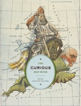
Over the centuries, maps have served many varied purposes; far from mere guides for reaching a destination, they are unique artistic forms, aides in planning commercial routes, literary devices for illuminating a story. Accuracy—or inaccuracy—of maps has been the make-or-break factor in countless military battles throughout history. They have graced the walls of homes, bringing prestige and elegance to their owners. They track the mountains, oceans, and stars of our existence. Maps help us make sense of our worlds both real and imaginary—they bring order to the seeming chaos of our surroundings.
With The Curious Map Book, Ashley Baynton-Williams gathers an amazing, chronologically ordered variety of cartographic gems, mainly from the vast collection of the British Library. He has unearthed a wide array of the whimsical and fantastic, from maps of board games to political ones, maps of the Holy Land to maps of the human soul. In his illuminating introduction, Baynton-Williams also identifies and expounds upon key themes of map production, peculiar styles, and the commerce and collection of unique maps. This incredible volume offers a wealth of gorgeous illustrations for anyone who is cartographically curious.
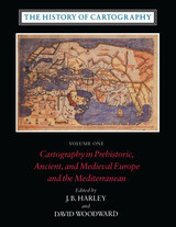
Volume One addresses the prehistorical and historical mapping traditions of premodern Europe and the Mediterranean world. A substantial introductory essay surveys the historiography and theoretical development of the history of cartography and situates the work of the multi-volume series within this scholarly tradition. Cartographic themes include an emphasis on the spatial-cognitive abilities of Europe's prehistoric peoples and their transmission of cartographic concepts through media such as rock art; the emphasis on mensuration, land surveys, and architectural plans in the cartography of Ancient Egypt and the Near East; the emergence of both theoretical and practical cartographic knowledge in the Greco-Roman world; and the parallel existence of diverse mapping traditions (mappaemundi, portolan charts, local and regional cartography) in the Medieval period.
Throughout the volume, a commitment to include cosmographical and celestial maps underscores the inclusive definition of "map" and sets the tone for the breadth of scholarship found in later volumes of the series.
"[The six-volume set] is certain to be the standard reference for all subsequent scholarship. The editors . . . have assembled and analyzed a vast collection of knowledge. . . . If the first volume is an indication, the complete set will be comprehensive and judicious." —John Noble Wilford, New York Times Book Review
"As well as enlarging the mind and lifting the spirits through the sheer magnitude of its endeavor, the collection delights the senses. The illustrations are exquisite: browsing fingers will instinctively alight on the sheaf of maps reproduced on stock slightly thicker than that of the text. The maps are so beguiling in the tantalizing glimpses they offer of other, seemingly incomprehensible, worlds, that the sight of them will stir the connoisseur in even the most-guarded scholar." —Ronald Rees, Geographical Review
"The corpus it brings to light, along with the extensive references, bibliography, and exhaustive appendices containing valuable comments about many of the pieces discussed, together make this book an important resource for the scholar."—Robert Provin, Professional Geographer
"This volume is a landmark of new research and will certainly contribute to further discoveries, translations, interpretations, inventories, more precise dating and the construction of stemmata." —Christian Jacob, Cartographica
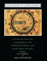
"In seeking to characterize the cartography of premodern Islamic and south Asian societies, the editors offer the image of an archipelago of cartographically conscious islands in a silent sea. The research potential which they have revealed is clearly vast and underappreciated, with many islands still to be discovered or enlarged. This important book, does more, therefore, than plug a huge gap in cartographic historiography. It provides the foundation for crosscultural cartographic research in two major world regions."-Jeffrey Stone, Ecumene
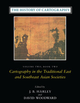
Volume 2, book 2, considers the cartographic traditions of China, Korea, Japan, Vietnam, Tibet, Burma, Thailand, Laos, Malaysia, Indonesia, Brunei, and the Philippines, presenting significant new research and interpretation of archaeological, literary, and graphic sources. Richly illustrated with forty color plates and over five hundred black and white illustrations, the book includes a number of rare and elaborate maps, many previously unpublished.
"The maps in this book provide an evocative picture of how indigenous peoples view and represent their worlds. They illuminate not only questions of material culture but also the cognitive systems and social motivations that underpin them" (from the introduction).
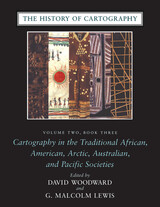
Although they are often rendered in forms unfamiliar to Western eyes, maps have existed in most cultures. In this latest book of the acclaimed History of Cartography, contributors from a broad variety of disciplines collaborate to describe and address the significance of traditional cartographies. Whether painted on rock walls in South Africa, chanted in a Melanesian ritual, or fashioned from palm fronds and shells in the Marshall Islands, all indigenous maps share a crucial role in representing and codifying the spatial knowledge of their various cultures. Some also serve as repositories of a group's sacred or historical traditions, while others are exquisite art objects.
The indigenous maps discussed in this book offer a rich resource for disciplines such as anthropology, archaeology, art history, ethnology, geography, history, psychology, and sociology. Copious illustrations and carefully researched bibliographies enhance the scholarly value of this definitive reference.
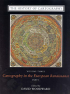
Cartography in the European Renaissance treats the period from 1450 to 1650, long considered the most important in the history of European mapping. This period witnessed a flowering in the production of maps comparable to that in the fields of literature and fine arts. Scientific advances, appropriations of classical mapping techniques, burgeoning trade routes—all such massive changes drove an explosion in the making and using of maps. While this volume presents detailed histories of mapping in such well-documented regions as Italy and Spain, it also breaks significant new ground by treating Renaissance Europe in its most expansive geographical sense, giving careful attention to often-neglected regions like Scandinavia, East-Central Europe, and Russia, and by providing innovative interpretive essays on the technological, scientific, cultural, and social aspects of cartography.
Lavishly illustrated with more than a thousand maps, many in color, the two volumes of Cartography in the European Renaissance will be the unsurpassable standard in its field, both defining it and propelling it forward.
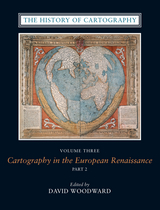
The social and intellectual changes that swept Enlightenment Europe also transformed many of its mapmaking practices. A new emphasis on geometric principles gave rise to improved tools for measuring and mapping the world, even as large-scale cartographic projects became possible under the aegis of powerful states. Yet older mapping practices persisted: Enlightenment cartography encompassed a wide variety of processes for making, circulating, and using maps of different types. The volume’s more than four hundred encyclopedic articles explore the era’s mapping, covering topics both detailed—such as geodetic surveying, thematic mapping, and map collecting—and broad, such as women and cartography, cartography and the economy, and the art and design of maps. Copious bibliographical references and nearly one thousand full-color illustrations complement the detailed entries.
The twentieth century is a pivotal period in map history. The transition from paper to digital formats led to previously unimaginable dynamic and interactive maps. Geographic information systems radically altered cartographic institutions and reduced the skill required to create maps. Satellite positioning and mobile communications revolutionized wayfinding. Mapping evolved as an important tool for coping with complexity, organizing knowledge, and influencing public opinion in all parts of the globe and at all levels of society. Volume 6 covers these changes comprehensively, while thoroughly demonstrating the far-reaching effects of maps on science, technology, and society—and vice versa.
The lavishly produced volume includes more than five hundred articles accompanied by more than a thousand images. Hundreds of expert contributors provide both original research, often based on their own participation in the developments they describe, and interpretations of larger trends in cartography. Designed for use by both scholars and the general public, this definitive volume is a reference work of first resort for all who study and love maps.
The first international history of railroads and railroad infrastructure told through stunningly reproduced maps.
Since their origins in eighteenth-century England, railroads have spread across the globe, changing everything in their path, from where and how people grew and made things to where and how they lived and moved. Railroads rewrote not only world geography but also the history of maps and mapping. Today, the needs of train companies and their users continue to shape the maps we consume and consult.
Featuring full-color maps primarily from the British Library's distinguished collection—many of them never before published—A History of the Railroad in 100 Maps is the first international history of railroads and railroad infrastructure told through maps. Jeremy Black includes examples from six continents, spanning a variety of uses from railroad planning and operations to guides for passengers, shippers, and tourists.
Arranged chronologically, the maps are accompanied by explanatory text that sheds light on the political, military, and urban development histories associated with the spread of railroads. A final chapter considers railroad maps from games, books, and other cultural artifacts. For anyone interested in the history of railroads or maps, A History of the Railroad in 100 Maps will offer new and unexpected insights into their intertwined global history.
President John F. Kennedy’s rousing “We will go to the Moon” speech in 1961 before the US Congress catalyzed the celebrated Apollo program, spurring the US Geological Survey’s scientists to map the Moon. Over the next eleven years a team of twenty-two, including a dozen illustrator-cartographers, created forty-four charts that forever changed the path of space exploration.
For the first time, each of those beautifully hand-drawn, colorful charts is presented together in one stunning book. In Lunar, National Air and Space Museum curator Matthew Shindell’s expert commentary accompanies each chart, along with the key geological characteristics and interpretations that were set out in the original Geologic Atlas of the Moon. Interwoven throughout the book are contributions from scholars devoted to studying the multifaceted significance of the Moon to humankind around the world. Traveling from the Stone Age to the present day, they explore a wide range of topics: the prehistoric lunar calendar; the role of the Moon in creation myths of Ancient Egypt, Greece, and Rome; the role of the Moon in astrology; the importance of the Moon in establishing an Earth-centered solar system; the association of the Moon with madness and the menstrual cycle; how the Moon governs the tides; and the use of the Moon in surrealist art.
Combining a thoughtful retelling of the Moon’s cultural associations throughout history with the beautifully illustrated and scientifically accurate charting of its surface, Lunar is a stunning celebration of the Moon in all its guises.
"This book should be welcomed by all students of mapping, for it will take them in uncomplicated stages through the complexities of compiling a map. . . . Mr. Greenwood is to be congratulated on an excellent book."—C.J. Angus, Canadian Geographical Journal
"For the baggy and middle-aged who cannot afford skiing in Austria or sailing off Bimini, Greenhood invites his readers to a sort of intellectual excitement which neither skiing nor sailing could equal. . . . Unless you work professionally with maps to the degree that a navigator does, for instance, this book will fascinate and enthrall you."—Monroe Bush, American Forests
"A teacher who wishes to go into the classroom with a storehouse of knowledge and ideas will find this a remarkable book. It is easy to read, and each page contains information which can be fed into the work in progress no matter which area of the world is being studied."—Instructor
"There is much to be praised in this book. It is an excellent history of how India came to be painted red in the nineteenth century. But more importantly, Mapping an Empire sets a new standard for books that examine a fundamental problem in the history of European imperialism."—D. Graham Burnett, Times Literary Supplement
"Mapping an Empire is undoubtedly a major contribution to the rapidly growing literature on science and empire, and a work which deserves to stimulate a great deal of fresh thinking and informed research."—David Arnold, Journal of Imperial and Commonwealth History
"This case study offers broadly applicable insights into the relationship between ideology, technology and politics. . . . Carefully read, this is a tale of irony about wishful thinking and the limits of knowledge."—Publishers Weekly
Reaching past the city limits, Mapping Historical Las Vegas also examines the development of public lands, military bases, and the canyons and valleys of the Colorado River before the Hoover Dam was built and Lake Mead was created. Weber also includes information on dams, highways, railroads, and other projects that were planned but never constructed— showing what might have been in one of the nation’s largest cities.
With 137 color maps generated using Geographic Information Systems, along with extensive mapping by Weber that draws on his decades of experience in the region, Mapping Historical Las Vegas offers a unique perspective on one of the world’s most famous desert cities.
In his acclaimed How to Lie with Maps, Mark Monmonier showed how maps can distort facts. In Mapping it Out: Expository Cartography for the Humanities and Social Sciences, he shows authors and scholars how they can use expository cartography—the visual, two-dimensional organization of information—to heighten the impact of their books and articles.
This concise, practical book is an introduction to the fundamental principles of graphic logic and design, from the basics of scale to the complex mapping of movement or change. Monmonier helps writers and researchers decide when maps are most useful and what formats work best in a wide range of subject areas, from literary criticism to sociology. He demonstrates, for example, various techniques for representing changes and patterns; different typefaces and how they can either clarify or confuse information; and the effectiveness of less traditional map forms, such as visibility base maps, frame-rectangle symbols, and complementary scatterplot designs for conveying complex spatial relationships.
There is also a wealth of practical information on map compilation, cartobibliographies, copyright and permissions, facsimile reproduction, and the evaluation of source materials. Appendixes discuss the benefits and limitations of electronic graphics and pen-and-ink drafting, and how to work with a cartographic illustrator.
Clearly written, and filled with real-world examples, Mapping it Out demystifies mapmaking for anyone writing in the humanities and social sciences.
"A useful guide to a subject most people probably take too much for granted. It shows how map makers translate abstract data into eye-catching cartograms, as they are called. It combats cartographic illiteracy. It fights cartophobia. It may even teach you to find your way."—Christopher Lehmann-Haupt, The New York Times
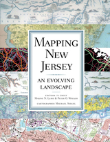
Tracing the changes in environment, land use patterns, demography, transportation, economy, and politics over the course of many centuries, Mapping New Jerseyilluminates the state's transformation from a simple agricultural society to a post-industrial and culturally diverse place inhabited by more people per acre than anywhere else in the country.
An innovator in transportation, from railroads to traffic circles to aviation, New Jersey from its beginnings was a "corridor" state, with a dense Native American trail system once crisscrossed on foot, country roads traveled by armies of the American Revolution, and, lately, the rolling wheels of many sedans, SUVs, hybrids, public and commercial vehicles, and freight. Early to industrialize, it also served as the headquarters for Thomas Edison and the development of the modern American economy. Small in territory and crowded with people, the state works to recycle garbage and, at the same time, best utilize and preserve its land.
New Jersey has been depicted in useful and quite stunning historical maps, many of the best included in Mapping New Jerseyùcrude maps drawn by sixteenth-century navigators; complex and beautifully decorated pieces created by early Dutch cartographers; land maps plotted by seventeenth-century English settlement surveyors; examples of the nineteenth century's scientific revolution in map making that helped locate topography and important mineral resources; detailed insurance maps that correct London map maker William Faden's 1777-78 classic rendering of the state; and aerial photos, remote sensing, and global positioning system maps generated through twenty-first-century technology breakthroughs in cartography.
Integrating new maps, graphs, and diagrams unavailable through ordinary research or Internet searches, Mapping New Jersey is divided into six topical chapters, each accompanied by an introduction and overview telling the story of the state's past and detailing its diversity. Mapping New Jersey, dramatically bold and in full color, travels where New Jersey has gone and the rest of the nation is likely to follow.
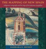
"Its contribution to its specific field is both significant and original. . . . It is a pure pleasure to read." —Sabine MacCormack, Isis
"Mundy has done a fine job of balancing the artistic interpretation of the maps with the larger historical context within which they were drawn. . . . This is an important work." —John F. Schwaller, Sixteenth Century Journal
"This beautiful book opens a Pandora's box in the most positive sense, for it provokes the reconsideration of several long-held opinions about Spanish colonialism and its effects on Native American culture." —Susan Schroeder, American Historical Review
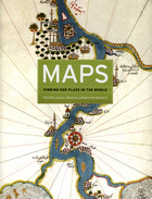
The book begins by examining the use of maps for wayfinding, revealing that even maps as common and widely used as these are the product of historical circumstances and cultural differences. The second chapter considers maps whose makers employed the smallest of scales to envision the broadest of human stages—the world, the heavens, even the act of creation itself. The next chapter looks at maps that are, literally, at the opposite end of the scale from cosmological and world maps—maps that represent specific parts of the world and provide a close-up view of areas in which their makers lived, worked, and moved.
Having shown how maps help us get around and make sense of our greater and lesser worlds, Maps then turns to the ways in which certain maps can be linked to particular events in history, exploring how they have helped Americans, for instance, to understand their past, cope with current events, and plan their national future. The fifth chapter considers maps that represent data from scientific instruments, population censuses, and historical records. These maps illustrate, for example, how diseases spread, what the ocean floor looks like, and how the weather is tracked and predicted. Next comes a turn to the imaginary, featuring maps that depict entire fictional worlds, from Hell to Utopia and from Middle Earth to the fantasy game World of Warcraft. The final chapter traces the origins of map consumption throughout history and ponders the impact of cartography on modern society.
A companion volume to the most ambitious exhibition on the history of maps ever mounted in North America, Maps will challenge readers to stretch conventional thought about what constitutes a map and how many different ways we can understand graphically the environment in which we live. Collectors, historians, mapmakers and users, and anyone who has ever “gotten lost” in the lines and symbols of a map will find much to love and learn from in this book.
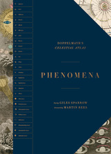
The expansive and intricate Atlas Coelestis, created by Johann Doppelmayr in 1742, set out to record everything known about astronomy at the time, covering constellations, planets, moons, comets, and more, all rendered in exquisite detail. Through stunning illustrations, historical notes, and scientific explanations, Phenomena contextualizes Doppelmayr’s atlas and creates a spectacular handbook to the heavens.
Phenomena begins by introducing Doppelmayr’s life and work, placing his extraordinary cosmic atlas in the context of discoveries made in the Renaissance and Enlightenment and highlighting the significance of its publication. This oversized book presents thirty beautifully illustrated and richly annotated plates, covering all the fundamentals of astronomy—from the dimensions of the solar system to the phases of the moon and the courses of comets. Each plate is accompanied by expert analysis from astronomer Giles Sparrow, who deftly presents Doppelmayr’s references and cosmological work to a modern audience. Each plate is carefully deconstructed, isolating key stars, planets, orbits, and moons for in-depth exploration. A conclusion reflects on the development of astronomy since the publication of the Atlas and traces the course of the science up to the present day. Following the conclusion is a timeline of key discoveries from ancient times onward along with short biographies of the key players in this history.
READERS
Browse our collection.
PUBLISHERS
See BiblioVault's publisher services.
STUDENT SERVICES
Files for college accessibility offices.
RECENTLY PUBLISHED

")


UChicago Accessibility Resources
home | accessibility | search | about | contact us
BiblioVault ® 2001 - 2024
The University of Chicago Press