
 A SCHOLARLY BOOK REPOSITORY
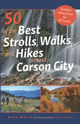
One of the area’s foremost experts on the outdoors, Mike White, author of 50 of the Best Strolls, Walks, and Hikes Around Reno, returns with a new guidebook dedicated to Carson City and its surrounding areas in northern Nevada. With over three hundred days of sunshine a year, this capital city’s parks, trails, lakes, and soaring peaks provide the perfect attractions for residents and visitors alike. This guide provides readers with the most precise information for a wide range of detailed paths and trails throughout the greater Carson City region and includes interesting sidebars about human and natural history for each trip.
From Virginia City and the Carson River on the east to the Sierra Nevada mountains to the west, this comprehensive guidebook offers the most complete guide for walkers, joggers, and hikers. Whether you are looking for a short and easy stroll on a city path or an extended hike along the Tahoe Rim Trail, this is your all-inclusive resource for your next outdoor adventure.
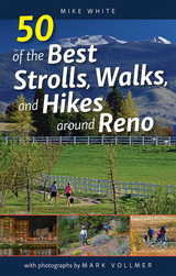
Reno, Nevada is one of the best communities in the nation for outdoor recreational opportunities. With over three hundred days of sunshine a year, the weather beckons residents and visitors alike to step outside and enjoy a casual stroll in a city park, a stiff climb to the top of one of the area’s surrounding mountains, or just about anything in between. White offers the most complete guide for walkers, joggers, runners, and hikers to the best paths and trails in the greater Reno-Sparks region.
This guide provides readers the most complete and detailed information for each excursion, from the Truckee River corridor to the Northern Valleys, including lakes, parks, trails, and mountains. Whether you are looking for a short and easy stroll on a paved path along one of the city’s greenbelts, or an extended hike into the mountains of the Mount Rose wilderness, this is your all-inclusive resource. White is one of the area’s foremost experts on the outdoors, and he includes interesting sidebars about human and natural history for each trip. This is a guide for anyone who enjoys a stroll, walk, or hike in and around Northern Nevada’s premier outdoor playgrounds.
For this first toponymic encyclopedia of Arizona, Barnes compiled information from published histories, federal and state government documents, and reminiscences of "old timers, Indians, Mexicans, cowboys, sheep-herders, historians, any and everybody who had a story to tell as to the origin and meaning of Arizona names." The result is a book chock full of oddments, humor, and now-forgotten lore, which belongs on the night table as well as in the glove compartment.
Barnes' original Arizona Place Names has become a booklover's favorite and is much in demand. The University of Arizona Press is pleased to reissue this classic of Arizoniana, which remains as useful and timeless as it was more than half a century ago.
Best Backpacking Trips in Montana, Wyoming, and Colorado provides everything you need to know to organize and execute the best backpacking trips in the Mountain West. Mike White and Douglas Lorain, who have walked every mile of the trails described inside, take readers and hikers into some of the wildest and most scenic backcountry landscapes in the nation and help them design the ultimate trip.
Focusing on one-week excursions, the book offers details on all the aspects of trip planning—trail narratives, technical data, maps, gear, food, information on regulations and permits, and more. But it is more than a basic guidebook. Trip information is enriched by valuable and interesting sidebars on history and ecology that will increase appreciation for these natural areas and the people who were instrumental in their discovery or protection.
In Best Backpacking Trips in Montana, Wyoming, and Colorado, White and Lorain pass on their knowledge of quality hikes, planning and preparation, and the unique satisfaction of multi-day backpacking. This guide, put into practice, will result in the trip of a lifetime.
This is the second book in a series of detailed guidebooks covering all the best “life-list” backpacking vacations in the spectacular backcountry of the American West. This new volume specifically covers the best such adventures in the states of Utah, Arizona, and New Mexico. Every conceivable aspect of trip planning is covered in the guide, including maps and descriptions of the trail, where to locate the nearest airport, other area attractions that shouldn’t be missed, and guide services that are available. A noteworthy feature of the book is the individual vignettes that give insight into the historical significance of many of the trails. Also unique are the interesting and humorous personal accounts that the authors share from their personal experiences hiking these routes. Backpackers will find a wide range of outstanding trips, from high mountain adventures to some of the world’s best lower-elevation canyon hikes. Best Backpacking Trips in Utah, Arizona, and New Mexico provides an extensive choice of terrific expeditions.
Growing up in Utah, Holdsworth couldn't wait to move away. Once ensconced on the East Coast, however, he found himself writing westerns and dreaming of the mountains he'd skied and climbed. Fed up with city life, he moved to a small Wyoming town.
In Big Wonderful, he writes of a mountaineering companion's death, the difficult birth of his son, and his father's terminal illness - encounters with mortality that sharpened his ideas about risk, care, and commitment. He puts a new spin on mountaineering literature, telling wild tales from his reunion with the mountains but also relating the surprising willpower it took to turn back from risks he would have taken before he became a father. He found he needed courage to protect and engage deeply with his family, his community, and the wild places he loves.
Holdsworth's essays and poems are rich with anecdotes, characters, and vivid images. Readers will feel as if they themselves watched a bear destroy an entire expedition's food, walked with his great-great-grandmother along the icy Mormon Trail, and tried to plant a garden in Wyoming's infamous wind.
Readers who love the outdoors will enjoy this funny and touching take on settling down and adventuring in the West's most isolated country.
Pettem devotes the first chapter to an introduction of the early photographers whose work appears throughout the book. Moving outward from the central business district as development did, each subsequent chapter focuses on a particular area in Boulder, with an introductory essay followed by historic and contemporary photographs with detailed captions.
Canyoneering 2: Technical Loop Hikes is a guide to seven, week-long backpack trips into some for the most unspoiled and least-visited areas in the Utah section of the Colorado Plateau. Every hike contains the four essentials of a great canyoneering route: spectacular canyons, intimate narrows, big views, and physical challenge. Although the routes are difficult, newcomers to the canyons will also find detailed information here that can be used to plan less demanding excursions. Hikes include Muddy Creek in the San Rafael Swell, Dirty Devil North, Dirty Devil South, Dark Canyon, White Canyon, Escalante East, and Escalante South. For experienced canyoneers.
A second volume covering the southern portion of the San Rafael Swell is in preparation.
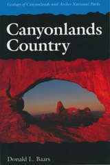
An easy-to-read geological history of the amazing red rock landscapes in southeastern Utah.
Towering red buttes, plunging canyon walls, domes, pinnacles, spires, ten thousand strangely carved forms—what visitor hasn’t marveled at the land of rock in southeastern Utah that is Canyonlands Country?
Canyonlands Country offers a unique geological history of this awesome landscape, in language understandable by the non-geologist. The story is as strange and fascinating as the land itself. Each exposed rock layer has a different geologic history: one is a stream deposit, another is an ancient field of dunes, another was deposited by shallow tropic seas. The Green and Colorado Rivers began carving canyons thirty million years ago, but to understand such relatively recent events Canyonlands Country takes us on a journey of two billion years.
Tours include Arches National Park, Island in the Sky, Needles District, The Maze and Elaterite Basin, Labyrinth and Stillwater Canyons, Meander Canyon, and Cataract Canyon.
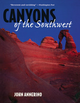
The canyons of the southwestern United States and northern Mexico contain some of the most dramatic landscapes in the world. John Annerino's pictorial celebration of this visually rich region is a handsome memento for those who have heard the wind whistling in these haunting canyons, and a beckoning invitation for those who have not yet made the journey.
Annerino has spent much of his adult life exploring this territory—as wilderness runner, adventurer, and photojournalist—and combines his firsthand knowledge with his expertise as a nature photographer and author to create an intimate portrait of these timeless places. Accompanying the photographs are informative essays describing the region's geological and human history.

Lamberton chases the four corners of Arizona, attempts every county, every reservation, and every national monument and state park, from the smallest community to the largest city. He drives his Kia Rio through the longest tunnels and across the highest suspension bridges, hikes the hottest deserts, and climbs the tallest mountain, all while visiting the people, places, and treasures that make Arizona great.
In the vivid, lyrical, often humorous prose the author is known for, each destination weaves together stories of history, nature, and people, along with entertaining side adventures and excursions. Maps and forty-four of the author’s detailed pencil drawings illustrate the journey.
Chasing Arizona is unlike any book of its kind. It is an adventure story, a tale of Arizona, a road-warrior narrative. It is a quest to see and experience as much of Arizona as possible. Through intimate portrayals of people and place, readers deeply experience the Grand Canyon State and at the same time celebrate what makes Arizona a wonderful place to visit and live.
Southwest Book of the Year Award Winner
Pubwest Book Design Award Winner
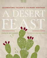
Drawing on thousands of years of foodways, Tucson cuisine blends the influences of Indigenous, Mexican, mission-era Mediterranean, and ranch-style cowboy food traditions. This book offers a food pilgrimage, where stories and recipes demonstrate why the desert city of Tucson became American’s first UNESCO City of Gastronomy.
Both family supper tables and the city’s trendiest restaurants feature native desert plants and innovative dishes incorporating ancient agricultural staples. Award-winning writer Carolyn Niethammer deliciously shows how the Sonoran Desert’s first farmers grew tasty crops that continue to influence Tucson menus and how the arrival of Roman Catholic missionaries, Spanish soldiers, and Chinese farmers influenced what Tucsonans ate.
White Sonora wheat, tepary beans, and criollo cattle steaks make Tucson’s cuisine unique. In A Desert Feast, you’ll see pictures of kids learning to grow food at school, and you’ll meet the farmers, small-scale food entrepreneurs, and chefs who are dedicated to growing and using heritage foods. It’s fair to say, “Tucson tastes like nowhere else.”
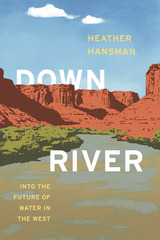
The Green River, the most significant tributary of the Colorado River, runs 730 miles from the glaciers of Wyoming to the desert canyons of Utah. Over its course, it meanders through ranches, cities, national parks, endangered fish habitats, and some of the most significant natural gas fields in the country, as it provides water for 33 million people. Stopped up by dams, slaked off by irrigation, and dried up by cities, the Green is crucial, overused, and at-risk, now more than ever.
Fights over the river’s water, and what’s going to happen to it in the future, are longstanding, intractable, and only getting worse as the West gets hotter and drier and more people depend on the river with each passing year. As a former raft guide and an environmental reporter, Heather Hansman knew these fights were happening, but she felt driven to see them from a different perspective—from the river itself. So she set out on a journey, in a one-person inflatable pack raft, to paddle the river from source to confluence and see what the experience might teach her. Mixing lyrical accounts of quiet paddling through breathtaking beauty with nights spent camping solo and lively discussions with farmers, city officials, and other people met along the way, Downriver is the story of that journey, a foray into the present—and future—of water in the West.

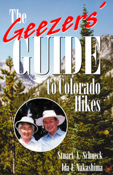
Fifty-six hikes are described that fit, in a graded fashion, the physical capabilities of most older hikers. While the majority of hikes listed are in the Denver / Boulder area and the nearby foothills, the authors have detailed several routes in Rocky Mountain National Park, Aspen, and Vail that will entice more ambitious readers up into the high Colorado Rockies.
The Geezers' Guide to Colorado Hikes includes an overview of the physiology of altitude and aging, a summary of altitude-related medical problems, notes on hike preparation and what to pack, and 56 recommended hikes with: Degree of difficulty ratings, distances, e stimated round-trip time for the older hiker, starting altitude and elevation gain figures, driving direction, trail descriptions, and maps.
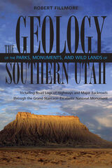
This detailed interpretive guide explains the forces that created Utah's unforgettable scenery, while providing road logs of highways and major backroads through the Grand Staircase of the Colorado Plateau.
Where in Utah can you find a fossilized ant hill that is at least fifty million years old? Do you know the location of an ancient beach that disappeared along with the dinosaurs that strolled it? Find out in The Geology of the Parks, Monuments, and Wildlands of Southern Utah.
This fascinating and authoritative guide belongs on the dashboard or in the backpack of every visitor to southern Utah or student of its natural history. More than sixty illustrations and nearly three dozen photographs accompany clear explanations of the spectacular geologic features of this landscape, including Capitol Reef, Bryce Canyon, and Zion National Parks, as well as the Grand Staircase-Escalante Monument.
Section I of the volume surveys chronologically the origins of the formations and structural features and the geologic processes that have shaped the Colorado Plateau. Section II provides road logs with mile-by-mile geologic descriptions of key sections of highway traversing this area.
This detailed interpretive guide turns any windshield into a window of opportunity for understanding the forces that created Utah’s unforgettable scenery—whether it be a breathtaking panorama or a dazzling array of fins and fractures, pillars and pedestals, or cliffs and chasms.
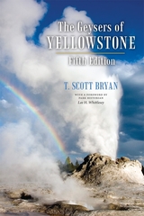
Both a reference work and a fine introduction to the nature of geyser activity, this popular field guide includes a glossary of key terms, a comprehensive appendix that discusses other geyser areas of the world, detailed maps of each geyser basin, and tables for easy reference. The Geysers of Yellowstone will continue to serve geyser gazers as well as newcomers to geothermal phenomena for years to come.
Both a reference work and a fine introduction to the nature of geyser activity, this popular field guide includes detailed maps of each geyser basin, tables for easy reference, and a glossary of key terms. A comprehensive appendix discusses other geyser areas of the world, several of which are described here for the first time. The Geysers of Yellowstone will continue to serve geyser gazers as well as newcomers to geothermal phenomena for years to come.
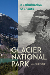
First there were tribes of Native Americans whose deep regard for nature left the landscape intact. They were followed by Euro-American explorers and settlers who may have been awed by the new lands, but began to move wildlife to near extinction. Fortunately for the area that would become Glacier, some began to recognize that laying siege to nature and its bounties would lead to wastelands.
Bristol recounts how a renewed conservation ethic fostered by such leaders as Emerson, Thoreau, Olmstead, Muir, and Teddy Roosevelt took hold. Their disciples were Grinnell, Hill, Mather, Albright, and Franklin Roosevelt, and they would not only take up the call but rally for the cause. These giants would create and preserve a park landscape to accommodate visitors and wilderness alike.
The Grand Canyon became a microcosm of the history and evolving values of the
National Park Service, long conflicted between encouraging tourism and protecting nature. Many vivid characters shaped the canyon’s past. Its largest story is one of cultural history and changing American visions of the land.
Grand Canyon: A History of a Natural Wonder and National Park is a mixture of great storytelling, unlikely characters, and important ideas. The book will appeal to both general readers and scholars interested in seeking a broader understanding of the canyon.
Contents
Foreword, by Ann H. Zwinger
1. The Geologic Record, by Stanley S. Beus
2. The Living Canyon, by Steven W. Carothers
3. Grand Canyon Indians, by Robert C. Euler
4. Historical Explorations, by Robert C. Euler
5. The Canyon by River, by Kim Crumbo
6. Hiking the Canyon, by Frank Tikalsky

The Nevada of lesser-known cities, towns, and outposts deserve their separate chronicles, and here Hulse fills a wide gap. He contributes in a text rich with memories tramping through rural Nevada as a child, then as a journalist seeking news and gossip, then later as an academic historian and a parent trying to share the wonders of the high desert with his family. Nobody is more qualified to write about the cultural nuances of rural Nevada than Hulse, who retired after 35 years as a professor of history at University of Nevada, Reno.
Robert Laxalt wrote an article in National Geographic in 1974 entitled “The Other Nevada” in which he referred to “the Nevada that has been eclipsed by the tinsel trimmings of Las Vegas, the round-the-clock casinos, the ski slopes of the Sierra. It is a Nevada that few tourists see.” With this book Hulse reflects on Laxalt’s insights and shows changes—often slow-moving and incremental—that have occurred since then. Much of the terrain of rural Nevada has not changed at all, while others have adapted to technological revolutions of recent times. Hulse states that there is no single “other” Nevada, but several subcultures with distinct features. He offers a tour of sorts to what John Muir called the “bewildering abundance” of the Nevada landscape.
Great Basin National Park is in large part a high-alpine park, but it sits in one of America’s driest, least populated, and most isolated deserts. That contrast is one facet of the diversity that characterizes this region. Within and outside the park are phenomenal landscape features, biotic wonders, unique environments, varied historic sites, and the local colors of isolated towns and ranches. Vast Snake and Spring Valleys, bracketing the national park, are also subjects of one of the West's most divisive environment contests, over what on the surface seems most absent but underground is abundant enough for sprawling Las Vegas to covet it—water.
Though the trail that these devoted pioneers broke across raw frontier was used for several years afterward, no highway was built over most of the route because it was deemed too rugged for modern vehicles. In addition to the historical value of the story of these pioneers, this guide includes road logs, maps, and hiking trails along the historic trail. It also points out fascinating natural history along the way, making A Guide to Southern Utah’s Hole-in-the-Rock Trail a significant reference for a variety of readers.
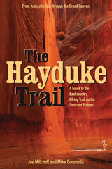
Joe Mitchell and Mike Coronella pioneered Hayduke after concluding that a long trail—such as the Appalachian or Pacific Crest— was possible on the Plateau, thus introducing more people to these unique and threatened public lands. The Hayduke Trail includes detailed maps of the entire route, suggested cache points, and a wealth of description and tips for tackling this intense undertaking.
Hiking the entire route requires at least three months, though like other long trails it can be broken into smaller segments. The guide, featured in the March 2005 issue of National Geographic Adventure Magazine, is designed for experienced desert trekkers seeking a thorough-hiking experience on a well-tested route.
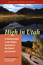
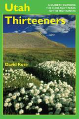
High in Utah is quite consciously a book for peak baggers, complete with a checklist and elevations. Summits range from Kings Peak, Utah’s highest at 13,528’ to the unnamed peak in Rich County, a mere 9,255’. In addition to the county high points, this book also has four “classic” climbs: Mt. Olympus in Salt Lake County; Mt. Timpanogos above Provo; Notch Peak in the House Range west of Delta; and Wellsville Cone, Cache Valley’s western landmark.
Since finding a place to start can often be the most frustrating part of a hike, emphasis is placed on directions to each trailhead. There is a road map for each hike, as well as a trail map showing contours. The routes in this guide are not always the easiest or most practical, but they may be the most appealing and are often the most commonly used (lessening human impact on other potential routes). Difficulty levels range from 'extreme'—long, steep routes that may require some route finding—to 'too easy'—reachable by car. Two sets of hiking times are provided to accommodate variations in hiking speed, and there are also sections on flora and fauna, mountain weather, low-impact hiking and camping, equipment, and altitude sickness.
"Alaska is our biggest, buggiest, boggiest state. Texas remains our largest unfrozen state. But mountainous Utah, if ironed out flat, would take up more space on a map than either."
—Edward Abbey, 1927–1989
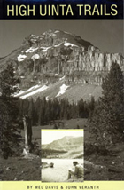
High Uinta Wilderness—three emotion-charged words that describe a very precious place. The highest mountains, the unique alpine ecosystem, and the largest designated Wilderness in Utah are all found here.
This is a complete rewriting of the original High Uinta Trails, first published in 1974. Access road and land management information has been expanded, new areas and routes have been added, and trail conditions have been completely updated.
The descriptions of the trails, lakes, ridges, and summits are an indispensable resource for selecting a destination and planning a trip but there are still plenty of undocumented places in the Uintas to explore.
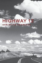
Highway 12 is undoubtedly one of not only America's but the world's most scenic highways. From its intersection on the west with Highway 89 south of Panguitch, Utah, it runs up through Red Canyon onto the Paunsagunt Plateau and across Bryce Canyon National Park. It then drops into the Paria River Valley, passes through several tiny villages, crosses some extraordinary (for anywhere but this region) badlands, and descends the Escalante River into Potato Valley. While a driver may justifiably feel she has seen some scenery by that point, the highway is just getting started, for in the next stretch, it crosses a labyrinth of multicolored sandstone humps and corridors, climaxed by a narrow hogback with steep slickrock drops to each side, all within Grand Staircase-Escalante National Monument. Reaching the oasis of Boulder within this desert of rock, the road then climbs across the flank of the Aquarius Plateau, providing spectacular vistas and terminating at the gateway to Capitol Reef National Park. Along the way side roads and trails access the vast wilderness of the Paria and Escalante Rivers and the high plateaus they drain. Congress acknowledged the unequaled splendor of Highway 12 by designating it one of a handful of All-American Roads.
To travel with Christian Probasco this road and its spurs, which lead deep into some of the wildest, most broken-up and stunning landscapes anywhere, can put a unique twist on an already singular experience. He knows the region as well as anyone and brings an original, edgy, youthful view to it. His opinions and his language may challenge you. His approaches to and perspectives on the land may sometimes surprise you. His understanding of the area's history and its people will likely teach you a thing or two.
A Hiking Guide to Cedar Mesa describes sixty-three routes, ranging from quarter-mile walks to fifteen-mile day hikes, loops, and multi-day backpack trips. There is essential information on permits, weather, gear, road, trailhead access, geology, human history in the region, and leave-no-trace camping.
Care is given to name only those well-known archaeological sites that are visible or immediately accessible from roads. Throughout, the author emphasizes proper visitation protocol for fragile archaeological sites. He states, "I have been touched by this landscape and would prefer to keep its teachings and secrets to myself, but I cannot. The experience of the desert should be available to everyone with the motivation to encounter it."
Northern Utah’s Wasatch Mountains are popular destinations for outdoor enthusiasts in every season. These mountains rise spectacularly from the relatively flat valley floor to thirteen peaks over 11,000 feet in elevation. An additional nineteen peaks rise more than 10,000 feet in elevation. Although many hiking guides exist for the Wasatch Mountains, there has been no guide book that focuses on the geologic features visible from the trails—until now.
Written by a recognized authority on the geology of the Wasatch Mountains, this guide is meant to enrich the experience of outdoor enthusiasts who want to understand the geological history and development of the Wasatch range. The first section of the book introduces the major geological time periods—the record of mountain building events from oldest to youngest, the effects of glaciation, and the development of the present topography. It then follows with a descriptive trail guide for each major trail system, including Mill Creek and Neffs Canyons, Mount Olympus, Little and Big Cottonwood Canyons, and Bells Canyon. Trail length, elevation gain, relative difficulty, and major geological features are outlined for each trail. Now you can hike these trails with the answers to all your geologic questions right at your fingertips.
An invaluable resource to anyone traversing the Escalante, this comprehensive guide details 43 hikes.
Publisher's Note: Realizing there are virtually no marked trails in the Escalante country (mostly canyons that wander and have many intersections, challenging anyone to write explicit description), this book includes directions to the trailhead, how to follow a particular route with choices of side canyons along the way, and occasional alternate endings. Some of the hikes may be appropriate for beginners. Some only the most experienced should attempt.
First named the Boulder Dam Recreation Area, this parkland was created in 1936 by a memorandum of agreement between the National Park Service and the U.S. Bureau of Reclamation. Over the course of its existence, the area has served as a model for a subsequent system of National Recreation Areas. The area’s extreme popularity has, in combination with changing public attitudes regarding preservation and safety, presented the National Park Service with tremendous challenges in recent decades. Jonathan Foster’s examination of these challenges and the responses to them reveal an increasingly anxious relationship between the government, the public, and special interest groups in the American West.
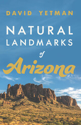
Whether you have climbed these peaks many times, enjoy seeing them from your car window, or simply want to learn more about southwestern geology and history, reading Natural Landmarks of Arizona is a fascinating way to learn about the ancient and recent history of beloved places such as Cathedral Rock, Granite Dells, Kitt Peak, and many others. With Yetman as your guide, you can tuck this book into your glove box and hit the road with profound new knowledge about the towering natural monuments that define our beautiful Arizona landscapes.
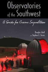
Douglas Isbell and Stephen Strom, both intimately involved in southwestern astronomy, have written a practical guide to the major observatories of the region for those eager to learn what modern telescopes are doing, to understand the role each of these often quirky places has played in advancing our understanding of the cosmos, and hopefully to visit and see the tools of the astronomer up close. For each observatory, the authors describe its history, highlights of its contributions to astronomy—with an emphasis on recent results—and information for visitors. Also included are wide-ranging interviews with astronomers closely associated with each site.
Observatories covered range from McDonald in Texas to Palomar in California, with significant outposts in between: Arizona’s Kitt Peak National Observatory southwest of Tucson, the Lowell Observatory in Flagstaff, and the Whipple Observatory outside Amado; and New Mexico’s Very Large Array near Socorro and Sacramento Peak close to Sunspot. In addition to describing these established institutions, they also take a look ahead to the most powerful ground-based telescope in the world just beginning to operate at full power on Mount Graham in Safford, Arizona.
With more than three dozen illustrations, Observatories of the Southwest is accessible to amateur astronomers, tourists, students, and teachers—anyone fascinated with the contributions that astronomy has made to deepening our understanding of humanity’s place in the universe, whether exploring the solar system from Lowell Observatory or studying the birth of stars using the army of giant radio telescopes at the Very Large Array. This book aims to inspire visits to these sites by illuminating the major scientific questions being pursued every clear night beneath the dark skies of the Southwest and the amazing machinery that makes these pursuits possible.
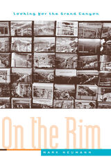
Why do nearly five million people travel to the Grand Canyon each year? Mark Neumann answers this question with a book as compelling as the panoramic vistas of the canyon. In On the Rim, he describes how the Grand Canyon became an internationally renowned tourist attraction and cultural icon, and delves into the meanings the place holds for the individuals who live, work, and travel there.
Weaving history, ethnography, documentary photography, and autobiography, Neumann exposes the roots—the personal and social dimensions—of America’s pursuit of leisure. He shows how people visiting the Grand Canyon create their own experiences, even while they are affected by one hundred years of social history and cultural expectations. On the Rim examines the lines between progress and nostalgia, science and spirituality, nature and culture, authenticity and mass production, and work and leisure—all of which crisscross the tourist experience.
To support his argument, Neumann uses evidence from tourist registers and Park Service records, first-person narratives, interviews, and scenes from television shows, Hollywood movies, and popular novels. Heavily illustrated with historical and contemporary photographs, the narrative shifts back and forth between early descriptions of the canyon and modern tourist stories, the past illuminating the present at every step.
From Albert Einstein’s visit and the hunt for the fugitive Danny Horning to the everyday experiences of local Native Americans, park rangers, and vacationing families, Neumann reminds us that every trip to the Grand Canyon is a complex journey, fueled by shared expectations but always open to the possibility of surprise. On the Rim is a multilayered, nuanced study of the place and its many visitors.
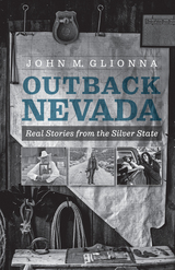
Glionna’s interest in Nevada’s rugged, isolated landscape and the people who choose to live in this often-harsh environment was born of his own wanderings into the “outback.” Through his stories, he shares intimate portraits of rural and small-town lifestyles not many understand. Readers meet men with names like Flash and Mr. Cool; will listen to a cowboy minister preach the word of God to his parishioners; will walk with an antiques dealer from Genoa as he hunts for denim in Nevada’s abandoned nineteenth-century mine shafts; and will learn from an ex-paramedic– turned–coffee-shop–owner who provides Boulder City with a true sense of community. Full of humor, eccentricities, and compassion, these stories reveal the state’s true nature and extend an invitation to get lost “somewhere out there” in the real Nevada.
Petrified Forest National Park: A Wilderness Bound in Time speeds the reader on an ancient ecological journey, from the time of dinosaurs to the discovery of their Triassic fossils and on through a century of political maneuvering to create a place for the forest in American history. George Lubick describes how a dedicated few understood the environmental importance as well as the unique beauty of the park's Triassic Chinle Formation and the Painted Desert. Nearly a million people "visit the Triassic" annually; this environmental history of the ancient forest is important for those who know the park as well as those interested in natural America. Petrified Forest National Park is one of the few complete histories of any national park, a well-told, balanced treatment of the environmental, political, and historical factors that shape America's natural history.
The story is vividly told through numerous historical photographs, lively anecdotes, and an engaging text, informed by decades of research by David Wentworth Lazaroff. Along the way the reader makes the acquaintance of ordinary picnickers as well as influential citizens who helped to reshape the canyon, while witnessing the canyon’s evolving relationship with its growing urban neighbor. The book will fascinate readers who are already familiar with Sabino Canyon, as well as anyone with an interest in local or regional history, or in historical photography.
Edward Geary’s collection of writings on the High Plateau country of central and southern Utah, a combination guidebook, travel narrative, personal essays, and natural, social, and literary history, encompasses each of those forms with a sweep as broad as the landscape it describes.
It traces the progress of travelers to the region, including the historic Dominguez-Escalante party in 1776, and trappers and explorers such as Jedediah Smith, John C. Freemont, and Kit Carson. Scandinavian and English descendants of the early Mormon pioneers, sent to settle Manti and surrounding areas by Brigham Young in 1849, populate many of the pages and dominate the agrarian villages described by the author. The book also describes the multiethnic society of French Basque, Greeks, Slavs, Italians, Chinese, Welsh, and Finnish laborers and coal miners that developed in the region.
Geary writes of all these people with affection and a deep sense of place, of belonging to a distinctive landscape and its history. It is a book that will bring a rush of understanding to those who have lived in the High Plateaus and greater depth of appreciation to visitors.
Rim to River is the story of this extraordinary journey through redrock country, down canyons, up mesas, and across desert plains to the obscure valley in Mexico that gave the state its enigmatic name. The trek is interspersed with incisive essays that pick apart the distinctive cultural landscape of Arizona: the wine-colored pinnacles and complex spirituality of Navajoland, the mind-numbing stucco suburbs, desperate border crossings, legislative skullduggery, extreme politics, billion-dollar copper ventures, dehydrating rivers, retirement kingdoms, old-time foodways, ghosts of old wars, honky-tonk dreamers, murder mysteries, and magical Grand Canyon reveries.
In Rim to River, Zoellner does for Arizona what Larry McMurtry did for Texas in In a Narrow Grave and what Wallace Stegner did for Utah in Mormon Country: paint an enduring portrait of a misunderstood American state. An indictment, a love letter, and a homecoming story all at once.
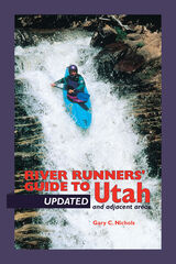
A fully revised and updated edition of Gary Nichols’ widely used guide to river running in Utah. Major changes have occurred on Big and Little Cottonwood Creeks, which have many new drops with dangerous hydraulics. This edition accounts for these and other alterations in the state’s waterways over the past fifteen years. Also, several of the original river access points are now on private land. Alternative access points are presented and users are alerted to the necessity of requesting permission. All this and much more will once again make A River Runners’ Guide to Utah and Adjacent Areas the one source for vital and reliable information on more than ninety river trips for beginner and expert alike. It includes:
-Over 90 river trips with descriptions and maps
-Location of access and take-out points
-Instructions for all skill levels
-Ratings of all waterways by levels of difficulty
-Identification of danger areas and obstacles
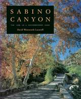
David Lazaroff has called on years of studying, photographing, and educating people about Sabino Canyon to produce this clearly written and beautifully illustrated book. Focusing on the importance of Sabino Creek both to plants and animals and to human recreation, he tracks the ebb and flow of canyon life through the year and tells how people have sought to utilize the canyon through history. First-time visitors to Sabino Canyon will find their experience enriched through Lazaroff's insights into plants, animals, and geology, while those who regularly frequent Sabino's trails or pools can become better informed about its fragile desert and riparian habitats.
For anyone curious about life in a genuine Southwestern oasis, this book captures the beauty and uniqueness of a natural treasure-house located in a bustling city's back yard.
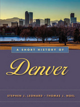
A Short History of Denver portrays the city’s twentieth-century ups and downs, including the City Beautiful movement, political corruption, the rise of the Ku Klux Klan in the 1920s, and the Great Depression of the 1930s. Here readers will find the meat and potatoes of economic and political history and much more, including sports history, social history, and the history of metropolitan-wide efforts to preserve the past.
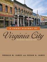
The city’s story did not end when the Comstock Lode played out. Beginning in the 1930s, bohemian artists, literati, and tourists were intrigued by this remnant of the Old West. The leader of Manhattan’s café society, Lucius Beebe, moved here and relaunched the Territorial Enterprise in 1950. Television’s most popular western from 1959 to 1973, Bonanza, located its fictional Ponderosa Ranch nearby. In the summer of 1965, a handful of Bay Area musicians, including Big Brother and the Holding Company, performed at the Red Dog Saloon and launched psychedelic rock, part of the inspiration for a defining decade of youth culture. Today it is both a National Historic Landmark District and a living community. Visitors come to enjoy its saloons and restaurants, admire its architecture, and learn from its museums and exhibits. A Short History of Virginia City will enhance their experience and will also be enjoyed by anyone interested in the history of Nevada, mining, and the Old West.
• Includes an illustrated walking tour describing more than thirty buildings and sites
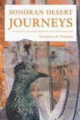
In Sonoran Desert Journeys ecologist Theodore H. Fleming discusses two remarkable journeys. First, Fleming offers a brief history of our intellectual and technical journey over the past three centuries to understand the evolution of life on Earth. Next, he applies those techniques on a journey of discovery about the evolution and natural history of some of the Sonoran Desert’s most iconic animals and plants. Fleming details the daily lives of a variety of reptiles, birds, mammals, and plants, describing their basic natural and evolutionary histories and addressing intriguing issues associated with their lifestyles and how they cope with a changing climate. Finally, Fleming discusses the complexity of Sonoran Desert conservation.
This book explores the evolution and natural history of iconic animals and plants of the northern Sonoran Desert through the eyes of a curious naturalist and provides a model of how we can coexist with the unique species that call this area home.
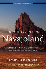
Tony Hillerman is beloved for his novels of intrigue in the American Southwest. In Tony Hillerman’s Navajoland, Laurance Linford takes readers on a journey through the Four Corners region to the haunts of Hillerman’s characters. Offered in encyclopedic form, each entry gives the common name of a particular location, the Navajo name and history, and a description of the location’s significance in various Hillerman novels. An understanding of the Navajo names and their relations to the landscape will lend a new dimension to the characters and events Tony Hillerman created.
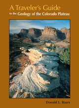
Driving across I-70 in southern Utah one can’t help but wonder about the magnificent upturned rocks of the San Rafael Reef. With A Travelers Guide to the Geology of the Colorado Plateau in hand, you’ll soon discover that you were driving through Page and Navajo Sandstone formations, sharply folded into a monocline along one of the "Basin and Range" fault lines. Nearing Flagstaff, Arizona, on Highway 89, you will learn that Mt. Humphry of the San Francisco Peaks, a Navajo Sacred Mountain, was once an active volcano. Keep reading and you’ll find many things worth a slight detour.
A Traveler's Guide to the Geology of the Colorado Plateau will enrich and enliven all of your trips through the varied landscapes of the Colorado Plateau as you learn about the geological forces that have shaped its natural features. The mile-by-mile road logs will take you from Vernal, Utah, in the north to the southernmost reaches of the Plateau in Sedona, Arizona; from the red rocks of Cedar Breaks National Monument near Cedar City, Utah, to the edges of the soaring peaks of the San Juan Mountains near Durango, Colorado. The most comprehensive geological guide to the Colorado Plateau

From the traditional restaurants of South Tucson to newer dining spots on the north and east sides, Tucson's Mexican Restaurants is an affectionate look at some of the best places to savor this wonderful cuisine. Suzanne Myal takes readers into the kitchens of many of these establishments to offer insights into the families that run them, the secrets of food preparation, and even the history of some of Tucson's best-loved recipes. Many of those recipes, along with others from prominent Mexican American families, are reproduced in the book, inviting readers to try their hand at red beef tamales, chiles rellenos, and other favorite dishes.
The book is organized by six sections of town, with a locator map for each. The entry for each establishment includes address, hours, price range, and credit card information, and indicates the specialties of the house. Each entry is also coded for features such as level of alcohol service; availability of carryout, delivery, and catering; and whether the menu features heart-healthy or vegetarian options. A separate section lists Mexican bakeries and tortilla factories, and a guide to fiestas helps readers choose beer or tequila—and find menudo when they've overindulged.
From street trucks to historic sites, Mexican restaurants in Tucson offer something for every palate. This book can help visitors and residents alike find their way around them and better enjoy some of the best Mexican food north of the border.
Most Utahns are familiar with the Uinta Mountains, but few realize that the range has twenty-one peaks above 13,000 feet, some of them still unnamed. The elevation, challenging terrain and weather, solitude, and beautiful setting in Utah’s largest wilderness area make climbing these peaks a particularly rewarding experience. Better yet, in the summer and early fall every one of them can be climbed by a reasonably fit hiker without rope or climbing gear.
This guide provides detailed topographical maps and information on trailheads, access and summit routes with difficulty ratings, camp locations, estimated hiking times, weather, advice, and brief facts about geology and the history of the wilderness area. It also includes over fifty photographs of this breathtaking country.
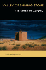
O'Keeffe saw the magic of sandstone cliffs and turquoise skies, but her life and death here are only part of the story. Reading almost like a novel, this book spills over with other legends buried deep in time, just as some of North America's oldest dinosaur bones lie hidden beneath the valley floor. Here are the stories of Pueblo Indians who have claimed this land for generations. Here, too, are Utes, Navajos, Jicarilla Apaches, Hispanos, and Anglos—many lives tangled together, yet also separate and distinct.
Underlying these stories is the saga of Ghost Ranch itself, a last living vestige of the Old West ideal of horses, cowboys, and wide-open spaces. Readers will meet a virtual Who's Who of visitors from "dude ranch" days, ranging from such luminaries as Willa Cather, Ansel Adams, and Charles Lindbergh to World War II scientist J. Robert Oppenheimer and his colleagues, who were working on the top-secret atomic bomb in nearby Los Alamos. Moving on through the twentieth century, the book describes struggles to preserve the valley's wild beauty in the face of land development and increased tourism.
Just as the Piedra Lumbre landscape has captivated countless wayfarers over hundreds of years, so its stories cast their own spell. Indispensable for travelers, pure pleasure for history buffs and general readers, these pages are a magic carpet to a magic land: Abiquiu, Ghost Ranch, the Valley of Shining Stone.
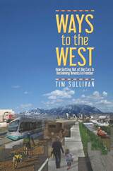
In Ways to the West, Tim Sullivan embarks on a car-less road trip through the Intermountain West, exploring how the region is taking on what may be its greatest challenge: sustainable transportation. Combining personal travel narrative, historical research, and his professional expertise in urban planning, Sullivan takes a critical yet optimistic and often humorous look at how contemporary Western cities are making themselves more hospitable to a life less centered on the personal vehicle.
The modern West was built by the automobile, but so much driving has jeopardized the West’s mystic hold on the American future. At first, automobility heightened the things that made the West great, but love became dependence, and dependence became addiction. Via his travels by bicycle, bus, and train through Las Vegas, Phoenix, Denver, Boise, Salt Lake City, and Portland, Sullivan captures the modern transportation evolution taking place across the region and the resulting ways in which contemporary Western communities are reinterpreting classic American values like mobility, opportunity, adventure, and freedom.
Finding a West created, lost, and reclaimed, Ways to the West will be of great interest to anyone curious about sustainable transportation and the history, geography, and culture of the American West.
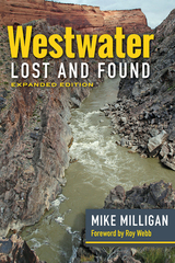
This expanded edition brings to light historical events and explores how Westwater’s location greatly contributed to early Grand (Upper) Colorado River boaters’ knowledge and how the lush Westwater Valley and Cisco became critical stops for water, wood, and grass along the North Branch of the Old Spanish Trail. Other new additions include explorer Ellsworth Kolb’s unpublished manuscript describing his 1916–1917 boating experiences on the Grand and Gunnison Rivers; two stories relating to Outlaw Cave, one of which expands upon the mystery of the outlaw brothers; a letter from James E. Miller to Frederick S. Dellenbaugh in 1906 revealing new information about his boating excursion with Oro DeGarmo Babcock on the Grand River in 1897; and a portion of botanist Frederick Kreutzfeld’s little-known journal of 1853 that describes Captain John W. Gunnison’s railroad survey.
Loaded with extensive information and river-running history, Milligan’s guide is sure to enhance readers’ knowledge of the Upper Colorado River and Grand Canyon regions. Boaters, river guides, scholars of the American West, and historians of the Colorado, Green, and Gunnison Rivers or the Old Spanish Trail will gain much from this new edition.
Mitchell draws on decades of experience to describe the trails, routes, wildlife, glaciers, lakes, and streams in Wyoming's fabulous two-and-a-quarter million acre Wind River Range.
A short hike was the beginning of a long career in wilderness living for Finis Mitchell of Rock Springs, Wyoming. He has scaled 244 peaks, including four times to the trop of Gannett Peak, the highest mountain in the state. A vigorous supporter of wilderness, the mountain man pours out his philosophy at meetings and slide shows with amazing attention to detail. He has taken 105,345 pictures as a hobby and uses them in his slide shows to show people their own public lands.
He has drawn on his vast experience in the Wind Rivers to describe, in this guide book, the trails, routes, wildlife, glaciers, 4,000 lakes and 800 miles of streams in Wyoming’s fabulous two and a quarter million acre Wind River Range.
Here, for the first time in a single book, is the incredible story of the wolves’ return to Yellowstone National Park as told by the very people responsible for their reintroduction, study, and management. Anchored in what we have learned from Yellowstone, highlighting the unique blend of research techniques that have given us this knowledge, and addressing the major issues that wolves still face today, this book is as wide-ranging and awe-inspiring as the Yellowstone restoration effort itself. We learn about individual wolves, population dynamics, wolf-prey relationships, genetics, disease, management and policy, newly studied behaviors and interactions with other species, and the rippling ecosystem effects wolves have had on Yellowstone’s wild and rare landscape. Perhaps most importantly of all, the book also offers solutions to ongoing controversies and debates.
Featuring a foreword by Jane Goodall, beautiful images, a companion online documentary by celebrated filmmaker Bob Landis, and contributions from more than seventy wolf and wildlife conservation luminaries from Yellowstone and around the world, Yellowstone Wolves is a gripping, accessible celebration of the extraordinary Yellowstone Wolf Project—and of the park through which these majestic and important creatures once again roam.
READERS
Browse our collection.
PUBLISHERS
See BiblioVault's publisher services.
STUDENT SERVICES
Files for college accessibility offices.
RECENTLY PUBLISHED


UChicago Accessibility Resources
home | accessibility | search | about | contact us
BiblioVault ® 2001 - 2024
The University of Chicago Press