Results by title
1038 books match the query 'Antiquities' and 94 start with c
Caborn-Welborn
Constructing a New Society after the Angel Chiefdom CollapseDavid Pollack
University of Alabama Press, 2004
Caborn-Welborn, a late Mississippian (A.D. 1400-1700) farming society centered at the confluence of the Ohio and Wabash Rivers (in what is now southwestern Indiana, southeastern Illinois, and northwestern Kentucky), developed following the collapse of the Angel chiefdom (A.D. 1000-1400). Using ceramic and settlement data, David Pollack examines the ways in which that new society reconstructed social, political, and economic relationships from the remnants of the Angel chiefdom. Unlike most instances of the demise of a complex society led by elites, the Caborn-Welborn population did not become more inward-looking, as indicated by an increase in extraregional interaction, nor did they disperse to smaller more widely scattered settlements, as evidenced by a continuation of a hierarchy that included large villages.
This book makes available for the first time detailed, well-illustrated descriptions of Caborn-Welborn ceramics, identifies ceramic types and attributes that reflect Caborn-Welborn interaction with Oneota tribal groups and central Mississippi valley Mississippian groups, and offers an internal regional chronology. Based on intraregional differences in ceramic decoration, the types of vessels interred with the dead, and cemetery location, Pollack suggests that in addition to the former Angel population, Caborn-Welborn society may have included households that relocated to the Ohio/Wabash confluence from nearby collapsing polities, and that Caborn-Welborn’s sociopolitical organization could be better considered as a riverine confederacy.
Caciques and Cemi Idols
The Web Spun by Taino Rulers Between Hispaniola and Puerto RicoJose R Oliver
University of Alabama Press, 2009
Cemís are both portable artifacts and embodiments of persons or spirit, which the Taínos and other natives of the Greater Antilles (ca. AD 1000-1550) regarded as numinous beings with supernatural or magic powers. This volume takes a close look at the relationship between humans and other (non-human) beings that are imbued with cemí power, specifically within the Taíno inter-island cultural sphere encompassing Puerto Rico and Hispaniola. The relationships address the important questions of identity and personhood of the cemí icons and their human “owners” and the implications of cemí gift-giving and gift-taking that sustains a complex web of relationships between caciques (chiefs) of Puerto Rico and Hispaniola.
Caere
Edited by Nancy Thomson de Grummond and Lisa C. Pieraccini
University of Texas Press, 2016
The Etruscan city of Caere and eleven other Etruscan city-states were among the first urban centers in ancient Italy. Roman descriptions of Etruscan cities highlight their wealth, beauty, and formidable defenses. Although Caere left little written historical record outside of funerary inscriptions, its complex story can be deciphered by analyzing surviving material culture, including architecture, tomb paintings, temples, sanctuaries, and materials such as terracotta, bronze, gold, and amber found in Etruscan crafts. Studying Caere provides valuable insight not only into Etruscan history and culture but more broadly into urbanism and the development of urban centers across ancient Italy.
Comprehensive in scope, Caere is the first English-language book dedicated to the study of its eponymous city. Collecting the work of an international team of scholars, it features chapters on a wide range of topics, such as Caere’s formation and history, economy, foreign relations, trade networks, art, funerary traditions, built environment, religion, daily life, and rediscovery. Extensively illustrated throughout, Caere presents new perspectives on and analysis of not just Etruscan civilization but also the city’s role in the wider pan-Mediterranean basin.
Cahokia and the Archaeology of Power
Thomas E. Emerson
University of Alabama Press, 1997
Examines the authority a ruling elite exercised over the surrounding countryside through a complex of social, political, and religious symbolism
This study uses the theoretical concepts of agency, power, and ideology to explore the development of cultural complexity within the hierarchically organized Cahokia Middle Mississippian society of the American Bottom from the 11th to the 13th centuries. By scrutinizing the available archaeological settlement and symbolic evidence, Emerson demonstrates that many sites previously identified as farmsteads were actually nodal centers with specialized political, religious, and economic functions integrated into a centralized administrative organization. These centers consolidated the symbolism of such 'artifacts of power' as figurines, ritual vessels, and sacred plants into a rural cult that marked the expropriation of the cosmos as part of the increasing power of the Cahokian rulers.
During the height of Cahokian centralized power, it is argued, the elites had convinced their subjects that they ruled both the physical and the spiritual worlds. Emerson concludes that Cahokian complexity differs significantly in degree and form from previously studied Eastern Woodlands chiefdoms and opens new discussion about the role of rural support for the Cahokian ceremonial center.

Cahokia and the Hinterlands
Middle Mississippian Cultures of the MidwestEdited by Thomas E. Emerson and R. Barry Lewis
University of Illinois Press, 1991
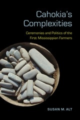
Cahokia's Complexities
Ceremonies and Politics of the First Mississippian FarmersSusan M. Alt
University of Alabama Press, 2018
The reasons for the rise and fall of early cities and ceremonial centers around the world have been sought for centuries. In the United States, Cahokia has been the focus of intense archaeological work to explain its mysteries. Cahokia was the first and exponentially the largest of the Mississippian centers that appeared across the Midwest and Southeast after AD 1000. Located near present-day East St. Louis, Illinois, the central complex of Cahokia spanned more than 12 square kilometers and encompassed more than 120 earthen mounds.
As one of the foremost experts on Cahokia, Susan M. Alt addresses long-standing considerations of eastern Woodlands archaeology—the beginnings, character, and ending of Mississippian culture (AD 1050–1600)—from a novel theoretical and empirical vantage point. Through this case study on farmers’ immigration and resettling, Alt’s narrative reanalyzes the relationship between administration and diversity, incorporating critical new discoveries and archaeological patterns from outside of Cahokia.
Alt examines the cultural landscape of the Cahokia flood plain and the layout of one extraordinary upland site, Grossman, as an administrative settlement where local farmers might have seen or participated in Cahokian rituals and ceremonies involving a web of ancestors, powers, and places. Alt argues that a farming district outside the center provides definitive evidences of the attempted centralized administration of a rural hinterland.
Cahokia, the Great Native American Metropolis
Biloine Whiting Young and Melvin L. Fowler
University of Illinois Press, 2000
Cahokia
Mirror of the CosmosSally A. Kitt Chappell
University of Chicago Press, 2002
Chappell seeks to answer fundamental questions about this unique, yet still relatively unknown space, which was designated a UNESCO World Heritage Site in 1982. How did this swampy land become so amenable to human life? Who were the remarkable people who lived here before the Europeans came? Why did the whole civilization disappear so rapidly? What became of the land in the centuries after the Mississippians abandoned it? And finally, what can we learn about ourselves as we look into the changing meaning of Cahokia through the ages?
To explore these questions, Chappell probes a wide range of sources, including the work of astronomers, geographers, geologists, anthropologists, and archaeologists. Archival photographs and newspaper accounts, as well as interviews with those who work at the site and Native Americans on their annual pilgrimage to the site, bring the story up to the present.
Tying together these many threads, Chappell weaves a rich tale of how different people conferred their values on the same piece of land and how the transformed landscape, in turn, inspired different values in them-cultural, spiritual, agricultural, economic, and humanistic.
Cahuachi in the Ancient Nasca World
Helaine Silverman
University of Iowa Press, 1993
Ever since its scientific discovery, the great Nasca site of Cahuachi on the south coast of the Central Andes has captured the attention of archaeologists, art historians, and the general public. Until Helaine Silverman's fieldwork, however, ancient Nasca culture was seen as an archaeological construct devoid of societal context. Silverman's long-term, multistage research as published in this volume reconstructs Nasca society and contextualizes the traces of this brilliant civilization (ca. 200 B.C.-A.D. 600).
Silverman shows that Cahuachi was much larger and more complex than portrayed in the current literature but that, surprisingly, it was not a densely populated city. Rather, Cahuachi was a grand ceremonial center whose population, size, density, and composition changed to accommodate a ritual and political calendar. Silverman meticulously presents and interprets an abundance of current data on the physical complexities, burials, and artifacts of this prominent site; in addition, she synthesizes the history of previous fieldwork at Cahuachi and introduces a corrected map and a new chronological chart for the Rio Grande de Nazca drainage system.
On the basis of empirical field data, ethnographic analogy, and settlement pattern analysis, Silverman constructs an Andean model of Nasca culture that is crucial to understanding the development of complex society in the Central Andes. Written in a clear and concise style and generously illustrated, this first synthesis of the published data about the ancient Nasca world will appeal to all archaeologists, art historians, urban anthropologists, and historians of ancient civilizations.
California's Channel Islands
The Archaeology of Human-Environment InteractionsChristopher S. Jazwa
University of Utah Press, 2013
California’s Ancient Past
From Pacific to the Range of LightJeanne E. Arnold
University Press of Colorado, 2010
Callachaca
Style Status In Inca CommunitySusan A. Niles
University of Iowa Press, 1987
Inca constructions, designed to conform to a state aesthetic, reveal the worldview of these masters of social and architectural engineering. In her meticulous analysis of Callachaca—the fifteenth-century estate of the royal Amaro Topa Inca and his retainers near the ancient capital of Cuzco—Susan Niles shows us that the physical order seen in this planned community reflects the Inca vision of an appropriate social order.
Callachaca: Style and Status in an Inca Community will be valuable reading for archaeologists, art historians, geographers, architects with an interest in pre-Columbian cultures, landscape architects, anthropologists, folklorists, and historians with a special interest in the Andes. Since she focuses on all the varied architectural remains at one site in the Inca heartland, Niles provides a unique model for examining royal Inca architecture and society.
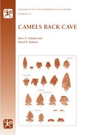
Camels Back Cave
Anthropological Paper 125Dave N. Schmitt
University of Utah Press, 2005
University of Utah Anthropological Paper No. 125
Camels Back Cave is in an isolated limestone ridge on the southern edge of the Great Salt Lake Desert. Recent archaeological investigations there have exposed a series of stratified deposits spanning the entire Holocene era (10,000 BP–present), deposits that show intermittent human occupations dating back through the past 7,600 years. Most human visits to the cave were brief—many likely representing overnight stays—and visitors did not dig pits or move sediment. As a result, fieldworkers were able to recognize and remove thirty-three stratigraphic horizons; radiocarbon analysis provided a pristine, high-resolution chronological sequence of human use. The brevity of visits and the undisturbed nature of the deposits also allowed researchers to identify portions of eight “living surfaces” where they exposed and mapped artifacts and ecofacts across contiguous blocks of units.
Aside from presenting model field techniques, this volume provides new and unique information on regional Holocene climates and biotic communities, cave taphonomy and small mammal hunting, as well as updated human chronologies for Great Basin occupation.
Canal Irrigation in Prehistoric Mexico
The Sequence of Technological ChangeBy William E. Doolittle
University of Texas Press, 1990
Prehistoric farmers in Mexico invented irrigation, developed it into a science, and used it widely. Indeed, many of the canal systems still in use in Mexico today were originally begun well before the discovery of the New World. In this comprehensive study, William E. Doolittle synthesizes and extensively analyzes all that is currently known about the development and use of irrigation technology in prehistoric Mexico from about 1200 B.C. until the Spanish conquest in the sixteenth century A.D.
Unlike authors of previous studies who have focused on the political, economic, and social implications of irrigation, Doolittle considers it in a developmental context. He examines virtually all the known systems, from small canals that diverted runoff from ephemeral mountain streams to elaborate networks that involved numerous large canals to irrigate broad valley floors with water from perennial rivers. Throughout the discussion, he gives special emphasis to the technological elaborations that distinguish each system from its predecessors. He also traces the spread of canal technology into and through different ecological settings.
This research substantially clarifies the relationship between irrigation technology in Mexico and the American Southwest and argues persuasively that much of the technology that has been attributed to the Spaniards was actually developed in Mexico by indigenous people. These findings will be important not only for archaeologists working in this area but also for geographers, historians, and engineers interested in agriculture, technology, and arid lands.
Capturing Water
Puebloan Resilience and Agricultural Sustainability in Chaco CanyonR. Gwinn Vivian and Samantha G. Fladd
University of Utah Press, 2025
The ability of the inhabitants of Chaco Canyon to sustain themselves through farming in an arid environment has long been a topic of debate among scholars. Building upon the work of his father, Gordon, R. Gwinn Vivian dedicated his lifetime of archaeological work to investigating water management and practices at Chaco. These efforts provide compelling evidence of the extensive use of canal irrigation systems and other water management techniques employed by the Ancestral Puebloan people by the ninth century and continuing through recent periods by Navajo farmers.
Rich with archaeological data, ethnographic evidence, maps, and photographs, this volume challenges long-standing assumptions about Chaco Canyon's agricultural potential. By highlighting the adaptability and ingenuity of the canyon's early inhabitants, the book offers a fresh perspective on the role of water management in the development of Chaco Canyon as a sociopolitical center in the northern Southwest.
Caribbean Paleodemography
Population, Culture History, and Sociopolitical Processes in Ancient Puerto RicoL. Antonio Curet
University of Alabama Press, 2005
Unearthing the demographic past of the Caribbean to illuminate its cultural origins and transformations.
According to the European chronicles, at the time of contact, the Greater Antilles were inhabited by the Taino or Arawak Indians, who were organized in hierarchical societies. Since its inception Caribbean archaeology has used population as an important variable in explaining many social, political, and economic processes such as migration, changes in subsistence systems, and the development of institutionalized social stratification.
In Caribbean Paleodemography, L. Antonio Curet argues that population has been used casually by Caribbean archaeologists and proposes more rigorous and promising ways in which demographic factors can be incorporated in our modeling of past human behavior. He analyzes a number of demographic issues in island archaeology at various levels of analysis, including inter- and intra-island migration, carrying capacity, population structures, variables in prehistory, cultural changes, and the relationship with material culture and social development. With this work, Curet brings together the diverse theories on Greater Antilles island populations and the social and political forces governing their growth and migration.
Caribou Hunting in the Upper Great Lakes
Edited by Elizabeth Sonnenburg, Ashley K. Lemke and John M. O'Shea
University of Michigan Press, 2015
Carnegie Maya II
Carnegie Institution of Washington <i>Current Reports</i>, 1952-1957John M. Weeks
University Press of Colorado, 2009
The final CIW field project took place in July of 1950, in the Maya region of Mayapán, where extensive and detailed investigations were conducted for five years. To ensure the rapid dissemination of the results of the Mayapán Project, two series of papers described the work being undertaken and reported the preliminary findings. These were volumes 50 through 57 of the Year Books and numbers 1 through 41 of the Current Reports. A total of forty one Current Reports were published by the Carnegie Institution of Washington from 1952 to 1957. All forty one of these are reproduced in The Carnegie Maya II, accompanied by an introduction by John Weeks, a forward by Marilyn Masson, and a summary table of data compiled by Marilyn Masson regarding artifacts unearthed at Mayapán.
Purchase of the print book comes with free individual access to the Adobe Digital Editions Carnegie Maya Series Ebook, which contains the complete set of The Carnegie Maya, The Carnegie Maya II, The Carnegie Maya III and The Carnegie Maya IV, thus making hundreds of documents from the Carnegie Institution's Maya program available in one source.
Carnegie Maya
The Carnegie Institution of Washington Maya Research Program, 1913-1957John M. Weeks
University Press of Colorado, 2006
The Carnegie Institution of Washington sponsored archaeological, ethnographic, linguistic, and historical investigations in the Maya region of southern Mexico and northern Central America between 1914 and 1957. The institution led the field during that time, with financial support and other resources no university could match.
Dispersed and out-of-print for fifty years, more than 350 reports from the Maya program are now available in this single volume. Reports from the institution's annual Year Books and other materials collected here tell the history of Maya research through firsthand accounts by participating scholars and reveal the progression of Mesoamerican archaeology from avocational interest to scholarly pursuit. Thematic and regional organization of the reports permits readers to monitor development of research concepts. Appendixes list all Carnegie Maya publications, Carnegie personnel, and the archival holdings of Carnegie-derived material at Harvard University, Tulane University, and the University of Chicago.
Purchase of the print book comes with free individual access to the Adobe Digital Editions Carnegie Maya Series Ebook, which contains the complete set of The Carnegie Maya, The Carnegie Maya II, The Carnegie Maya III and The Carnegie Maya IV, thus making hundreds of documents from the Carnegie Institution's Maya program available in one source.
Casas Grandes and Its Hinterlands
Prehistoric Regional Organization in Northwest MexicoMichael E. Whalen and Paul E. Minnis
University of Arizona Press, 2001

Cataloging Cultural Objects
A Guide to Describing Cultural Works and Their ImagesMurtha Baca
American Library Association, 2006
Catawba Valley Mississippian
Ceramics, Chronology, and Catawba IndiansDavid G. Moore
University of Alabama Press, 2002
By the 18th century, the modern Catawba Indians were living along the river and throughout the valley that bears their name near the present North Carolina-South Carolina border, but little was known of their history and origins. With this elegant study, David Moore proposes a model that bridges the archaeological record of the protohistoric Catawba Valley with written accounts of the Catawba Indians from the 17th, 18th, and 19th centuries, thus providing an ethnogenesis theory for these Native Americans.
Because the Catawba Confederacy had a long tradition of pottery making, dating ceramics and using them for temporal control was central to establishing a regional cultural chronology. Moore accomplishes this with a careful, thorough review and analysis of disparate data from the whole valley. His archaeological discoveries support documentary evidence of 16th century Spaniards in the region interacting with the resident Indians. By tracking the Spanish routes through the Catawba River valley and comparing their reported interactions with the native population with known archaeological sites and artifacts, he provides a firm chronological and spatial framework for Catawba Indian prehistory.
With excellent artifact photographs and data-rich appendixes, this book is a model study that induces us to contemplate a Catawba genesis and homeland more significant than traditionally supposed. It will appeal to professional archaeologists concerned with many topics—Mississippian, Lamar, early historic Indians, de Soto, Pardo, and chiefdom studies—as well as to the broader public interested in the archaeology of the Carolinas.
Cayman's 1794 Wreck of the Ten Sail
Peace, War, and Peril in the CaribbeanMargaret E. Leshikar-Denton
University of Alabama Press, 2020
The story has been passed through generations for more than two centuries. Details vary depending on who is doing the telling, but all refer to this momentous maritime event as the Wreck of the Ten Sail. Sometimes misunderstood as the loss of a single ship, it was in fact the wreck of ten vessels at once, comprising one of the most dramatic maritime disasters in all of Caribbean naval history. Surviving historical documents and the remains of the wrecked ships in the sea confirm that the narrative is more than folklore. It is a legend based on a historical event in which HMS Convert, formerly L’Inconstante, a recent prize from the French, and 9 of her 58-ship merchant convoy sailing from Jamaica to Britain, wrecked on the jagged eastern reefs of Grand Cayman in 1794.
The incident has historical significance far beyond the boundaries of the Cayman Islands. It is tied to British and French history during the French Revolution, when these and other European nations were competing for military and commercial dominance around the globe. The Wreck of the Ten Sail attests to the worldwide distribution of European war and trade at the close of the eighteenth century.
In Cayman’s 1794 Wreck of the Ten Sail: Peace, War, and Peril in the Caribbean, Margaret E. Leshikar-Denton focuses on the ships, the people, and the wreck itself to define their place in Caymanian, Caribbean, and European history. This well-researched volume weaves together rich oral folklore accounts, invaluable supporting documents found in archives in the United Kingdom, Jamaica, and France, and tangible evidence of the disaster from archaeological sites on the reefs of the East End.
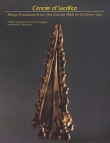
Cenote of Sacrifice
Maya Treasures from the Sacred Well at Chichen ItzaClemency Chase Coggins
University of Texas Press, 1984
Chichén Itzá ("mouth of the well of the Itza") was one of the great centers of civilization in prehistoric America, serving between the eighth and twelfth centuries A.D. as a religious, economic, social, and political capital on the Yucatán Peninsula. Within the ancient city there were many natural wells or cenotes. One, within the ceremonial heart of the city, is an impressive natural feature with vertical limestone walls enclosing a deep pool of jade green water some eighty feet below ground level. This cenote, which gave the city its name, became a sacred shrine of Maya pilgrimage, described by one post-Conquest observer as similar to Jerusalem and Rome. Here, during the city's ascendancy and for centuries after its decline, the peoples of Yucatán consulted their gods and made ritual offerings of precious objects and living victims who were thought to receive prophecies.
Although the well was described by Bishop Diego de Landa in the late sixteenth century, its contents were not known until the early 1900s when revealed by the work of Edward H. Thompson. Conducting excavations for the Peabody Museum of Harvard University, Thompson recovered almost thirty thousand artifacts, most ceremonially broken and many beautifully preserved by burial in the deep silt at the bottom of the well. The materials were sent to the Peabody Museum, where they remained, unexhibited, for over seventy years.
In 1984, for the first time, nearly three hundred objects of gold, jade, copper, pottery, wood, copal, textile, and other materials from the collection were gathered into a traveling interpretive exhibition. No other archaeological exhibition had previously given this glimpse into Maya ritual life because no other collection had objects such as those found in the Sacred Cenote. Moreover, the objects from the Cenote come from throughout Mesoamerica and lower Central America, representing many artistic traditions. The exhibit and this, its accompanying catalog, marked the first time all of the different kinds of offerings have ever been displayed together, and the first time many have been published.
Essays by Gordon R. Willey and Linnea H. Wren place the Cenote of Sacrifice and the great Maya city of Chichén Itzá within the larger context of Maya archaeology and history. The catalog entries, written by Clemency Chase Coggins, describe the objects displayed in the traveling exhibition. Some entries are brief descriptive statements; others develop short scholarly themes bearing on the function and interpretation of specific objects. Coggins' introductory essay describes how the objects were collected by Thompson and how the exhibition collection has been studied to reveal the periods of Cenote ritual and the changing practices of offering to the Sacred Cenote.
Center Places and Cherokee Towns
Archaeological Perspectives on Native American Architecture and Landscape in the Southern AppalachiansChristopher B. Rodning
University of Alabama Press, 2015
In Center Places and Cherokee Towns, Christopher B. Rodning opens a panoramic vista onto protohistoric Cherokee culture. He posits that Cherokee households and towns were anchored within their cultural and natural landscapes by built features that acted as “center places.”
Rodning investigates the period from just before the first Spanish contact with sixteenth-century Native American chiefdoms in La Florida through the development of formal trade relations between Native American societies and English and French colonial provinces in the American South during the late 1600s and 1700s. Rodning focuses particularly on the Coweeta Creek archaeological site in the upper Little Tennessee Valley in southwestern North Carolina and describes the ways in which elements of the built environment were manifestations of Cherokee senses of place.
Drawing on archaeological data, delving into primary documentary sources dating from the eighteenth century, and considering Cherokee myths and legends remembered and recorded during the nineteenth century, Rodning shows how the arrangement of public structures and household dwellings in Cherokee towns both shaped and were shaped by Cherokee culture. Center places at different scales served as points of attachment between Cherokee individuals and their communities as well as between their present and past. Rodning explores the ways in which Cherokee architecture and the built environment were sources of cultural stability in the aftermath of European contact, and how the course of European contact altered the landscape of Cherokee towns in the long run.
In this multi-faceted consideration of archaeology, ethnohistory, and recorded oral tradition, Rodning adeptly demonstrates the distinct ways that Cherokee identity was constructed through architecture and other material forms. Center Places and Cherokee Towns will have a broad appeal to students and scholars of southeastern archaeology, anthropology, Native American studies, prehistoric and protohistoric Cherokee culture, landscape archaeology, and ethnohistory.
Centuries of Decline during the Hohokam Classic Period at Pueblo Grande
Edited by David R. Abbott
University of Arizona Press, 2003
New data from major excavations in Phoenix, however, suggest that little was "classic" about the Classic period at Pueblo Grande. These findings challenge views of Hohokam society that prevailed for most of the twentieth century, suggesting that for Pueblo Grande it was a time of decline rather than prosperity, a time marked by overpopulation, environmental degradation, resource shortage, poor health, and social disintegration. During this period, the Hohokam in the lower Salt River Valley began a precipitous slide toward the eventual abandonment of a homeland that they had occupied for more than one thousand years.
This volume is a long-awaited summary of one of the most important data-recovery projects in Southwest archaeology, synthesizing thousands of pages of data and text published in seven volumes of contract reports. The authors—all leading authorities in Hohokam archaeology who played primary roles in this revolution of understanding—here craft a compelling argument for the eventual collapse of Hohokam society in the late fourteenth century as seen from one of the largest and seemingly most influential irrigation communities along the lower Salt River.
Drawing on extremely large and well-preserved collections, the book reveals startling evidence of a society in decline as reflected in catchment analysis, archaeofaunal assemblage composition, skeletal studies, burial assemblages, artifact exchange, and ceramic production. The volume also includes a valuable new summary of the archival reconstruction of the architectural sequence for the Pueblo Grande platform mound.
With its wealth of data, interpretation, and synthesis, Centuries of Decline represents a milestone in our understanding of Hohokam culture. It is a key reference for Southwest archaeologists who seek to understand the Hohokam collapse and a benchmark for anyone interested in the prehistory of Arizona.
Ceramic Commodities and Common Containers
The Production and Distribution of White Mountain Red Ware in the Grasshopper Region, ArizonaDaniela Triadan
University of Arizona Press, 1997
Relying primarily on stylistic analyses and the relative abundance of this ceramic ware in site assemblages, most scholars have assumed that it was manufactured within a restricted area on the southeastern edge of the Colorado Plateau and distributed via trade and exchange networks that may have involved controlled access to these ceramics.
This monograph critically evaluates these traditional interpretations, utilizing large-scale compositional and petrographic analyses that established multiple production zones for White Mountain Red Ware—including one in the Grasshopper region—during Pueblo IV times. The compositional data combined with settlement data and an analysis of archaeological contexts demonstrates that White Mountain Red Ware vessels were readily accessible and widely used household goods, and that migration and subsequent local production in the destinaton areas were important factors in their wide distribution during the 14th century.
Ceramic Commodities and Common Containers provides new insights into the organization of ceramic production and distribution in the northern Southwest and into the processes of social reorganization that characterized the late 13th and 14th century Western Pueblo world. As one of the few studies that integrate materials analysis into archaeological research, Triadan's monograph marks a crucial contribution to the reconstruction of these prehistoric societies.
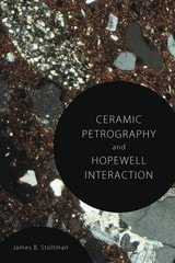
Ceramic Petrography and Hopewell Interaction
James B. Stoltman
University of Alabama Press, 2015
Petrography is the microscopic examination of thin sections of pottery to determine their precise mineralogical composition. In this groundbreaking work, James B. Stoltman applies quantitative as well as qualitative methods to the petrography of Native American ceramics. As explained in Ceramic Petrography and Hopewell Interaction, by adapting refinements to the technique of petrography, Stoltman offers a powerful new set of tools that enables fact-based and rigorous identification of the composition and sources of pottery.
Stoltman’s subject is the cultural interaction among the Hopewell Interaction Sphere societies of the Ohio Valley region and contemporary peoples of the Southeast. Inferring social and commercial relationships between disparate communities by determining whether objects found in one settlement originated there or elsewhere is a foundational technique of archaeology. The technique, however, rests on the informed but necessarily imperfect visual inspection of objects by archaeologists. Petrography greatly amplifies archaeologists’ ability to determine objects’ provenance with greater precision and less guesswork.
Using petrography to study a vast quantity of pottery samples sourced from Hopewell communities, Stoltman is able for the first time to establish which items are local, which are local but atypical, and which originated elsewhere. Another exciting possibility with petrography is to further determine the home source of objects that came from afar. Thus, combining traditional qualitative techniques with a wealth of new quantitative data, Ceramic Petrography and Hopewell Interaction offers a map of social and trade relationships among communities within and beyond the Hopewell Interaction Sphere with much greater precision and confidence than in the past.
Ceramic Petrography and Hopewell Interaction provides a clear and concise explanation of petrographic methods, Stoltman’s findings about Hopewell and southeastern ceramics in various sites, and the fascinating discovery that visits to Hopewell centers by southeastern Native Americans were not only for trade purposes but more for such purposes as pilgrimages, vision- and power-questing, healing, and the acquisition of knowledge.
Ceramic Production in the American Southwest
Edited by Barbara J. Mills and Patricia L. Crown
University of Arizona Press, 1995
Ceramic Sequence in Colima
Capacha, an Early PhaseIsabel Kelly
University of Arizona Press, 1980
Ceramics and Community Organization among the Hohokam
David R. Abbott
University of Arizona Press, 2000
Through ceramic analyses from Classic period sites such as Pueblo Grande, Abbott shows that ceramic production sources and exchange networks can be determined from the composition, surface treatment attributes, and size and shape of clay containers. The distribution networks revealed by these analyses provide evidence for community boundaries and the web of social ties within them.
Abbott's meticulous research documents formerly unrecognized horizontal cohesiveness in Hohokam organizational structure and suggests how irrigation was woven into the fabric of their social evolution. By demonstrating the contribution that ceramic research can make toward resolving issues about community organization, this work expands the breadth and depth of pottery studies in the American Southwest.
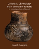
Ceramics, Chronology, and Community Patterns
An Archaeological Study at MoundvilleVincas P. Steponaitis
University of Alabama Press, 2009
Moundville, located on the Black Warrior River in west-central Alabama, is one of the best known and most intensively studied archaeological sites in North America. Yet, in spite of all these investigations, many aspects of the site's internal chronology remained unknown until the original 1983 publication of this volume. The author embarked on a detailed study of Moundville ceramics housed in museums and collections, and hammered out a new chronology for Moundville.This volume is a clearly written description of the analytical procedures employed on these ceramic samples and the new chronology this study revealed. Using the refined techniques outlined in this volume, it was possible for the author to trace changes in community patterns, which in turn shed light on Moundville's internal development and its place among North America's ancient cultures.
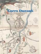
Cerro Danush
Excavations at a Hilltop Community in the Eastern Valley of Oaxaca, MexicoRonald K. Faulseit
University of Michigan Press, 2013
Monte Albán was the capital of the Valley of Oaxaca, Mexico, ca. 500 BC–AD 600, but once its control began to wane, other sites filled the political vacuum. Archaeologists have long awaited a meticulous excavation of one of these sites—one that would help us better understand the process that transformed second-tier sites into a series of polities or señoríos that competed with each other for centuries.
This book reports in detail on Ronald Faulseit’s excavations at the site of Dainzú-Macuilxóchitl in the Valley of Oaxaca. His 2007–2010 mapping and excavation seasons focused on the Late Classic (AD 600–900) and Early Postclassic (AD 900–1300). The spatial distributions of surface artifacts—collected during the intensive mapping and systematic surface collecting—on residential terraces at Cerro Danush are analyzed to evaluate evidence for craft production, ritual, and abandonment at the community level. This community analysis is complemented by data from the comprehensive excavation of a residential terrace, which documents diachronic patterns of behavior at the household level. The results from Faulseit’s survey and excavations are evaluated within the theoretical frameworks of political cycling and resilience theory. Faulseit concludes that resilient social structures may have helped orchestrate reorganization in the dynamic political landscape of Oaxaca after the political collapse of Monte Albán.
Cerro Palenque
Power and Identity on the Maya PeripheryBy Rosemary A. Joyce
University of Texas Press, 1991
Excavations at Cerro Palenque, a hilltop site in the Ulua Valley of northwest Honduras, revolutionized scholars’ ideas about the Terminal Classic period (roughly ad 850–1050) of Maya history and about the way in which cultures of the southeast Maya periphery related to the Lowland Maya. In this pathfinding study, Rosemary Joyce combines archaeological data gleaned from site research in 1980–1983 with anthropological theory about the evolution of social power to reconstruct something of the culture and lifeways of the prehispanic inhabitants of Cerro Palenque.
Joyce organizes her study in a novel way. Rather than presenting each category of excavated material (ceramics, lithics, etc.) in a separate chapter, she integrates this data in discussions of what people did and where they did it, resulting in a reconstruction of social activity more than in a description of material culture.
Joyce’s findings indicate that the precolumbian elites of the Ulua Valley had very strong and diversified contacts with Lowland Maya culture, primarily through the Bay of Honduras, with far less contact with Copán in the Highlands. The elites used their contacts with these distant, powerful cultures to reinforce their difference from the people they ruled and the legitimacy of their privileged status. Indeed, their dependence on foreign contacts ultimately led to their downfall when their foreign partners reorganized their economic and social order during the Terminal Classic period.
Although archaeological research in the region has been undertaken since the 1890s, Cerro Palenque is the first full-length study of an Ulua Valley site ever published. Joyce’s pioneering approach—archaeological ethnography—will be of interest to scholars dealing with any prehistoric people whose material remains provide the only clues to their culture.
Cetamura del Chianti
By Nancy Thomson de Grummond
University of Texas Press, 2020
Expanding the study of Etruscan habitation sites to include not only traditional cities but also smaller Etruscan communities, Cetamura del Chianti examines a settlement that flourished during an exceptional time period, amid wars with the Romans in the fourth to first centuries BCE.
Situated in an ideal hilltop location that was easy to defend and had access to fresh water, clay, and timber, the community never grew to the size of a city, and no known references to it survive in ancient writings; its ancient name isn’t even known. Because no cities were ever built on top of the site, excavation is unusually unimpeded. Intriguing features described in Cetamura del Chianti include an artisans’ zone with an adjoining sanctuary, which fostered the cult worship of Lur and Leinth, two relatively little known Etruscan deities, and ancient wells that reveal the cultural development and natural environment, including the vineyards and oak forests of Chianti, over a period of some six hundred years. Deeply enhancing our understanding of an intriguing economic, political, and cultural environment, this is a compelling portrait of a singular society.
Chaco Revisited
New Research on the Prehistory of Chaco Canyon, New MexicoEdited by Carrie C. Heitman and Stephen Plog
University of Arizona Press, 2015
In each of the twelve chapters, luminaries from the field of archaeology and anthropology, such as R. Gwinn Vivian, Peter Whiteley, and Paul E. Minnis, address some of the most fundamental questions surrounding Chaco, from agriculture and craft production, to social organization and skeletal analyses. Though varied in their key questions about Chaco, each author uses previous research or new studies to ultimately blaze a trail for future research and discoveries about the canyon.
Written by both up-and-coming and well-seasoned scholars of Chaco Canyon, Chaco Revisited provides readers with a perspective that is both varied and balanced. Though a singular theory for the Chaco Canyon phenomenon is yet to be reached, Chaco Revisited brings a new understanding to scholars: that Chaco was perhaps even more productive and socially complex than previous analyses would suggest.
Chaco and After in the Northern San Juan
Excavations at the Bluff Great HouseCatherine M. Cameron
University of Arizona Press, 2009
Bluff’s massive great house, great kiva, and earthen berms are described and compared to other great houses in the northern Chaco region. Those assessments support intriguing new ideas about the Chaco region and the effect of the collapse of Chaco Canyon on “outlying” great houses.
New insights from the Bluff Great House clarify the construction and use of great houses during the Chaco era and trace the history of great houses in the generations after Chaco’s decline. An innovative comparative study of the northern and southern portions of the Chaco world (the northern San Juan area around Bluff and the Cibola area around Zuni) leads to new ideas about population aggregation and regional abandonment in the Southwest. Appendixes present details and descriptions of artifacts recovered from Bluff: ceramics, projectile points, pollen analyses, faunal remains, bone tools, ornaments, and more.
This book is one of only a handful of reports on Chacoan great houses in the northern San Juan region. It provides an in-depth study of the Chaco era and clarifies the relationship of “outlying” great houses to Chaco Canyon. Research at the Bluff Great House begins to answer key questions about the nature of Chaco and its region, and the history of the northern San Juan in the Chaco and post-Chaco worlds.
Chaco's Northern Prodigies
Salmon, Aztec, and the Ascendancy of the Middle San Juan Region after AD 1100Paul F Reed
University of Utah Press, 2011
Work by two groups of contributors resulted in this synthetic volume, which interprets thirty-five years of research at Salmon Ruins. Chaco’s Northern Prodigies also puts recent work at Salmon Ruins in the context of Middle San Juan archaeological research. It is a timely synopsis of the archaeology of this region of the Southwest.
Challenging Colonial Narratives
Nineteenth-Century Great Lakes ArchaeologyMatthew A. Beaudoin
University of Arizona Press, 2019
To create a conceptual bridge between disparate dialogues, Beaudoin examines multigenerational nineteenth-century Mohawk and settler sites in southern Ontario, Canada. He demonstrates that few obvious differences exist and calls for more nuanced interpretive frameworks. Using conventional categories, methodologies, and interpretative processes from Indigenous and settler archaeologies, Beaudoin encourages archaeologists and scholars to focus on the different or similar aspects among sites to better understand the nineteenth-century life of contemporaneous Indigenous and settler peoples.
Beaudoin posits that the archaeological record represents people’s navigation through the social and political constraints of their time. Their actions, he maintains, were undertaken within the understood present, the remembered past, and perceived future possibilities. Deconstructing existing paradigms in colonial and postcolonial theories, Matthew A. Beaudoin establishes a new, dynamic discourse on identity formation and politics within the power relations created by colonization that will be useful to archaeologists in the academy as well as in cultural resource management.
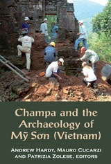
Champa and the Archaeology of M? So'n (Vietnam)
Edited by Andrew Hardy, Mauro Cucarzi, and Patrizia Zolese
National University of Singapore Press, 2009
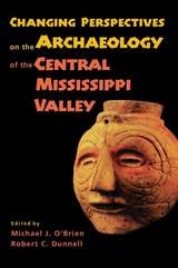
Changing Perspectives on the Archaeology of the Central Mississippi Valley
Michael J. O'Brien
University of Alabama Press, 1998
Fourteen experts examine the current state of Central Valley prehistoric research and provide an important touchstone for future archaeological study of the region
The Mississippi Valley region has long played a critical role in the development of American archaeology and continues to be widely known for the major research of the early 1950s. To bring the archaeological record up to date, fourteen Central Valley experts address diverse topics including the distribution of artifacts across the landscape, internal configurations of large fortified settlements, human-bone chemistry, and ceramic technology.
The authors demonstrate that much is to be learned from the rich and varied archaeological record of the region and that the methods and techniques used to study the record have changed dramatically over the past half century. Operating at the cutting edge of current research strategies, these archaeologists provide a fresh look at old problems in central Mississippi Valley research.
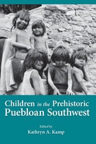
Children in Prehistoric Puebloan Southwest
Kathryn Kamp
University of Utah Press, 2002
Is there evidence of children in the archaeological record? Some would answer no, that "subadults" can only be distinguished when there is osteological confirmation. Others might suggest that the reason children don’t exist in prehistory is because no one has looked for them, much as no one had looked for women in the same context until recently.
Focusing on the Southwest, contributors to this volume attempt to find some of those children, or at least show how they might be found. They address two issues: what was the cultural construction of childhood? What were childrens' lives like?
Determining how cultures with written records have constructed childhood in the past is hard enough, but the difficulty is magnified in the case of ancient Puebloan societies. The contributors here offer approaches from careful analysis of artifacts and skeletal remains to ethnographic evidence in rock art. Topics include ceramics and evidence of child manufacture and painting, cradleboards, evidence of child labor, and osteological evidence of health conditions.
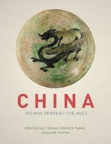
China
Visions through the AgesEdited by Lisa C. Niziolek, Deborah A. Bekken and Gary M. Feinman
University of Chicago Press, 2018
China’s long history is one of the richest and most complex in the known world, and the Cyrus Tang Hall of China offers visitors a wonderful, comprehensive survey of it through some 350 artifacts on display, spanning from the Paleolithic period to present day. Now, with China: Visions through the Ages, anyone can experience the marvels of this exhibition through the book’s beautifully designed and detailed pages. Readers will gain deeper insight into The Field Museum’s important East Asian collections, the exhibition development process, and research on key aspects of China’s fascinating history. This companion book, edited by the exhibition’s own curatorial team, takes readers even deeper into the wonders of the Cyrus Tang Hall of China and enables them to study more closely the objects and themes featured in the show. Mirroring the exhibition’s layout of five galleries, the volume is divided into five sections. The first section focuses on the Paleolithic and Neolithic periods; the second, the Bronze Age, the first dynasties, and early writing; the third, the imperial system and power; the fourth, religion and performance; and the fifth, interregional trade and the Silk Routes. Each section also includes highlights containing brief stories on objects or themes in the hall, such as the famous Lanting Xu rubbing.
With chapters from a diverse set of international authors providing greater context and historical background, China: Visions through the Ages is a richly illustrated volume that allows visitors, curious readers, and China scholars alike a chance to have an enduring exchange with the objects featured in the exhibition and with their multifaceted histories.
Chipped Stone Technological Organization
Central Place Foraging and Exchange on the Northern Great PlainsCraig M. Johnson
University of Utah Press, 2019
Central place foraging theory, through the field processing model, posits that the farther a source material is from the central living area, the more it will be processed before it is transported back, to avoid hauling heavy, nonusable parts on long trips. Johnson’s data support this theory and demonstrate that this model applies not only to nomadic hunter-gatherers but also to semisedentary farmer-hunters. His results also indicate that toolstone usage creates distinctive spatial patterns along the Missouri River, largely related to village distance from the sources. This is best illustrated with Knife River flint, which gradually declines in popularity downriver from its source in west-central North Dakota but increases in central South Dakota because of exchange.
Chipped Stone Tools in Formative Oaxaca, Mexico
Their Procurement, Production and UseWilliam J. Parry
University of Michigan Press, 1987
Chronological Analysis of Tsegi Phase Sites in Northeastern Arizona
Jeffrey S. Dean
University of Arizona Press, 1970

Chronologies in Old World Archaeology
Third EditionEdited by Robert W. Ehrich
University of Chicago Press, 1992
Circular Villages of the Monongahela Tradition
Bernard K. Means
University of Alabama Press, 2007
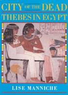
City of the Dead
Thebes in EgyptLise Manniche
University of Chicago Press, 1987
The author traces the history of the site discussing the more important tombs in some detail, and sheds new light on the symbolism used in painting to help the deceased in the Afterlife. She also surveys the role of the treasure hunters and travellers of the eighteenth and early nineteenth-centuries and the pioneer epigraphers who followed them and paved the way for the archeological investigation and research that continues today.
Classic Maya Polities of the Southern Lowlands
Integration, Interaction, DissolutionDamien B. Marken
University Press of Colorado, 2015
Classic Maya Polities of the Southern Lowlands investigates Maya political and social structure in the southern lowlands, assessing, comparing, and interpreting the wide variation in Classic period Maya polity and city composition, development, and integration. Traditionally, discussions of Classic Maya political organization have been dominated by the debate over whether Maya polities were centralized or decentralized. With new, largely unpublished data from several recent archaeological projects, this book examines the premises, strengths, and weaknesses of these two perspectives before moving beyond this long-standing debate and into different territory.
The volume examines the articulations of the various social and spatial components of Maya polity—the relationships, strategies, and practices that bound households, communities, institutions, and dynasties into enduring (or short-lived) political entities. By emphasizing the internal negotiation of polity, the contributions provide an important foundation for a more holistic understanding of how political organization functioned in the Classic period.
Contributors include Francisco Estrada Belli, James L. Fitzsimmons, Sarah E. Jackson, Caleb Kestle, Brigitte Kovacevich, Allan Maca, Damien B. Marken, James Meierhoff, Timothy Murtha, Cynthia Robin, Alexandre Tokovinine, and Andrew Wyatt.