Results by title
152 books match the query 'Cartography' and 45 start with t
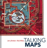
Talking Maps
Jerry Brotton and Nick Millea
Bodleian Library Publishing, 2019
Drawing on the Bodleian Library’s outstanding map collection and covering almost a thousand years, Talking Maps takes a new approach to map-making by showing how maps and stories have always been intimately entwined. Including such rare treasures as a unique map of the Mediterranean from the eleventh-century Arabic Book of Curiosities, a twelfth-century map of the world by al-Sharīf al-Idrīsī, and C. S. Lewis’s map of Narnia, this fascinating book analyzes maps as objects that enable us to cross sea and land; as windows into alternative and imaginary worlds; as guides to reaching the afterlife; as tools to manage cities, nations, and empires; as images of environmental change; and as digitized visions of the global future.
By telling the stories behind the artifacts and those generated by them, Talking Maps reveals how each map is not just a tool for navigation but also a worldly proposal that helps us to understand who we are by describing where we are.
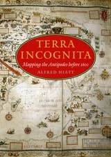
Terra Incognita
Mapping the Antipodes before 1600Alfred Hiatt
University of Chicago Press, 2008
In Terra Incognita, Alfred Hiatt draws on sources both literary and visual to understand the appeal of the antipodes. Examining maps and diagrams, as well as evidence contained in geographical and historical works, poetry, travel narratives, and legal documents, he challenges long-standing characterizations of medieval spatiality as exclusively symbolic and religious. Instead, Hiatt finds, the idea of people on the other side of the Earth provided a potent and malleable symbol for political theorists, satirists, scholars, and poets—as well as for map makers. Terra Incognita is, in the end, the history of a non-place, of lands conjured by the scientific imagination, which nevertheless drove exploration, and which continued to shape the world map, even as they slowly vanished from it.
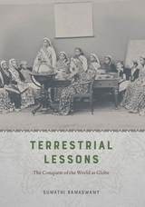
Terrestrial Lessons
The Conquest of the World as GlobeSumathi Ramaswamy
University of Chicago Press, 2017
In Terrestrial Lessons, Ramaswamy provides the first in-depth analysis of the globe’s history in and impact on the Indian subcontinent during the colonial era and its aftermath. Drawing on a wide array of archival sources, she delineates its transformation from a thing of distinction possessed by elite men into that mass-produced commodity used in classrooms worldwide—the humble school globe. Traversing the length and breadth of British India, Terrestrial Lessons is an unconventional history of this master object of pedagogical modernity that will fascinate historians of cartography, science, and Asian studies.
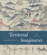
Territorial Imaginaries
Beyond the Sovereign MapEdited by Kären Wigen
University of Chicago Press, 2025
This strikingly colorful volume contends that modern mapping has never been sufficient to illustrate the complex reality of territory and political sovereignty, whether past or present. For Territorial Imaginaries, editor Kären Wigen has assembled an impressive slate of experts, spanning disciplines from political science to art history, to contribute perspectives and case studies covering three main themes: mapping before the nation-state, rethinking and critiquing mapping practices, and robust traditions of counter-cartography.
Each contributor proposes alternative ways to think about mapping, and the essays are supported with rich archival documentation. Among the far-reaching case studies are Barbara Mundy’s cartographic history of Indigenous dispossession in the Americas, Peter Bol’s examination of two Chinese maps created five hundred years apart, and Ali Yaycıoğlu’s exploration of tensions between top-down and bottom-up mapping of Habsburg and Ottoman border claims.
Texas Takes Shape
A History in Maps from the General Land OfficeBy Mark Lambert, James Harkins, Brian A. Stauffer, and Patrick Walsh
University of Texas Press, 2025
2025 Second Place, Presidio La Bahía Award, Sons of the Republic of Texas
2026 Ron Tyler Award for Best Illustrated Book on Texas History and Culture, Texas State Historical Association (TSHA)
A comprehensive volume on historical mapping in Texas.
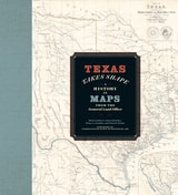
The Texas General Land Office’s map collection contains over 45,000 maps, some dating from the sixteenth century, making it one of the most important cartographic archives in Texas. As products and agents of history drawn by cartographers with motives and means as diverse as the places they document, maps provide a unique perspective on geopolitical, cultural, and economic processes. The maps of the GLO offer key insights into Texas’s sprawling history. They speak to issues of changing borders, social and political upheaval, and questions of sovereignty and power.
Texas Takes Shape offers an illuminating selection from the GLO archive: over one hundred maps that tell—and sometimes obscure—the stories of European colonization, Spanish and Mexican rule, the Republic of Texas, and the modern US state. There are maps here of every scale, from the hemispheric visions of European explorers to individual survey plats. Accompanying essays offer fascinating lessons on topics ranging from Indigenous cartography to military and railroad mapmaking and frontier surveys. Artful and informative, Texas Takes Shape examines a unique place through the eyes and imaginations of those who sought to govern it, profit from it, understand it, and call it home.
The Art of Terrestrial Diagrams in Early China
Michelle H. Wang
University of Chicago Press, 2023
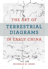
This is the first English-language monograph on the early history of maps in China, centering on those found in three tombs that date from the fourth to the second century BCE and constitute the entire known corpus of early Chinese maps (ditu). More than a millennium separates them from the next available map in the early twelfth century CE. Unlike extant studies that draw heavily from the history of cartography, this book offers an alternative perspective by mobilizing methods from art history, archaeology, material culture, religion, and philosophy. It examines the diversity of forms and functions in early Chinese ditu to argue that these pictures did not simply represent natural topography and built environments, but rather made and remade worlds for the living and the dead. Wang explores the multifaceted and multifunctional diagrammatic tradition of rendering space in early China.
The Atlas of Boston History
Edited by Nancy S. Seasholes
University of Chicago Press, 2019
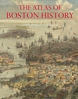
Edited by historian Nancy S. Seasholes, this landmark volume captures all aspects of Boston’s past in a series of fifty-seven stunning full-color spreads. Each section features newly created thematic maps that focus on moments and topics in that history. These maps are accompanied by hundreds of historical and contemporary illustrations and explanatory text from historians and other expert contributors. They illuminate a wide range of topics including Boston’s physical and economic development, changing demography, and social and cultural life. In lavishly produced detail, The Atlas of Boston History offers a vivid, refreshing perspective on the development of this iconic American city.
Contributors
Robert J. Allison, Robert Charles Anderson, John Avault, Joseph Bagley, Charles Bahne, Laurie Baise, J. L. Bell, Rebekah Bryer, Aubrey Butts, Benjamin L. Carp, Amy D. Finstein, Gerald Gamm, Richard Garver, Katherine Grandjean, Michelle Granshaw, James Green, Dean Grodzins, Karl Haglund, Ruth-Ann M. Harris, Arthur Krim, Stephanie Kruel, Kerima M. Lewis, Noam Maggor, Dane A. Morrison, James C. O’Connell, Mark Peterson, Marshall Pontrelli, Gayle Sawtelle, Nancy S. Seasholes, Reed Ueda, Lawrence J. Vale, Jim Vrabel, Sam Bass Warner, Jay Wickersham, and Susan Wilson
The Atlas of Coasts and Oceans
Ecosystems, Threatened Resources, Marine ConservationDon Hinrichsen
University of Chicago Press, 2011
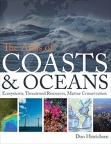
Oceans drive the world’s climate, nurture marine ecosystems full of aquatic life, and provide shipping lanes that have defined the global economy for centuries. And few realize that half of the world’s population lives in a coastal region within easy reach of one. Yet human activities such as commercial fishing, coastal real estate development, and industrial pollution have taken their toll on the seas. The first book of its kind, The Atlas of Coasts and Oceans documents the fraught relationship between humans and the earth’s largest bodies of water—and outlines the conservation steps needed to protect the marine environment for generations to come.
The Atlas offers a fascinating and often sobering account of how urbanization, climate change, offshore oil drilling, shipping routes, global tourism, and maritime conflict have had a profound impact on the world’s oceans and coasts. Combining text and images in visually engaging, thematically organized map spreads, this volume addresses the ecological, environmental, and economic importance of marine phenomena such as coral reefs, eroding shorelines, hurricanes, and fish populations—and how development threatens to destroy the ultimate source of all life on the “blue planet.” Lavishly illustrated with global and regional maps, from the Arabian Gulf to the Great Barrier Reef, from the Black Sea to the Mediterranean, and all the other major global waterways, The Atlas of Coasts and Oceans will be the definitive companion to any study of its subject for years to come.
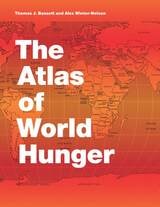
The Atlas of World Hunger
Thomas J. Bassett and Alex Winter-Nelson
University of Chicago Press, 2010
Earlier this year, President Obama declared one of his top priorities to be “making sure that people are able to get enough to eat.” The United States spends about five billion dollars on food aid and related programs each year, but still, both domestically and internationally, millions of people are hungry. In 2006, the Food and Agricultural Organization of the United Nations counted 850 million hungry people worldwide, but as food prices soared, an additional 100 million or more who were vulnerable succumbed to food insecurity.
If hunger were simply a matter of food production, no one would go without. There is more than enough food produced annually to provide every living person with a healthy diet, yet so many suffer from food shortages, unsafe water, and malnutrition every year. That’s because hunger is a complex political, economic, and ecological phenomenon. The interplay of these forces produces a geography of hunger that Thomas J. Bassett and Alex Winter-Nelson illuminate in this empowering book. The Atlas of World Hunger uses a conceptual framework informed by geography and agricultural economics to present a hunger index that combines food availability, household access, and nutritional outcomes into a single tool—one that delivers a fuller understanding of the scope of global hunger, its underlying mechanisms, and the ways in which the goals for ending hunger can be achieved. The first depiction of the geography of hunger worldwide, the Atlas will be an important resource for teachers, students, and anyone else interested in understanding the geography and causes of hunger. This knowledge, the authors argue, is a critical first step toward eliminating unnecessary suffering in a world of plenty.

The Cadastral Map in the Service of the State
A History of Property MappingRoger J. P. Kain and Elizabeth Baigent
University of Chicago Press, 1992
The Cadastral Map in the Service of the State, illustrated with 126 maps, traces the development and application of rural property mapping in Europe from the Renaissance through the nineteenth century. Beginning with a review of the roots of cadastral mapping in the Roman Empire, the authors concentrate on the use of cadastral maps in the Netherlands, France, England, the Nordic countries, the German lands, the territories of the Austrian Habsburgs, and the European colonies. During the sixteenth century government institutions began to use maps to secure economic and political bases; by the nineteenth century these maps had become tools for aggressive governmental control of land as tax bases, natural resources, and national territories. This work demonstrates how the seemingly neutral science of cartography became a political instrument for national
interests.
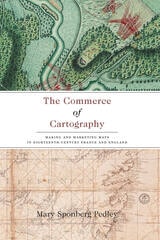
The Commerce of Cartography
Making and Marketing Maps in Eighteenth-Century France and EnglandMary Sponberg Pedley
University of Chicago Press, 2005
Conceptualizing the relationship between economics and cartography, Pedley traces the process of mapmaking from compilation, production, and marketing to consumption, reception, and criticism. In detailing the rise of commercial cartography, Pedley explores qualitative issues of mapmaking as well. Why, for instance, did eighteenth-century ideals of aesthetics override the modern values of accuracy and detail? And what, to an eighteenth-century mind and eye, qualified as a good map?
A thorough and engaging study of the business of cartography during the Enlightenment, The Commerce of Cartography charts a new cartographic landscape and will prove invaluable to scholars of economic history, historical geography, and the history of publishing.
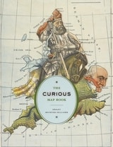
The Curious Map Book
Ashley Baynton-Williams
University of Chicago Press, 2015
Over the centuries, maps have served many varied purposes; far from mere guides for reaching a destination, they are unique artistic forms, aides in planning commercial routes, literary devices for illuminating a story. Accuracy—or inaccuracy—of maps has been the make-or-break factor in countless military battles throughout history. They have graced the walls of homes, bringing prestige and elegance to their owners. They track the mountains, oceans, and stars of our existence. Maps help us make sense of our worlds both real and imaginary—they bring order to the seeming chaos of our surroundings.
With The Curious Map Book, Ashley Baynton-Williams gathers an amazing, chronologically ordered variety of cartographic gems, mainly from the vast collection of the British Library. He has unearthed a wide array of the whimsical and fantastic, from maps of board games to political ones, maps of the Holy Land to maps of the human soul. In his illuminating introduction, Baynton-Williams also identifies and expounds upon key themes of map production, peculiar styles, and the commerce and collection of unique maps. This incredible volume offers a wealth of gorgeous illustrations for anyone who is cartographically curious.
The Darker Side of the Renaissance
Literacy, Territoriality, & Colonization, 2nd EditionWalter D. Mignolo
University of Michigan Press, 2003
Walter D. Mignolo is Professor in the Department of Romance Studies and the Program in Literature, Duke University.
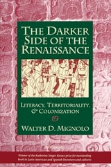
The Darker Side of the Renaissance
Literacy, Territoriality, and ColonizationWalter D. Mignolo
University of Michigan Press, 1995
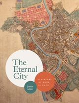
The Eternal City
A History of Rome in MapsJessica Maier
University of Chicago Press, 2020
In this unique and visually engaging book, Jessica Maier considers Rome through the eyes of mapmakers and artists who have managed to capture something of its essence over the centuries. Viewing the city as not one but ten “Romes,” she explores how the varying maps and art reflect each era’s key themes. Ranging from modest to magnificent, the images comprise singular aesthetic monuments like paintings and grand prints as well as more popular and practical items like mass-produced tourist plans, archaeological surveys, and digitizations. The most iconic and important images of the city appear alongside relatively obscure, unassuming items that have just as much to teach us about Rome’s past. Through 140 full-color images and thoughtful overviews of each era, Maier provides an accessible, comprehensive look at Rome’s many overlapping layers of history in this landmark volume.
The first English-language book to tell Rome’s rich story through its maps, The Eternal City beautifully captures the past, present, and future of one of the most famous and enduring places on the planet.
The History of Cartography, Volume 3 (Replacement Volume)
Cartography in the European Renaissance, Part 1Edited by David Woodward
University of Chicago Press, 2007
Cartography in the European Renaissance treats the period from 1450 to 1650, long considered the most important in the history of European mapping. This period witnessed a flowering in the production of maps comparable to that in the fields of literature and fine arts. Scientific advances, appropriations of classical mapping techniques, burgeoning trade routes—all such massive changes drove an explosion in the making and using of maps. While this volume presents detailed histories of mapping in such well-documented regions as Italy and Spain, it also breaks significant new ground by treating Renaissance Europe in its most expansive geographical sense, giving careful attention to often-neglected regions like Scandinavia, East-Central Europe, and Russia, and by providing innovative interpretive essays on the technological, scientific, cultural, and social aspects of cartography.
Lavishly illustrated with more than a thousand maps, many in color, the two volumes of Cartography in the European Renaissance will be the unsurpassable standard in its field, both defining it and propelling it forward.
The History of Cartography, Volume 3 (Replacement Volume)
Cartography in the European Renaissance, Part 2Edited by David Woodward
University of Chicago Press, 2007
Cartography in the European Renaissance treats the period from 1450 to 1650, long considered the most important in the history of European mapping. This period witnessed a flowering in the production of maps comparable to that in the fields of literature and fine arts. Scientific advances, appropriations of classical mapping techniques, burgeoning trade routes—all such massive changes drove an explosion in the making and using of maps. While this volume presents detailed histories of mapping in such well-documented regions as Italy and Spain, it also breaks significant new ground by treating Renaissance Europe in its most expansive geographical sense, giving careful attention to often-neglected regions like Scandinavia, East-Central Europe, and Russia, and by providing innovative interpretive essays on the technological, scientific, cultural, and social aspects of cartography.
Lavishly illustrated with more than a thousand maps, many in color, the two volumes of Cartography in the European Renaissance will be the unsurpassable standard in its field, both defining it and propelling it forward.
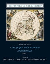
The History of Cartography, Volume Four
Cartography in the European EnlightenmentEdited by Matthew H. Edney and Mary Sponberg Pedley
University of Chicago Press, 2020
The social and intellectual changes that swept Enlightenment Europe also transformed many of its mapmaking practices. A new emphasis on geometric principles gave rise to improved tools for measuring and mapping the world, even as large-scale cartographic projects became possible under the aegis of powerful states. Yet older mapping practices persisted: Enlightenment cartography encompassed a wide variety of processes for making, circulating, and using maps of different types. The volume’s more than four hundred encyclopedic articles explore the era’s mapping, covering topics both detailed—such as geodetic surveying, thematic mapping, and map collecting—and broad, such as women and cartography, cartography and the economy, and the art and design of maps. Copious bibliographical references and nearly one thousand full-color illustrations complement the detailed entries.
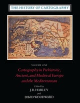
The History of Cartography, Volume One
Cartography in Prehistoric, Ancient, and Medieval Europe and the MediterraneanEdited by J. B. Harley and David Woodward
University of Chicago Press, 1987
Volume One addresses the prehistorical and historical mapping traditions of premodern Europe and the Mediterranean world. A substantial introductory essay surveys the historiography and theoretical development of the history of cartography and situates the work of the multi-volume series within this scholarly tradition. Cartographic themes include an emphasis on the spatial-cognitive abilities of Europe's prehistoric peoples and their transmission of cartographic concepts through media such as rock art; the emphasis on mensuration, land surveys, and architectural plans in the cartography of Ancient Egypt and the Near East; the emergence of both theoretical and practical cartographic knowledge in the Greco-Roman world; and the parallel existence of diverse mapping traditions (mappaemundi, portolan charts, local and regional cartography) in the Medieval period.
Throughout the volume, a commitment to include cosmographical and celestial maps underscores the inclusive definition of "map" and sets the tone for the breadth of scholarship found in later volumes of the series.
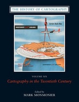
The History of Cartography, Volume Six
Cartography in the Twentieth CenturyEdited by Mark Monmonier
University of Chicago Press, 2015
The twentieth century is a pivotal period in map history. The transition from paper to digital formats led to previously unimaginable dynamic and interactive maps. Geographic information systems radically altered cartographic institutions and reduced the skill required to create maps. Satellite positioning and mobile communications revolutionized wayfinding. Mapping evolved as an important tool for coping with complexity, organizing knowledge, and influencing public opinion in all parts of the globe and at all levels of society. Volume 6 covers these changes comprehensively, while thoroughly demonstrating the far-reaching effects of maps on science, technology, and society—and vice versa.
The lavishly produced volume includes more than five hundred articles accompanied by more than a thousand images. Hundreds of expert contributors provide both original research, often based on their own participation in the developments they describe, and interpretations of larger trends in cartography. Designed for use by both scholars and the general public, this definitive volume is a reference work of first resort for all who study and love maps.
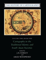
The History of Cartography, Volume Two, Book One
Cartography in the Traditional Islamic and South Asian SocietiesEdited by J. B. Harley and David Woodward
University of Chicago Press, 1992
"[The six-volume set] is certain to be the standard reference for all subsequent scholarship. The editors . . . have assembled and analyzed a vast collection of knowledge. . . . If the first volume is an indication, the complete set will be comprehensive and judicious." —John Noble Wilford, New York Times Book Review
"As well as enlarging the mind and lifting the spirits through the sheer magnitude of its endeavor, the collection delights the senses. The illustrations are exquisite: browsing fingers will instinctively alight on the sheaf of maps reproduced on stock slightly thicker than that of the text. The maps are so beguiling in the tantalizing glimpses they offer of other, seemingly incomprehensible, worlds, that the sight of them will stir the connoisseur in even the most-guarded scholar." —Ronald Rees, Geographical Review
"The corpus it brings to light, along with the extensive references, bibliography, and exhaustive appendices containing valuable comments about many of the pieces discussed, together make this book an important resource for the scholar."—Robert Provin, Professional Geographer
"This volume is a landmark of new research and will certainly contribute to further discoveries, translations, interpretations, inventories, more precise dating and the construction of stemmata." —Christian Jacob, Cartographica
"In seeking to characterize the cartography of premodern Islamic and south Asian societies, the editors offer the image of an archipelago of cartographically conscious islands in a silent sea. The research potential which they have revealed is clearly vast and underappreciated, with many islands still to be discovered or enlarged. This important book, does more, therefore, than plug a huge gap in cartographic historiography. It provides the foundation for crosscultural cartographic research in two major world regions."-Jeffrey Stone, Ecumene
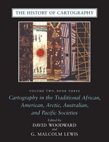
The History of Cartography, Volume Two, Book Three
Cartography in the Traditional African, American, Arctic, Australian, and Pacific SocietiesEdited by David Woodward and G. Malcolm Lewis
University of Chicago Press, 1998
"The maps in this book provide an evocative picture of how indigenous peoples view and represent their worlds. They illuminate not only questions of material culture but also the cognitive systems and social motivations that underpin them" (from the introduction).
Although they are often rendered in forms unfamiliar to Western eyes, maps have existed in most cultures. In this latest book of the acclaimed History of Cartography, contributors from a broad variety of disciplines collaborate to describe and address the significance of traditional cartographies. Whether painted on rock walls in South Africa, chanted in a Melanesian ritual, or fashioned from palm fronds and shells in the Marshall Islands, all indigenous maps share a crucial role in representing and codifying the spatial knowledge of their various cultures. Some also serve as repositories of a group's sacred or historical traditions, while others are exquisite art objects.
The indigenous maps discussed in this book offer a rich resource for disciplines such as anthropology, archaeology, art history, ethnology, geography, history, psychology, and sociology. Copious illustrations and carefully researched bibliographies enhance the scholarly value of this definitive reference.
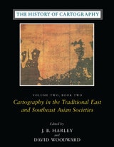
The History of Cartography, Volume Two, Book Two
Cartography in the Traditional East and Southeast Asian SocietiesEdited by J. B. Harley and David Woodward
University of Chicago Press, 1994
Volume 2, book 2, considers the cartographic traditions of China, Korea, Japan, Vietnam, Tibet, Burma, Thailand, Laos, Malaysia, Indonesia, Brunei, and the Philippines, presenting significant new research and interpretation of archaeological, literary, and graphic sources. Richly illustrated with forty color plates and over five hundred black and white illustrations, the book includes a number of rare and elaborate maps, many previously unpublished.
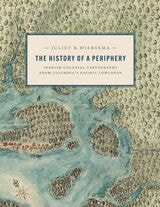
The History of a Periphery
Spanish Colonial Cartography from Colombia's Pacific LowlandsJuliet B. Wiersema
University of Texas Press, 2024
2025 ALAA Book Award, Association for Latin American Art/Arvey Foundation, College Art Association
An exploration of Colombian maps in New Granada.
During the late Spanish colonial period, the Pacific Lowlands, also called the Greater Chocó, was famed for its rich placer deposits. Gold mined here was central to New Granada’s economy yet this Pacific frontier in today’s Colombia was considered the “periphery of the periphery.” Infamous for its fierce, unconquered Indigenous inhabitants and its brutal tropical climate, it was rarely visited by Spanish administrators, engineers, or topographers and seldom appeared in detail on printed maps of the period.
In this lavishly illustrated and meticulously researched volume, Juliet Wiersema uncovers little-known manuscript cartography and makes visible an unexamined corner of the Spanish empire. In concert with thousands of archival documents from Colombia, Spain, and the United States, she reveals how a "periphery" was imagined and projected, largely for political or economic reasons. Along the way, she unearths untold narratives about ephemeral settlements, African adaptation and autonomy, Indigenous strategies of resistance, and tenuous colonialisms on the margins of a beleaguered viceroyalty.
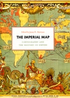
The Imperial Map
Cartography and the Mastery of EmpireEdited by James R. Akerman
University of Chicago Press, 2009
Critically reflecting on elements of mapping and imperialism from the late seventeenth century to the early twentieth century, the essays discuss the nature of the imperial map through a series of case studies of empires, from the Qing dynasty of China, to the Portuguese empire in South America, to American imperial pretensions in the Pacific Ocean, among others. Collectively, the essays reveal that the relationship between mapping and imperialism, as well as the practice of political and economic domination of weak polities by stronger ones, is a rich and complex historical theme that continues to resonate in our modern day.
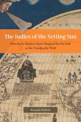
The Indies of the Setting Sun
How Early Modern Spain Mapped the Far East as the Transpacific WestRicardo Padrón
University of Chicago Press, 2020
Narratives of Europe’s westward expansion often tell of how the Americas came to be known as a distinct landmass, separate from Asia and uniquely positioned as new ground ripe for transatlantic colonialism. But this geographic vision of the Americas was not shared by all Europeans. While some imperialists imagined North and Central America as undiscovered land, the Spanish pushed to define the New World as part of a larger and eminently flexible geography that they called las Indias, and that by right, belonged to the Crown of Castile and León. Las Indias included all of the New World as well as East and Southeast Asia, although Spain’s understanding of the relationship between the two areas changed as the realities of the Pacific Rim came into sharper focus. At first, the Spanish insisted that North and Central America were an extension of the continent of Asia. Eventually, they came to understand East and Southeast Asia as a transpacific extension of their empire in America called las Indias del poniente, or the Indies of the Setting Sun.
The Indies of the Setting Sun charts the Spanish vision of a transpacific imperial expanse, beginning with Balboa’s discovery of the South Sea and ending almost a hundred years later with Spain’s final push for control of the Pacific. Padrón traces a series of attempts—both cartographic and discursive—to map the space from Mexico to Malacca, revealing the geopolitical imaginations at play in the quest for control of the New World and Asia.
The Invention of Order
On the Coloniality of SpaceDon Thomas Deere
Duke University Press, 2025
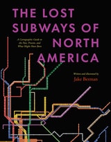
The Lost Subways of North America
A Cartographic Guide to the Past, Present, and What Might Have BeenJake Berman
University of Chicago Press, 2023
A visual exploration of the transit histories of twenty-three US and Canadian cities.
Every driver in North America shares one miserable, soul-sucking universal experience—being stuck in traffic. But things weren’t always like this. Why is it that the mass transit systems of most cities in the United States and Canada are now utterly inadequate?
The Lost Subways of North America offers a new way to consider this eternal question, with a strikingly visual—and fun—journey through past, present, and unbuilt urban transit. Using meticulous archival research, cartographer and artist Jake Berman has successfully plotted maps of old train networks covering twenty-three North American metropolises, ranging from New York City’s Civil War–era plan for a steam-powered subway under Fifth Avenue to the ultramodern automated Vancouver SkyTrain and the thousand-mile electric railway system of pre–World War II Los Angeles. He takes us through colorful maps of old, often forgotten streetcar lines, lost ideas for never-built transit, and modern rail systems—drawing us into the captivating transit histories of US and Canadian cities.
Berman combines vintage styling with modern printing technology to create a sweeping visual history of North American public transit and urban development. With more than one hundred original maps, accompanied by essays on each city’s urban development, this book presents a fascinating look at North American rapid transit systems.
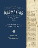
The Mapmakers of New Zion
A Cartographic History of MormonismRichard Francaviglia
University of Utah Press, 2015
From their earliest days on the American frontier through their growth into a worldwide church, the spatially expansive Mormons made maps to help them create idealized communities, migrate to and colonize large parts of the American West, visualize the stories in their sacred texts, and spread their message internationally through a well-organized missionary system. This book identifies many Mormon mapmakers who played an important but heretofore unsung role in charting the course of Latter-day Saint history. For Mormons, maps had and continue to have both practical and spiritual significance. In addition to using maps to help build their new Zion and to explore the Intermountain West, Latter-day Saint mapmakers used them to depict locations and events described in the Book of Mormon.
Featuring over one hundred historical maps reproduced in full color—many never before published—The Mapmakers of New Zion sheds new light on Mormonism and takes readers on a fascinating journey through maps as both historical documents and touchstones of faith.
Winner of the Southwest Book Design and Production Award from the New Mexico Book Association.
Selected as one of the American Library Association's Best of the Best from University Presses.
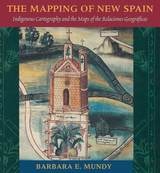
The Mapping of New Spain
Indigenous Cartography and the Maps of the Relaciones GeograficasBarbara E. Mundy
University of Chicago Press, 1996
"Its contribution to its specific field is both significant and original. . . . It is a pure pleasure to read." —Sabine MacCormack, Isis
"Mundy has done a fine job of balancing the artistic interpretation of the maps with the larger historical context within which they were drawn. . . . This is an important work." —John F. Schwaller, Sixteenth Century Journal
"This beautiful book opens a Pandora's box in the most positive sense, for it provokes the reconsideration of several long-held opinions about Spanish colonialism and its effects on Native American culture." —Susan Schroeder, American Historical Review
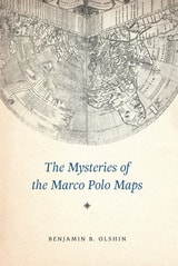
The Mysteries of the Marco Polo Maps
Benjamin B. Olshin
University of Chicago Press, 2014
In The Mysteries of the Marco Polo Maps, historian of cartography Benjamin B. Olshin offers the first credible book-length analysis of these artifacts, charting their course from obscure origins in the private collection of Italian-American immigrant Marcian Rossi in the 1930s; to investigations of their authenticity by the Library of Congress, J. Edgar Hoover, and the FBI; to the work of the late cartographic scholar Leo Bagrow; to Olshin’s own efforts to track down and study the Rossi maps, all but one of which are in the possession of Rossi’s great-grandson Jeffrey Pendergraft. Are the maps forgeries, facsimiles, or modernized copies? Did Marco Polo’s daughters—whose names appear on several of the artifacts—preserve in them geographic information about Asia first recorded by their father? Or did they inherit maps created by him? Did Marco Polo entrust the maps to Admiral Ruggero Sanseverino, who has links to Rossi’s family line? Or, if the maps have no connection to Marco Polo, who made them, when, and why?
Regardless of the maps’ provenance, Olshin’s tale—stretching from the remote reaches of the northern Pacific to early Chinese legends—takes readers on a journey confounding yet fascinating, offering insights into Italian history, the age of exploration, and the wonders of cartography.
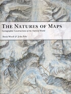
The Natures of Maps
Cartographic Constructions of the Natural WorldDenis Wood and John Fels
University of Chicago Press, 2008
To answer that question, the authors turn to a category of maps with a particularly strong reputation for objectivity: maps of nature. From depictions of species habitats and bird migrations to portrayals of the wilds of the Grand Canyon and the reaches of the Milky Way, such maps are usually presumed—even by users who should know better—to be strictly scientific. Yet by drawing our attention to every aspect of these maps’ self-presentation, from place names to titles and legends, the authors reveal the way that each piece of information collaborates in a disguised effort to mount an argument about reality. Without our realizing it, those arguments can then come to define our very relationship to the natural world—determining whether we see ourselves as humble hikers or rampaging despoilers, participants or observers, consumers or stewards.
Richly illustrated, and crafted in vivid and witty prose, The Natures of Maps will enlighten and entertain map aficionados, scholars, and armchair navigators alike. You’ll never be able to look at Google Maps quite the same way again.
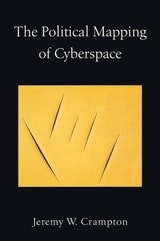
The Political Mapping of Cyberspace
Jeremy W. Crampton
University of Chicago Press, 2003
Using concepts and methods derived from the work of Michel Foucault, Crampton outlines a new mapping of cyberspace to help define the role of space in virtual worlds and to provide constructive ways in which humans can exist in another spatial dimension. He delineates the critical role maps play in constructing the medium as an object of knowledge and demonstrates that by processes of mapping we come to understand cyberspace. Maps, he argues, shape political thinking about cyberspace, and he deploys in-depth case studies of crime mapping, security maintenance, and geo-surveillance to show how we map ourselves onto cyberspace, inexorably, and indelibly.
Offering a powerful reinterpretation of technology and contemporary life, this innovative book will be an essential touchstone for the study of cartography and cyberspace in the twenty-first century.
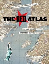
The Red Atlas
How the Soviet Union Secretly Mapped the WorldJohn Davies and Alexander J. Kent
University of Chicago Press, 2017
From 1950 to 1990, the Soviet Army conducted a global topographic mapping program, creating large-scale maps for much of the world that included a diversity of detail that would have supported a full range of military planning. For big cities like New York, DC, and London to towns like Pontiac, MI and Galveston, TX, the Soviets gathered enough information to create street-level maps. What they chose to include on these maps can seem obvious like locations of factories and ports, or more surprising, such as building heights, road widths, and bridge capacities. Some of the detail suggests early satellite technology, while other specifics, like detailed depictions of depths and channels around rivers and harbors, could only have been gained by actual Soviet feet on the ground. The Red Atlas includes over 350 extracts from these incredible Cold War maps, exploring their provenance and cartographic techniques as well as what they can tell us about their makers and the Soviet initiatives that were going on all around us.
A fantastic historical document of an era that sometimes seems less distant, The Red Atlas offers an uncanny view of the world through the eyes of Soviet strategists and spies.
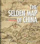
The Selden Map of China
A New Understanding of the Ming DynastyHongping Annie Nie
Bodleian Library Publishing, 2019
Exploring the commercial aims of the Ming Dynasty, the port city of Quanzhou and its connections with the voyages of the early traveler Zheng He, this book describes the historical background of the era in which the map was used. It also includes an analysis of the skills and techniques involved in Chinese map-making and the significance of the compass bearings, scale, and ratios found on the map, all of which combine to represent a breakthrough in cartographic techniques.
The enthralling story revealed by this extraordinary artifact sheds light on the long history of China’s relationship with the sea and with the wider world.
The Self-Made Map
Cartographic Writing in Early Modern FranceTom Conley
University of Minnesota Press, 2011
Conley traces the explosion of interest in mapmaking that occurred with the discovery of the New World, and discusses the commensurate rise of what he defines as cartographic writing-writing that "holds, penetrates, delineates, and explores space." Considering the works of such writers as Rabelais, Montaigne, and Descartes, Conley provides a "navigation" through the printed page, revealing the emerging values of Renaissance France. In his examination of the placing of words, letters, and graphic elements in books, he exposes the playful and sometimes enigmatic relation between spatial organization and text.
Conley also exposes the ideological exercise inherent in mapmaking, arguing that Renaissance cartography is inseparably bound up with the politics of the era. He undertakes close readings of maps and illustrations, discussing the necessity of viewing Renaissance maps in the context of their typographic layout, graphic reproduction, and literary and ideological import.
Richly illustrated throughout, The Self-Made Map combines studies of art, geography, history, literature, and printing to show a clear historical transformation, along the way linking geographical discoveries, printing processes, and political awareness. Conley's provocative analysis discloses how early modern printed literature and cartography worked together to crystallize broader issues engaging the then emergent status of cultural identity, nation, and individuality.
The Sovereign Map
Theoretical Approaches in Cartography throughout HistoryChristian Jacob
University of Chicago Press, 2006
Beginning with a historical overview of maps and their creation—from those traced in the dirt by primitive hands to the monumental Dutch atlases and ornate maps on Italian palace walls—Jacob goes on to consider the visual components of cartography: the decorative periphery, geometric grid, topographical lines, dots, details of iconographic figures, and many other aspects. Considering text on maps—titles, toponyms, legends, and keys—Jacob proposes that writing can both clarify and interfere with a map's visual presentation. Finally Jacob examines the role of the viewer in decoding a map's meaning and the role of society in defining the power of maps as authoritative depictions of space.
Innovative in its philosophical motivation and its interdisciplinary approach to looking at and writing about maps, The Sovereign Map is eagerly awaited by scholars from many different fields.
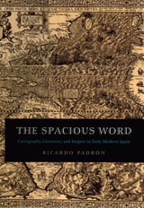
The Spacious Word
Cartography, Literature, and Empire in Early Modern SpainRicardo Padrón
University of Chicago Press, 2004
Padrón contends too that maps and geographic writings heavily influenced the Spanish imperial imagination. During the early modern period, the idea of "America" was still something being invented in the minds of Europeans. Maps of the New World, letters from explorers of indigenous civilizations, and poems dramatizing the conquest of distant lands, then, helped Spain to redefine itself both geographically and imaginatively as an Atlantic and even global empire. In turn, such literature had a profound influence on Spanish ideas of nationhood, most significantly its own.
Elegantly conceived and meticulously researched, The Spacious Word will be of enormous interest to historians of Spain, early modern literature, and cartography.
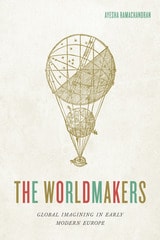
The Worldmakers
Global Imagining in Early Modern EuropeAyesha Ramachandran
University of Chicago Press, 2015
The Worldmakers moves beyond histories of globalization to explore how “the world” itself—variously understood as an object of inquiry, a comprehensive category, and a system of order—was self-consciously shaped by human agents. Gathering an international cast of characters, from Dutch cartographers and French philosophers to Portuguese and English poets, Ramachandran describes a history of firsts: the first world atlas, the first global epic, the first modern attempt to develop a systematic natural philosophy—all part of an effort by early modern thinkers to capture “the world” on the page.
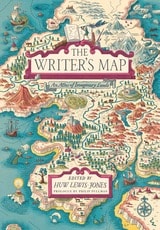
The Writer's Map
An Atlas of Imaginary LandsEdited by Huw Lewis-Jones
University of Chicago Press, 2018
Philip Pullman recounts the experience of drawing a map as he set out on one of his early novels, The Tin Princess. Miraphora Mina recalls the creative challenge of drawing up ”The Marauder’s Map” for the Harry Potter films. David Mitchell leads us to the Mappa Mundi by way of Cloud Atlas and his own sketch maps. Robert Macfarlane reflects on the cartophilia that has informed his evocative nature writing, which was set off by Robert Louis Stevenson and his map of Treasure Island. Joanne Harris tells of her fascination with Norse maps of the universe. Reif Larsen writes about our dependence on GPS and the impulse to map our experience. Daniel Reeve describes drawing maps and charts for The Hobbit film trilogy. This exquisitely crafted and illustrated atlas explores these and so many more of the maps writers create and are inspired by—some real, some imagined—in both words and images.
Amid a cornucopia of 167 full-color images, we find here maps of the world as envisaged in medieval times, as well as maps of adventure, sci-fi and fantasy, nursery rhymes, literary classics, and collectible comics. An enchanting visual and verbal journey, The Writer’s Map will be irresistible for lovers of maps, literature, and memories—and anyone prone to flights of the imagination.
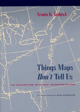
Things Maps Don't Tell Us
An Adventure into Map InterpretationArmin K. Lobeck
University of Chicago Press, 1993
A master cartographer and teacher, Armin Lobeck provides a clear, accessible guide to discerning the geological history of an area through an understanding of the lines of rivers, mountains, and coasts found on maps. He presents commonplace physical features that map users normally take for granted as a collection of cartographic detective stories. After pointing out patterns that call for solutions, Lobeck assembles clues and leads his readers through thoughtful, carefully crafted explanations, to show how to grasp the history of the earth through the art of map reading.
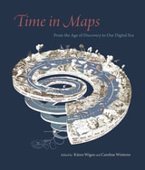
Time in Maps
From the Age of Discovery to Our Digital EraEdited by Kären Wigen and Caroline Winterer
University of Chicago Press, 2020
Focusing on maps created in Spanish America, Europe, the United States, and Asia, these essays take us from the Aztecs documenting the founding of Tenochtitlan, to early modern Japanese reconstructing nostalgic landscapes before Western encroachments, to nineteenth-century Americans grappling with the new concept of deep time. The book also features a defense of traditional paper maps by digital mapmaker William Rankin. With more than one hundred color maps and illustrations, Time in Maps will draw the attention of anyone interested in cartographic history.
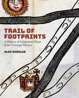
Trail of Footprints
A History of Indigenous Maps from Viceregal MexicoBy Alex Hidalgo
University of Texas Press, 2019
Trail of Footprints offers an intimate glimpse into the commission, circulation, and use of indigenous maps from colonial Mexico. A collection of sixty largely unpublished maps from the late sixteenth to the eighteenth centuries and made in the southern region of Oaxaca anchors an analysis of the way ethnically diverse societies produced knowledge in colonial settings. Mapmaking, proposes Hidalgo, formed part of an epistemological shift tied to the negotiation of land and natural resources between the region’s Spanish, Indian, and mixed-race communities. The craft of making maps drew from social memory, indigenous and European conceptions of space and ritual, and Spanish legal practices designed to adjust spatial boundaries in the New World. Indigenous mapmaking brought together a distinct coalition of social actors—Indian leaders, native towns, notaries, surveyors, judges, artisans, merchants, muleteers, collectors, and painters—who participated in the critical observation of the region’s geographic features. Demand for maps reconfigured technologies associated with the making of colorants, adhesives, and paper that drew from Indian botany and experimentation, trans-Atlantic commerce, and Iberian notarial culture. The maps in this study reflect a regional perspective associated with Oaxaca’s decentralized organization, its strategic position amidst a network of important trade routes that linked central Mexico to Central America, and the ruggedness and diversity of its physical landscape.
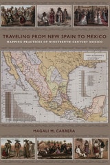
Traveling from New Spain to Mexico
Mapping Practices of Nineteenth-Century MexicoMagali M. Carrera
Duke University Press, 2011
From the sixteenth century until the early nineteenth, Europeans had envisioned New Spain (colonial Mexico) in texts, maps, and other images. In the first decades of the 1800s, ideas about Mexican, rather than Spanish, national character and identity began to cohere in written and illustrated narratives produced by foreign travelers. During the nineteenth century, technologies and processes of visual reproduction expanded to include lithography, daguerreotype, and photography. New methods of display—such as albums, museums, exhibitions, and world fairs—signaled new ideas about spectatorship. García Cubas participated in this emerging visual culture as he reconfigured geographic and cultural imagery culled from previous mapping practices and travel writing. In works such as the Atlas geográfico (1858) and the Atlas pintoresco é historico (1885), he presented independent Mexico to Mexican citizens and the world.
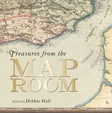
Treasures from the Map Room
A Journey through the Bodleian CollectionsEdited by Debbie Hall
Bodleian Library Publishing, 2016
Treasures from the Map Room publishes seventy-five extraordinary examples from this collection, housed in the Map Room at the newly renovated Weston Library. The maps reproduced in Treasures range from the fourteenth to the twenty-first century. Among them are the fourteenth-century Gough Map, the earliest road map of Great Britain that achieved a remarkable level of accuracy and detail for its time; fifteenth-century portolan charts intended for maritime navigation; the Selden Map of China, the earliest Chinese map to show shipping routes; and an important early map from the medieval Islamic Book of Curiosities. The book also includes a great many recent examples, including J. R. R. Tolkien’s map of Middle Earth and C. S. Lewis’s map of Narnia. Debbie Hall takes readers back in time to uncover the fascinating story of each treasure, from a map plotting outbreaks of cholera to a jigsaw map of India from the 1850s and silk escape maps carried by pilots flying missions over occupied Europe during World War II.
With lavish full-color photography and descriptions of each map’s provenance, purpose, and creation, Treasures from the Map Room is a beautiful and informative catalog of this remarkable collection.