Results by title
156 books match the query 'Geology' and 49 start with t
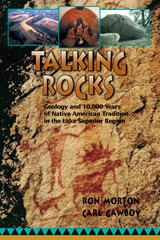
Talking Rocks
Geology and 10,000 Years of Native American Tradition in the Lake Superior RegionRon Morton
University of Minnesota Press, 2003
Join the conversation as an earth scientist and a Native American elder—wise men from two cultures—explore the natural history of the Lake Superior region, examining both the science and the spirit of the land.
As the geologist carefully presents a modern scientific perspective, the storyteller eloquently recounts a traditional Native American understanding, passed on through tales, myths, and symbols that illustrate how intimately his people have known and honored the earth and its history for over a hundred centuries.
Talking Rocks is not only a story of geological history told from two perspectives, it is also a chronicle of two people from very different cultural and scientific heritages learning to understand and appreciate each other’s distinct yet complementary ways of viewing the land we share.
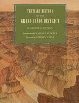
Tertiary History of the Grand Cañon District
Clarence E. Dutton; Introduction by Wallace Stegner; Foreword by Stephen J. Pyne
University of Arizona Press, 2001
Originally published in 1882, Clarence Dutton’s Tertiary History of the Grand Cañon District has become one of the definitive books on the Grand Canyon. Commissioned as a study of the region’s geology and issued by the fledgling U.S. Geological Survey, it is as much admired today for its literary as its scientific merits. With its beautiful illustrations by Thomas Moran and William Henry Holmes, it is a seminal work on the Canyon that has never been surpassed for its eloquence and authority.
This new edition of Dutton’s magnum opus makes that work available once again. Visitors to the Canyon will gain a new appreciation of its majesty as Dutton takes readers on several excursions among its castellated and cathedral-like peaks and ridges. Along the way, he explains the peculiar characteristics of different rocks, the water-sculpturing process, volcanic cones and outflows, the extent of the river’s erosion, and other geological features.
Dutton’s Tertiary History remains arguably the most evocative and compelling geological writing ever done on the Grand Canyon region. As Stephen J. Pyne observes in his foreword, Dutton “recast a rocky peninsula into geo-poetry, reshaped an amorphous panorama of Time into narrative History, and transformed an American scene into a universal symbol.” No one who has thrilled to the majesty of the Grand Canyon will fail to be moved by this timeless work.
The Age of Everything
How Science Explores the PastMatthew Hedman
University of Chicago Press, 2007
Hedman details, for example, how interdisciplinary studies of the Great Pyramids of Egypt can determine exactly when and how these incredible structures were built. He shows how the remains of humble trees can illuminate how the surface of the sun has changed over the past ten millennia. And he also explores how the origins of the earth, solar system, and universe are being discerned with help from rocks that fall from the sky, the light from distant stars, and even the static seen on television sets.
Covering a wide range of time scales, from the Big Bang to human history, The Age of Everything is a provocative and far-ranging look at how science has determined the age of everything from modern mammals to the oldest stars, and will be indispensable for all armchair time travelers.
“We are used to being told confidently of an enormous, measurable past: that some collection of dusty bones is tens of thousands of years old, or that astronomical bodies have an age of some billions. But how exactly do scientists come to know these things? That is the subject of this quite fascinating book. . . . As told by Hedman, an astronomer, each story is a marvel of compressed exegesis that takes into account some of the most modern and intriguing hypotheses.”—Steven Poole, Guardian
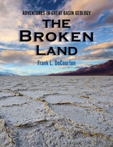
The Broken Land
Adventures in Great Basin GeologyFrank DeCourten
University of Utah Press, 2003
"The desert may seem timeless from within the Yellow Circle tonight, but the permanence of the surrounding landscape is only an illusion. Even the land is alive here, constantly changing and evolving as do all living things. Nothing here is 'finished.' Everything around us—the plants, the animals, the rocks, and the terrain itself—is in the process of becoming something else. And, of course, so are we. None of us around the campfire tonight are the same people we were yesterday, or will be tomorrow."—from the book
The Broken Land surveys the geological phenomena of the magnificent Great Basin landscape of western Utah, Nevada, eastern California, and adjacent regions. Each chapter focuses on a locality or area that provides insight into the deep history of one of North America's most remote regions—one of its continental margins. It is the only book available covering the geology of the entire Great Basin. Written for anyone with a casual to serious interest in natural history, The Broken Land conveys Frank DeCourten's awe at the story written in the rock of the basin.

The Color of Rock
A NovelSandra Cavallo Miller
University of Nevada Press, 2019
A young physician, Dr. Abby Wilmore, attempts to escape her past by starting over at the Grand Canyon Clinic. Silently battling her own health issues, Abby struggles with adjusting to the demands of this unique rural location. She encounters everything from squirrel bites to suicides to an office plagued by strong personalities. While tending to unprepared tourists, underserved locals, and her own mental trials, Abby finds herself entangled in an unexpected romance and trapped amidst a danger even more treacherous than the foreboding desert landscape.
Sandra Cavallo Miller’s debut novel transports readers to the beautiful depths of Arizona and weaves an adventurous and heartwarming tale of the courage and strength it takes to overcome personal demons and to find love.
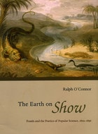
The Earth on Show
Fossils and the Poetics of Popular Science, 1802-1856Ralph O'Connor
University of Chicago Press, 2007
Shrewd science-writers, O’Connor shows, marketed spectacular visions of past worlds, piquing the public imagination with glimpses of man-eating mammoths, talking dinosaurs, and sea-dragons spawned by Satan himself. These authors—including men of science, women, clergymen, biblical literalists, hack writers, blackmailers, and prophets—borrowed freely from the Bible, modern poetry, and the urban entertainment industry, creating new forms of literature in order to transport their readers into a vanished and alien past.
In exploring the use of poetry and spectacle in the promotion of popular science, O’Connor proves that geology’s success owed much to the literary techniques of its authors. An innovative blend of the history of science, literary criticism, book history, and visual culture, The Earth on Show rethinks the relationship between science and literature in the nineteenth century.
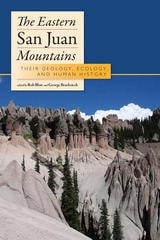
The Eastern San Juan Mountains
Their Ecology, Geology, and Human HistoryRob Blair
University Press of Colorado, 2011
A natural division between the eastern and western slopes of the San Juans is the north-south line that runs approximately through Lake City, south of the crossing of the Piedra River by US Highway 160. In this super guidebook, twenty-seven contributors--all experts in their fields--artfully bring the geology, hydrology, animal and plant life, human histories, and travel routes of these eastern slopes to life. Designed to inform researchers, educators, and students about the region's complex systems, The Eastern San Juan Mountains also serves as an informative guidebook to accompany visitors along their travels on the Silver Thread National Scenic Byway, which stretches between South Fork and Lake City.
The Eastern San Juan Mountains deserves a place next to The Western San Juan Mountains on the bookshelf of every naturalist, researcher, resident, educator, student, and tourist seeking a greater understanding of this marvelous place and its history.
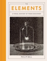
The Elements
A Visual History of Their DiscoveryPhilip Ball
University of Chicago Press, 2021
The Elements is a stunning visual journey through the discovery of the chemical building blocks of our universe. By piecing together the history of the periodic table, Ball explores not only how we have come to understand what everything is made of, but also how chemistry developed into a modern science. Ball groups the elements into chronological eras of discovery, covering seven millennia from the first known to the last named. As he moves from prehistory and classical antiquity to the age of atomic bombs and particle accelerators, Ball highlights images and stories from around the world and sheds needed light on those who struggled for their ideas to gain inclusion. By also featuring some elements that aren’t true elements but were long thought to be—from the foundational prote hyle and heavenly aetherof the ancient Greeks to more recent false elements like phlogiston and caloric—The Elements boldly tells the full history of the central science of chemistry.
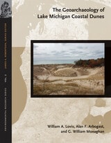
The Geoarchaeology of Lake Michigan Coastal Dunes
William A. Lovis, Alan F. Arbogast, and G. William Monaghan
Michigan State University Press, 2012
Complex sets of environmental factors have interacted over the past 5,000 years to affect how changes in climate, temperature, relative precipitation, and the levels of Lake Michigan influence the preservation of archaeological sites in coastal sand dunes along Lake Michigan. As a collaboration between earth scientists, archaeologists, and geoarchaeologists, this study draws on a wealth of research and multidisciplinary insights to explore the conditions necessary to safeguard ancient human settlements in these landscapes. A variety of contemporary and innovative techniques, including numerous dating methods and approaches, were employed to determine when and for how long sand dunes were active and when and for how long archaeological sites were occupied. Knowledge of dune processes and settlement patterns not only affects archaeological interpretations, but it is also consummately important to land planners responsible for managing heritage archaeological sites in the Lake Michigan coastal zone.
The Great Basin Seafloor
Exploring the Ancient Oceans of the Desert WestFrank DeCourten
University of Utah Press, 2022
Written for a nontechnical audience, this book interprets the rock record left by more than 500 million years of oceanic activity, when mud and sand accumulated and solidified to produce today’s Great Basin across parts of modern Utah, Nevada, and California. DeCourten deciphers clues within exposed slopes and canyons to reconstruct the vanished seafloor and its volcanic events and examines fossils to reveal once-thriving ancient marine communities. Supplemental material is available online to serve as a field guide for readers wishing to explore this ancient ocean themselves as they travel through the region.
The Great Devonian Controversy
The Shaping of Scientific Knowledge among Gentlemanly SpecialistsMartin J. S. Rudwick
University of Chicago Press, 1985
"After a superficial first glance, most readers of good will and broad knowledge might dismiss [this book] as being too much about too little. They would be making one of the biggest mistakes in their intellectual lives. . . . [It] could become one of our century's key documents in understanding science and its history."—Stephen Jay Gould, New York Review of Books
"Surely one of the most important studies in the history of science of recent years, and arguably the best work to date in the history of geology."—David R. Oldroyd, Science
The Great Paleolithic War
How Science Forged an Understanding of America's Ice Age PastDavid J. Meltzer
University of Chicago Press, 2015
In The Great Paleolithic War, David J. Meltzer tells the story of a scientific quest that set off one of the longest-running feuds in the history of American anthropology, one so vicious at times that anthropologists were deliberately frightened away from investigating potential sites. Through his book, we come to understand how and why this controversy developed and stubbornly persisted for as long as it did; and how, in the process, it revolutionized American archaeology.
The Highlands Controversy
Constructing Geological Knowledge through Fieldwork in Nineteenth-Century BritainDavid R. Oldroyd
University of Chicago Press, 1990
Oldroyd uses archival material and his own extensive reconstruction of the nineteenth-century fieldwork in a case study showing how detailed maps and sections made it possible to understand the exceptionally complex geological structure of the Highlands
An invaluable addition to the history of geology, The Highlands Controversy also makes important contributions to our understanding of the social and conceptual processes of scientific work, especially in times of heated dispute.

The Journal of Geology, volume 129 number 1 (January 2021)
The University of Chicago Press
University of Chicago Press Journals, 2021
The Journal of Geology, volume 129 number 2 (March 2021)
The University of Chicago Press
University of Chicago Press Journals, 2021
The Journal of Geology, volume 129 number 3 (May 2021)
The University of Chicago Press
University of Chicago Press Journals, 2021
The Journal of Geology, volume 129 number 4 (July 2021)
The University of Chicago Press
University of Chicago Press Journals, 2021
The Journal of Geology, volume 129 number 5 (September 2021)
The University of Chicago Press
University of Chicago Press Journals, 2021
The Journal of Geology, volume 129 number 6 (November 2021)
The University of Chicago Press
University of Chicago Press Journals, 2021
The Journal of Geology, volume 130 number 1 (January 2022)
The University of Chicago Press
University of Chicago Press Journals, 2022
The Journal of Geology, volume 130 number 2 (March 2022)
The University of Chicago Press
University of Chicago Press Journals, 2022
The Journal of Geology, volume 130 number 3 (May 2022)
The University of Chicago Press
University of Chicago Press Journals, 2022
The Journal of Geology, volume 130 number 4 (July 2022)
The University of Chicago Press
University of Chicago Press Journals, 2022
The Journal of Geology, volume 130 number 5 (September 2022)
The University of Chicago Press
University of Chicago Press Journals, 2022
The Journal of Geology, volume 130 number 6 (November 2022)
The University of Chicago Press
University of Chicago Press Journals, 2022
The Journal of Geology, volume 131 number 1 (January 2023)
The University of Chicago Press
University of Chicago Press Journals, 2023
The Journal of Geology, volume 131 number 2 (March 2023)
The University of Chicago Press
University of Chicago Press Journals, 2023
The Journal of Geology, volume 131 number 3 (May 2023)
The University of Chicago Press
University of Chicago Press Journals, 2023
The Journal of Geology, volume 131 number 4 (July 2023)
The University of Chicago Press
University of Chicago Press Journals, 2023
The Journal of Geology, volume 131 number 5 (September 2023)
The University of Chicago Press
University of Chicago Press Journals, 2023
The Journal of Geology, volume 131 number 6 (November 2023)
The University of Chicago Press
University of Chicago Press Journals, 2023
The Journal of Geology, volume 132 number 1-2 (March 2024)
The University of Chicago Press
University of Chicago Press Journals, 2024
The Journal of Geology, volume 132 number 3-4 (September 2024)
The University of Chicago Press
University of Chicago Press Journals, 2024
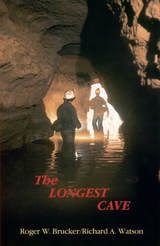
The Longest Cave
Roger W. Brucker and Richard A. Watson
Southern Illinois University Press, 1987
In 1925 the geological connection between Flint Ridge and Mammoth Cave was proved when dye placed in a Flint Ridge spring showed up in Echo River at Mammoth Cave.
That tantalizing swirl of dye confirmed speculations that wereto tempt more than 650cavers over half a century with the thrill of being the first to make human passage of the cave connection. Roger Brucker and Richard Watson tell not only of their own twenty-year effort to complete the link but the stories of many others who worked their way through mud-choked crawlways less than a foot high only to find impenetrable blockages.
Floyd Collins died a grisly death in nearby Sand Cave in1925, after being trapped there for 15 days. The wide press coverage of the rescue efforts stirred the imagination of the public and his body was on macabre display in a glass-topped coffin in Crystal Cave into the 1940s. Agents of a rival cave owner once even stole his corpse, which was recovered and still is in a coffin in the cave. Modern cavers still have a word with Floyd as they start their downward treks.
Brucker and Watson joined the parade of cavers who propelled themselves by wiggling kneecaps, elbows, and toes through quarter-mile long crawlways, clinging by fingertips and boot toes across mud-slick walls, over bottomless pits, into gurgling streams beneath stone ceilings that descend to water level, down crumbling crevices and up mountainous rockfalls, into wondrous domed halls, and straight ahead into a blackness intensified rather than dispelled by the carbide lamps on their helmets.
Over two decades they explored the passages with others who sought the final connection as vigorously as themselves. Pat Crowther, a young mother of two, joined them and because of her thinness became the member of the crew to go first into places no human had ever gone before. In that role, in July 1972, she wiggled her way through the Tight Spot and found the route that would link the Flint Ridge and Mammoth Cave systems into one cave extending 144.4 miles through the Kentucky limestone.
In a new afterword to this edition the authors summarize the subsequent explorations that have more than doubled the established length of the cave system. Based upon geological evidence, the authors predict that new discoveries will add another 200 miles to the length of the world’s longest cave, making it over 500 miles long.
The Microflora of Lakes and Its Geochemical Activity
By S. I. Kuznetsov
University of Texas Press, 1975
The geochemical processes that take place in water bodies do not stem entirely from the activity of bacteria, but are also determined by the biological activity of higher plants and animals. The Microflora of Lakes and Its Geochemical Activity, the first English translation of the work of S. I. Kuznetsov, renowned Soviet microbiologist, is a detailed description of these processes.
The Microflora of Lakes opens with a complete outline of the ecology and physical and chemical properties of water bodies and a discussion of the entire complex of hydrobionts, since these factors exert tremendous influence on the microbial population. The work then focuses on the principles of the morphology and physiology of the living cell, background knowledge essential to the understanding of the role of microorganisms in the chemical cycle. Having laid the groundwork for the discussion, Kuznetsov follows with chapters on the distribution of bacteria and transformations of organic matter in lakes. He then examines the role of bacteria in the oxygen regime, and the cycles of organic matter, nitrogen, sulfur, iron, manganese and phosphorus. The last chapter describes the role of microorganisms in sediments of calcium carbonate waters.
The Microflora of Lakes and Its Geochemical Activity provides a wealth of information on the microbial limnology of fresh-water lakes throughout the world, particularly in the Soviet Union. As a summary of the geochemical activities as related to the geographic, geological, and physical relationships of fresh-water lakes, it is a monumental study.
The Microflora of Lakes was translated for the National Science Foundation, Washington, D.C., by the Israel Program for Scientific Translations in Jerusalem.
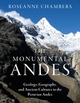
The Monumental Andes
Geology, Geography, and Ancient Cultures in the Peruvian AndesRoseanne Chambers
University of Utah Press, 2024
At once approachable and informative, The Monumental Andes tells the history of the lofty mountains and civilizations that characterize the Central Andes. The book explores many interconnected aspects of ancient Andean life, including climate, topography, agricultural methods, natural hazards, the construction of monumental structures, the creation of sophisticated art objects, and the plant-based hallucinogens and narcotics used in religious rituals. From earthquake-resistant structures to shrines on the tops of active volcanoes, ancient Andeans left behind relics that amaze and inspire today.
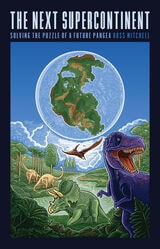
The Next Supercontinent
Solving the Puzzle of a Future PangeaRoss Mitchell
University of Chicago Press, 2023
An internationally recognized scientist shows that Earth’s separate continents, once together in Pangea, are again on a collision course.
You’ve heard of Pangea, the single landmass that broke apart some 175 million years ago to give us our current continents, but what about its predecessors, Rodinia or Columbia? These “supercontinents” from Earth’s past provide evidence that land repeatedly joins and separates. While scientists debate what that next supercontinent will look like—and what to name it—they all agree: one is coming.
In this engaging work, geophysicist Ross Mitchell invites readers to remote (and sometimes treacherous) lands for evidence of past supercontinents, delves into the phenomena that will birth the next, and presents the case for the future supercontinent of Amasia, defined by the merging of North America and Asia. Introducing readers to plate tectonic theory through fieldwork adventures and accessible scientific descriptions, Mitchell considers flows deep in the Earth’s mantle to explain Amasia’s future formation and shows how this developing theory can illuminate other planetary mysteries. He then poses the inevitable question: how can humanity survive the intervening 200 million years necessary to see Amasia?
An expert on the supercontinent cycle, Mitchell offers readers a front-row seat to a slow-motion mystery and an ongoing scientific debate.
The Next Tsunami
Living on a Restless CoastBonnie Henderson
Oregon State University Press, 2014
More than twenty years passed before geologists discovered that it was neither Seaside’s first nor worst tsunami. In fact, massive tsunamis strike the Pacific coast every few hundred years, triggered not by distant temblors but by huge quakes less than one hundred miles off the Northwest coast. Not until the late 1990s would scientists use evidence like tree rings and centuries-old warehouse records from Japan to fix the date, hour, and magnitude of the Pacific Northwest coast’s last megathrust earthquake: 9 p.m., January 26, 1700, magnitude 9.0—one of the largest quakes the world has known. When the next one strikes—this year or hundreds of years from now—the tsunami it generates is likely to be the most devastating natural disaster in the history of the United States.
In The Next Tsunami, Bonnie Henderson shares the stories of scientists like meteorologist Alfred Wegener, who formulated his theory of continental drift while gazing at ice floes calving from Greenland glaciers, and geologist Brian Atwater, who paddled his dented aluminum canoe up coastal streams looking for layers of peat sandwiched among sand and silt. The story begins and ends with Tom Horning, who grew up to become a geologist and return to his family home at the mouth of the river in Seaside—arguably the Northwest community with the most to lose from what scientist Atwater predicts will be an “apocalyptic” disaster. No one in Seaside understands earthquake science—and the politics and complicated psychology of living in a tsunami zone—better than Horning.
Henderson’s compelling story of how scientists came to understand the Cascadia Subduction Zone—a fault line capable of producing earthquakes even larger than the 2011 Tohoku quake in Japan—and how ordinary people cope with that knowledge is essential reading for anyone interested in the charged intersection of science, human nature, and public policy
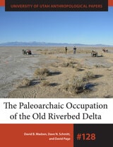
The Paleoarchaic Occupation of the Old River Bed Delta
David B. Madsen, Dave N. Schmitt, and David Page
University of Utah Press, 2015
University of Utah Anthropological Paper No. 128
About 12,000 years ago, a major river ran from the Sevier Basin to the Great Salt Lake, feeding a wetland delta system and creating riparian habitat along its length. But after three thousand years the river dried up and the surrounding lands became more like what we see today. Because the Old River Bed Delta experienced less environmental and human disturbance than other areas, many of the Paleoarchaic sites found there have remained relatively intact—a rare find in the Great Basin. This book presents a comprehensive synthesis of a decade of investigations conducted by research teams working in different parts of the delta and explores questions about how the old riverbed was formed, how its distributary system changed through time, and how these changes affected early foragers. It concludes with an integrated summary and interpretation. Additional material from this study will be available online at UofUpress.com.
Supplementary Material for The Paleoarchaic Occupation of the Old River Bed Delta
Chapter 3 - SDM Trench and Locality Descriptions November
Chapter 3 SDM Individual Channel Images November
Chapter 5 - SDM Additional Lithic Artifact Images
Chapter 6 - SDM Results of XRF and PXRF Analysis
Chapter 6 - SDM Source Assignment Tables

The Powers That Be
Global Energy for the Twenty-first Century and BeyondScott L. Montgomery
University of Chicago Press, 2010
Thirty years ago, our global energy landscape did not look remarkably different from what it does today. Three or four decades from now, it certainly will: dwindling oil reserves will clash with skyrocketing demand, as developing nations around the world lead their citizens into the modern energy economy, and all the while, the grave threat of catastrophic climate change looms ever larger. Energy worries are at an all-time high—just how will we power our future?
With The Powers That Be, Scott L. Montgomery cuts through the hype, alarmism, and confusion to give us a straightforward, informed account of where we are now, and a map of where we’re going. Starting with the inescapable fact of our current dependence on fossil fuels—which supply 80% of all our energy needs today—Montgomery clearly and carefully lays out the many alternative energy options available, ranging from the familiar, like water and solar, to such nascent but promising sources as hydrogen and geothermal power. What is crucial, Montgomery explains, is understanding that our future will depend not on some single, wondrous breakthrough; instead, we should focus on developing a more diverse, adaptable energy future, one that draws on a variety of sources—and is thus less vulnerable to disruption or failure.
An admirably evenhanded and always realistic guide, Montgomery enables readers to understand the implications of energy funding, research, and politics at a global scale. At the same time, he doesn’t neglect the ultimate connection between those decisions and the average citizen flipping a light switch or sliding behind the wheel of a car, making The Powers That Be indispensible for our ever-more energy conscious age.
The Pulse of the Earth
Political Geology in JavaAdam Bobbette
Duke University Press, 2023
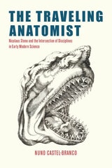
The Traveling Anatomist
Nicolaus Steno and the Intersection of Disciplines in Early Modern ScienceNuno Castel-Branco
University of Chicago Press, 2025
Nicolaus Steno (1638–1686) was a renowned anatomist in his lifetime. He reformed the anatomical understanding of glands, argued that the heart was a muscle, renamed the so-called female testicles as ovaries, and developed a mathematical model for understanding muscle contraction—discoveries that were fundamental to the fields of anatomy and physiology. However, other aspects of Steno’s life have come to define him: his claim that mountains’ strata reveal the history of the Earth and his conversion to Catholicism as a practicing scientist. This excessive attention to his geological discoveries and to asking whether science and religion are compatible, Nuno Castel-Branco argues, has obscured his significant accomplishments as an anatomist. The Traveling Anatomist thus restores Steno to his rightful place as a crucial figure in early modern science.
Using Steno’s extensive travels as a framework, this book depicts him as an active participant in the Republic of Letters. Castel-Branco traverses Leiden, Paris, Copenhagen, Florence, and Rome as he follows Steno in his sojourns through different scientific academies, courts, and artisanal workshops. There he developed new friends, some of whom were women, with whom he researched and exchanged ideas. Drawing on Steno’s books, correspondence, and novel archival material, Castel-Branco invites us to approach Steno and his accomplishments in anatomy, mathematics, and geology through the eyes of his contemporaries. Doing so, Castel-Branco reconstructs the rich and overlapping worlds of scientific disciplines that shaped Steno’s work, revealing the richness of interdisciplinary research in early modern intellectual life. And through Steno, he illustrates larger developments and new networks of significance in mid-seventeenth-century science. By focusing on ideas, scientific genres, institutions, and friendships, Castel-Branco offers a way others might also productively study science from the early modern period until today.
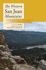
The Western San Juan Mountains
Their Geology, Ecology, and Human HistoryRob Blair
University Press of Colorado, 1996
The most complete work published on the natural history of southwest Colorado's majestic mountain system, The Western San Juan Mountains: Their Geology, Ecology, and Human History is designed to be used while exploring the scenic 235-mile paved San Juan Skyway, which passes through Durango, Silverton, Ouray, Telluride, Dolores, and Cortez.
The Western San Juan Mountains covers the physical environment, the biological communities, the human history, and points of interest represented on milepost signs along the highway. Some of the many topics covered include: how the San Juan Mountains were formed; why the landscape is so rugged and picturesque; why the vegetation changes from the lowlands to the alpine heights; energy and mineral resources of the area; why these mountains intrigued early explorers; factors that influence the unpredictable weather; and the first-known inhabitants.
The contributions to this guide include Fort Lewis College geologists, biologists, archaeologists, historians, and other specialists. Together they have amassed more than one hundred years of study based not only on previous work but on their own research.
This generously illustrated guidebook is aimed at all those who wish to understand this intricate mountain system in much greater detail than provided by most picture books.
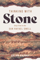
Thinking with Stone
Deep Time in the San Rafael SwellBrian Rajski
University of Utah Press, 2026
An intellectual journey through 250 million years of stone
In the San Rafael Swell, geologic forces have tilted and exposed the strata so that over 250 million years of geologic history can be observed simply by traveling across the rocky landscape, with its dramatic variety of colors and forms. Largely neglected by visitors to the state’s national parks and monuments and overlooked by many nature writers of the Colorado Plateau, the exceptional “Swell” offers a unique opportunity to think about people’s connections to the layers of earth beneath our feet.
Thinking with Stone takes readers on an intellectual journey across the Swell, moving from the youngest rocks at its edges to the oldest near its center and guiding readers through the features and histories of each geological layer. Drawing on personal experience and scientific research, Brian Rajski explores how creatively engaging with geology by using rocks as the foundation for thinking can generate new ideas about art, ethics, and the environment. Ultimately, the book reimagines the relationships between history and deep time, humanity and geology, and the individual and the stories told by stone.
Thousand-Miler
Adventures Hiking the Ice Age TrailMelanie Radzicki McManus
Wisconsin Historical Society Press, 2017
In thirty-six thrilling days, Melanie Radzicki McManus hiked 1,100 miles around Wisconsin, landing her in the elite group of Ice Age Trail thru-hikers known as the Thousand-Milers. In prose that’s alternately harrowing and humorous, Thousand-Miler takes you with her through Wisconsin’s forests, prairies, wetlands, and farms, past the geologic wonders carved by long-ago glaciers, and into the neighborhood bars and gathering places of far-flung small towns. Follow along as she worries about wildlife encounters, wonders if her injured feet will ever recover, and searches for an elusive fellow hiker known as Papa Bear. Woven throughout her account are details of the history of the still-developing Ice Age Trail—one of just eleven National Scenic Trails—and helpful insight and strategies for undertaking a successful thru-hike.
In addition to chronicling McManus’s hike, Thousand-Miler also includes the little-told story of the Ice Age Trail’s first-ever thru-hiker Jim Staudacher, an account of the record-breaking thru-run of ultrarunner Jason Dorgan, the experiences of a young combat veteran who embarked on her thru-hike as a way to ease back into civilian life, and other fascinating tales from the trail. Their collective experiences shed light on the motivations of thru-hikers and the different ways hikers accomplish this impressive feat, providing an entertaining and informative read for outdoors enthusiasts of all levels.
Time's River
Archaeological Syntheses from the Lower Mississippi ValleyEdited by Janet Rafferty and Evan Peacock
University of Alabama Press, 2008
An archaeologically rich region, in advance of impending disturbance
This volume stands as a key general resource for archaeologists working in the region extending from Louisiana through Mississippi north to Missouri and Kentucky, and it represents an opportunity to influence for decades a large part of the archaeological work to take place in the Southeast.
The book responds to a need for a comprehensive archaeological overview of the Lower Mississippi Valley that forms a portion of an interstate corridor spanning nine states that will run from southern Michigan to the Texas-Mexico border. The culturally sensitive Mississippi Delta is one of the richest archaeological areas in North America, and it is crucial that research designs be comprehensive, coordinated, and meet current preservation and future research needs. The authors are well-respected researchers from both within and outside the region with expertise in the full range of topics that comprise American archaeology. They examine matters of method and theory, the application of materials science, geophysics, and other high-tech tools in archaeology that provide for optimum data-recovery.
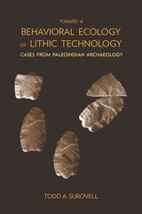
Toward a Behavioral Ecology of Lithic Technology
Cases from Paleoindian ArchaeologyTodd A. Surovell
University of Arizona Press, 2009
Because the fundamental processes of making, using, and discarding stone tools are, at root, exercises in problem solving, Todd Surovell asks what conditions favor certain technological solutions. Whether asking if a biface should be made thick or thin or if a flake should be saved or discarded, Surovell seeks answers that extend beyond a case-by-case analysis. One avenue for addressing these questions theoretically is formal mathematical modeling.
Here Surovell constructs a series of models designed to link environmental variability to human decision making as it pertains to lithic technology. To test the models, Surovell uses data from the analysis of more than 40,000 artifacts from five Rocky Mountain and Northern Plains Folsom and Goshen complex archaeological sites dating to the Younger Dryas stadial (ca. 12,600-11,500 years BP). The primary result is the production of powerful new analytical tools useful to the interpretation of archaeological assemblages.
Surovell's goal is to promote modeling and explore the general issues governing technological decisions. In this light, his models can be applied to any context in which stone tools are made and used.
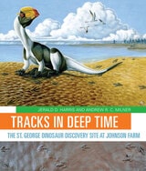
Tracks in Deep Time
The St. George Dinosaur Discovery Site at Johnson FarmJerald D. Harris and Andrew R. Milner
University of Utah Press, 2015
Tracks in Deep Time presents, for the first time, an engaging, thoroughly readable account of the history, geology, and paleontology of this important site. Two hundred million years ago, Lake Dixie covered the site. Within its waters and along its shores, a diverse ecosystem of dinosaurs, early crocodylians, fishes, plants, and other organisms thrived, leaving behind thousands of footprints and other fossils preserved in layers of rock. Unusual fossils found here include the world’s largest collection of tracks left by swimming dinosaurs and one of only six traces known to have been made by a sitting, meat-eating dinosaur. With approachable text and lavish, full-color photographs and illustrations, Jerald Harris and Andrew Milner describe how geologists and paleontologists have painstakingly reconstructed a vivid “snapshot” of life from the Early Jurassic epoch.
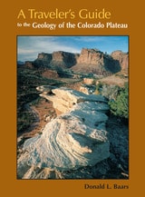
Travelers Guide
To The Geology Of Colorado PlateauDonald L Baars
University of Utah Press, 2002
Driving across I-70 in southern Utah one can’t help but wonder about the magnificent upturned rocks of the San Rafael Reef. With A Travelers Guide to the Geology of the Colorado Plateau in hand, you’ll soon discover that you were driving through Page and Navajo Sandstone formations, sharply folded into a monocline along one of the "Basin and Range" fault lines. Nearing Flagstaff, Arizona, on Highway 89, you will learn that Mt. Humphry of the San Francisco Peaks, a Navajo Sacred Mountain, was once an active volcano. Keep reading and you’ll find many things worth a slight detour.
A Traveler's Guide to the Geology of the Colorado Plateau will enrich and enliven all of your trips through the varied landscapes of the Colorado Plateau as you learn about the geological forces that have shaped its natural features. The mile-by-mile road logs will take you from Vernal, Utah, in the north to the southernmost reaches of the Plateau in Sedona, Arizona; from the red rocks of Cedar Breaks National Monument near Cedar City, Utah, to the edges of the soaring peaks of the San Juan Mountains near Durango, Colorado. The most comprehensive geological guide to the Colorado Plateau