
 A SCHOLARLY BOOK REPOSITORY
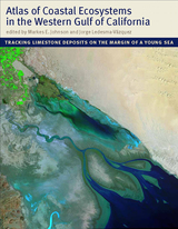
With an emphasis on the intricate workings of the Gulf, a team of scientists led by Markes E. Johnson and Jorge Ledesma-Vázquez explores how marine invertebrates such as corals and bivalves, as well as certain algae, contribute to the operation of a vast “organic engine” that acts as a significant carbon trap. The Atlas reveals that the role of these organisms in the ecology of the Gulf was greatly underestimated in the past. The organisms that live in these environments (or provide the sediments for beaches and dunes) are mass producers of calcium carbonate. Until now, no book has considered the centrality of calcium carbonate production as it functions today across multiple ecosystems and how it has evolved over time.
An important work of scholarship that also evokes the region’s natural splendor, the Atlas will be of interest to a wide range of scientists, including geologists, paleontologists, marine biologists, ecologists, and conservation biologists.
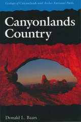
An easy-to-read geological history of the amazing red rock landscapes in southeastern Utah.
Towering red buttes, plunging canyon walls, domes, pinnacles, spires, ten thousand strangely carved forms—what visitor hasn’t marveled at the land of rock in southeastern Utah that is Canyonlands Country?
Canyonlands Country offers a unique geological history of this awesome landscape, in language understandable by the non-geologist. The story is as strange and fascinating as the land itself. Each exposed rock layer has a different geologic history: one is a stream deposit, another is an ancient field of dunes, another was deposited by shallow tropic seas. The Green and Colorado Rivers began carving canyons thirty million years ago, but to understand such relatively recent events Canyonlands Country takes us on a journey of two billion years.
Tours include Arches National Park, Island in the Sky, Needles District, The Maze and Elaterite Basin, Labyrinth and Stillwater Canyons, Meander Canyon, and Cataract Canyon.
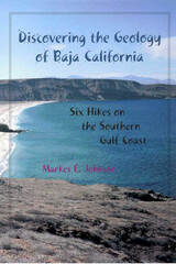
For those who wish to unlock the mysteries of Baja California, geologist Markes Johnson offers the key. He has taken a body of technical research on the geology and paleontology of the region and made it accessible in plain language for anyone who visits the peninsula, whether for study or recreation. His book teaches general concepts in coastal geomorphology and tectonics, as well as the basic geological and natural history of the Gulf of California, in a conversive, intellectually stimulating fashion.
Johnson's guide takes the form of six day-long hikes in the area of Punta Chivato on the east coast of the southern Baja California peninsula. Punta Chivato is presented as a microcosm of the entire region; it can enable visitors to better understand major themes in the natural history of the Gulf of California and its geological past. All of the hikes begin at the southeast corner of the Punta Chivato promontory and loop out in different directions. Each circuit is designed to minimize overlap with adjacent hikes and to maximize the visitor's exposure to instructive variations in the landscape. Each chapter features additional reflections on a geologist of another time and place who has advanced the field in a way that elucidates the material covered in that chapter. Through these asides, readers will learn the basic lessons about how geologists read the secrets hidden in landscapes.
Discovering the Geology of Baja California invites visitors to these shores to explore not only rocks and fossils but also the continuum of past ecosystems with the ecology of the present. It offers both an unparalleled guide to a remote area and a new understanding of life caught in an endless cycle of change.

In her volume, Ecologics, Howe narrates how an antidote to the Anthropocene became both failure and success. Tracking the development of what would have been Latin America's largest wind park, Howe documents indigenous people's resistance to the project and the political and corporate climate that derailed its renewable energy potential. Using feminist and more-than-human theories, Howe demonstrates how the dynamics of energy and environment cannot be captured without understanding how human aspirations for energy articulate with nonhuman beings, technomaterial objects, and the geophysical forces that are at the heart of wind and power.
Ecologies of a Storied Planet in the Anthropocene is a tour de force. With transdisciplinarity and theoretical lucidity, it rethinks the Anthropocene from a material ecocritical perspective, envisioning innovative modes of knowledge for deeper understandings of Anthropocene ecologies. Focusing on nonhuman agencies, Serpil Oppermann shows in fascinating detail how to better imagine an ecological future on our storied planet that has suffered enormously from an anthropocentric mindset.

In his volume, Energopolitics, Boyer examines the politics of wind power and how it is shaped by myriad factors, from the legacies of settler colonialism and indigenous resistance to state bureaucracy and corporate investment. Drawing on interviews with activists, campesinos, engineers, bureaucrats, politicians, and bankers, Boyer outlines the fundamental impact of energy and fuel on political power. Boyer also demonstrates how large conceptual frameworks cannot adequately explain the fraught and uniquely complicated conditions on the isthmus, illustrating the need to resist narratives of anthropocenic universalism and to attend to local particularities.
Currently 2,500 miles from the equator and more than 250 miles north of the Gulf of Mexico, the Minkin site was a swampy tropical forest adjacent to a tidal flat during the Coal Age or Carboniferous Period more than 300 million years ago. That fecund strand of sand and mud at the ocean’s edge teemed with the earth’s earliest reptiles as well as amphibians, fish, horseshoe crabs, spiders, jumping insects, and other fascinating organisms. Unlike dinosaurs and other large animals whose sturdy bodies left hard fossil records, most of these small, soft-bodied creatures left no concrete remains. But they did leave something else. Preserved in the site’s coal beds along with insect wings and beautifully textured patterns of primeval plants are their footprints, fossilized animal tracks from which modern paleontologists can glean many valuable insights about their physical anatomies and behaviors.
The paleontological examination of fossil tracks is now the cutting-edge of contemporary scholarship, and the Minkin site is the first and largest site of its kind in eastern North America. Discovered by a local high school science teacher, the site provides both professional and amateur paleontologists around the world with a wealth of fossil track samples along with an inspirational story for amateur explorers and collectors.
Authoritative and extensively illustrated, Footprints in Stone brings together the contributions of many geologists and paleontologists who photographed, documented, and analyzed the Minkin site’s fossil trackways. An engrossing tale of its serendipitous discovery and a detailed study of its fossil records, Footprints in Stone is a landmark publication in the history of paleontology.
"A welcome addition to our library of southwestern studies. Well-written, extremely well illustrated, and filled with useful dates, field techniques, and stratigraphic data." —International Journal of Geoarchaeology
"This geoarchaeological study is in the very best tradition of interdisciplinary research that applies geological concepts and methods to the study of archaeological contexts." —The Kiva
"After a superficial first glance, most readers of good will and broad knowledge might dismiss [this book] as being too much about too little. They would be making one of the biggest mistakes in their intellectual lives. . . . [It] could become one of our century's key documents in understanding science and its history."—Stephen Jay Gould, New York Review of Books
"Surely one of the most important studies in the history of science of recent years, and arguably the best work to date in the history of geology."—David R. Oldroyd, Science
Oldroyd uses archival material and his own extensive reconstruction of the nineteenth-century fieldwork in a case study showing how detailed maps and sections made it possible to understand the exceptionally complex geological structure of the Highlands
An invaluable addition to the history of geology, The Highlands Controversy also makes important contributions to our understanding of the social and conceptual processes of scientific work, especially in times of heated dispute.
Northern Utah’s Wasatch Mountains are popular destinations for outdoor enthusiasts in every season. These mountains rise spectacularly from the relatively flat valley floor to thirteen peaks over 11,000 feet in elevation. An additional nineteen peaks rise more than 10,000 feet in elevation. Although many hiking guides exist for the Wasatch Mountains, there has been no guide book that focuses on the geologic features visible from the trails—until now.
Written by a recognized authority on the geology of the Wasatch Mountains, this guide is meant to enrich the experience of outdoor enthusiasts who want to understand the geological history and development of the Wasatch range. The first section of the book introduces the major geological time periods—the record of mountain building events from oldest to youngest, the effects of glaciation, and the development of the present topography. It then follows with a descriptive trail guide for each major trail system, including Mill Creek and Neffs Canyons, Mount Olympus, Little and Big Cottonwood Canyons, and Bells Canyon. Trail length, elevation gain, relative difficulty, and major geological features are outlined for each trail. Now you can hike these trails with the answers to all your geologic questions right at your fingertips.
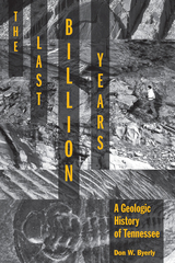
The Last Billion Years: A Geologic History of Tennessee is the first general overview in more than thirty years to interpret the state’s geological record. With minimal jargon, numerous illustrations and photographs, and a glossary of scientific terms, this volume provides the tools necessary for readers with little or no background in the subject to learn about the geologic formation of Tennessee, making it an excellent resource for high school students, college students, and interested general readers. Yet, because of the depth of its scholarship, the book is also an invaluable reference for professional geologists.
Recognizing that every reader is familiar with the roles of wind, water, gravity, and organisms in their everyday environment, author Don Byerly employs the Earth Systems Science approach, showing how the five interacting parts of the Earth—the geosphere, hydrosphere, atmosphere, biosphere, and cryosphere—have worked together for eons to generate the rock compositions that make up Tennessee’s geologic past.
All regions of the state are covered. Featuring a unique time chart that illustrates the state’s geologic history from east to west, The Last Billion Years shows that while the geologic aspects of the state’s three grand divisions are related in many ways, each division has a distinctly different background. The organization of the book further enhances its usability, allowing the reader to see and compare what was happening contemporaneously across the state during the key sequences of its geologic history. Written in a clear and engaging style, The Last Billion Years will have broad appeal to students, lay readers, and professionals.

The research in this volume derives from investigations conducted in connection with proposed widening and realignment of the Paulina-East Lake Highway, located within the caldera of Newberry Volcano. Formal evaluation of 13 localities and data recovers at four sites produced a wealth of information regarding human uses of the caldera and vicinity throughout the Holocene.
Sediments in Archaeological Context concerns the analysis of this matrix and the potential use of sediments to answer archaeological questions. Describing sediments and sampling them in appropriate ways do not replace the study of artifacts, but they can provide additional, useful information regarding a site complex, its physical environment, and the relations of artifacts to each other.
Each chapter in the volume considers sediments within a specific context. Topics include sediments found in a variety of environments: cultural environments, rockshelter and cave environments, dryland alluvial environments, humid alluvial environments, lake environments, shoreline environments, and spring and wetland environments.
Sediments in Archaeological Context is intended for every archaeologist who investigates sites in depositional contexts.
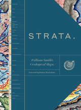
This sumptuous volume begins with an introduction by Douglas Palmer that places Smith’s work in the context of earlier, concurrent, and subsequent ideas regarding the structure and natural processes of the earth, geographical mapping, and biostratigraphical theories. The book is then organized into four parts, each beginning with four sheets from Smith’s hand-colored, 1815 strata map, accompanied by related geological cross-sections and county maps, and followed by fossil illustrations by Smith contemporary James Sowerby, all organized by strata. Essays between each section explore the aims of Smith’s work and its application in the fields of mining, agriculture, cartography and hydrology. Strata concludes with reflections on Smith’s later years as an itinerant geologist and surveyor, plagiarism by a rival, receipt of the first Wollaston Medal in recognition of his achievements, and the influence of his geological mapping and biostratigraphical theories on the sciences—all of which culminated in the establishment of the modern geological timescale.
Featuring a foreword by Robert Macfarlane, Strata is a glorious testament to the lasting geological and illustrative genius of William Smith, a collection as colossal and awe-inspiring as the layers of the Earth themselves.
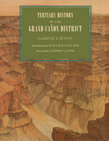
Originally published in 1882, Clarence Dutton’s Tertiary History of the Grand Cañon District has become one of the definitive books on the Grand Canyon. Commissioned as a study of the region’s geology and issued by the fledgling U.S. Geological Survey, it is as much admired today for its literary as its scientific merits. With its beautiful illustrations by Thomas Moran and William Henry Holmes, it is a seminal work on the Canyon that has never been surpassed for its eloquence and authority.
This new edition of Dutton’s magnum opus makes that work available once again. Visitors to the Canyon will gain a new appreciation of its majesty as Dutton takes readers on several excursions among its castellated and cathedral-like peaks and ridges. Along the way, he explains the peculiar characteristics of different rocks, the water-sculpturing process, volcanic cones and outflows, the extent of the river’s erosion, and other geological features.
Dutton’s Tertiary History remains arguably the most evocative and compelling geological writing ever done on the Grand Canyon region. As Stephen J. Pyne observes in his foreword, Dutton “recast a rocky peninsula into geo-poetry, reshaped an amorphous panorama of Time into narrative History, and transformed an American scene into a universal symbol.” No one who has thrilled to the majesty of the Grand Canyon will fail to be moved by this timeless work.
READERS
Browse our collection.
PUBLISHERS
See BiblioVault's publisher services.
STUDENT SERVICES
Files for college accessibility offices.
RECENTLY PUBLISHED


UChicago Accessibility Resources
home | accessibility | search | about | contact us
BiblioVault ® 2001 - 2024
The University of Chicago Press