
 A SCHOLARLY BOOK REPOSITORY
Contributors to this volume examine the migration process under two explanatory frameworks: alliance and landscape. These frameworks are used to explore competing hypotheses, positing either a rapid colonization associated with an alliance organized for warfare at a regional scale, or a more protracted migration as this landscape became comparatively more attractive for migrating farmers in the late thirteenth century.
As the first major publication on the archaeology of Perry Mesa, this volume contributes to theoretical perspectives on migration and ethnogenesis, the study of warfare in the prehistoric Southwest, the study of intensive agricultural practices in a marginal environment, and the cultural history of a little studied and largely unknown portion of the ancient Southwest. It not only documents the migration but also the ensuing birth of a new ethnic identity that arose from the coalescence of diverse groups atop Perry Mesa.
Several different cultures-Iroquois, Coosa, Anasazi, Hohokam, San Agustín, Wankarani, Formative Gulf Coast Mexico, and Formative, Classic, Colonial, and contemporary Maya-are analyzed through the lens of household archaeology in concrete, data-driven case studies. The text is divided into three sections: Section I examines the spatial and social organization and context of household production; Section II looks at the role and results of households as primary producers; and Section III investigates the role of, and interplay among, households in their greater political and socioeconomic communities.
In the past few decades, household archaeology has made substantial contributions to our understanding and explanation of the past through the documentation of the household as a social unit-whether small or large, rural or urban, commoner or elite. These case studies from a broad swath of the Americas make Ancient Households of the Americas extremely valuable for continuing the comparative interdisciplinary study of households.
Much of what we currently know about the ancient Maya concerns the activities of the elites who ruled the societies and left records of their deeds carved on the monumental buildings and sculptures that remain as silent testimony to their power and status. But what do we know of the common folk who labored to build the temple complexes and palaces and grew the food that fed all of Maya society?
This pathfinding book marshals a wide array of archaeological, ethnohistorical, and ethnographic evidence to offer the fullest understanding to date of the lifeways of ancient Maya commoners. Senior and emerging scholars contribute case studies that examine such aspects of commoner life as settlement patterns, household organization, and subsistence practices. Their reports cover most of the Maya area and the entire time span from Preclassic to Postclassic. This broad range of data helps resolve Maya commoners from a faceless mass into individual actors who successfully adapted to their social environment and who also held primary responsibility for producing the food and many other goods on which the whole Maya society depended.
Nasca society arose on the south coast of Peru two thousand years ago and evolved over the course of the next seven hundred years. Helaine Silverman's long-term, multistage work on the south coast of Peru has established her as one of the world's preeminent authorities on this brilliant and enigmatic civilization. Ancient Nasca Settlement and Society is the first extended treatment of the range of sites occupied by the people responsible for some of the most exquisite art, largest ground drawings, most intense hunting of human heads as trophies, and most ingenious hydraulic engineering of the pre-Columbian world.
Ancient Nasca Settlement and Society is based on Silverman's comprehensive survey of the Ingenio Valley, a water-rich tributary of the Río Grande de Nazca drainage; it also includes a critical synthesis of the settlement pattern data from the other river valleys of the system maps and tables, Silverman allows comparisons among the various phases of change in Nasca society. A companion CD-ROM provides a great deal of graphic material and allows users to manipulate the data in alternative scenarios.
Silverman situates the various classes of Nasca material culture within the spatial, social, economic, political, and ideological realities that can be adduced from the archaeological record. A work of archaeo-logical ethnography focused on a once-living society, this convincing and highly original book illuminates the ancient Nasca people's social construction of space and cultural meaning through their manipulation of their natural setting and their creation of particular kinds of built environments.
Mesoamerican archaeologists have long been interested in the collapse of political systems or civilizations but have been slow to undertake detailed abandonment analyses of specific settlements. The Archaeology of Settlement Abandonment in Middle America explores some of the old questions in Middle American archaeology in light of the newer theoretical approach provided by abandonment studies. Unlike much of the abandonment work previously done in the American Southwest, a number of contributions to this volume examine relatively large population centers.
Among the original contributions in this collection is the discovery that deposits resulting from termination rituals are more common than previously thought. Several chapters point out that structures and places can continue to serve ritual functions even after abandonment. Another finding is that the causes of abandonment—warfare, economic marginalization, or natural cataclysm—are likely to have varied effects on different social groups, which in turn sheds light on occupational histories in specific sites preceding major abandonments.
First and foremost irrigation farmers, the Sobaipuri O’odham permanently occupied verdant strips along all the major rivers in the region—including the headwaters of the San Pedro and various other areas thought to be beyond their domain. Seymour draws on career-spanning fieldwork, conversations with direct descendants (the O’odham residents of Wa:k), and recent breakthroughs in archaeological, ethnographic, and ethnohistorical research to shed light on their unique forms of landscape use, settlement patterns, and way of life. She details the building materials, linear site layout, and other elements of their singular archaeological signature; newly established dating for individual sites, complex building episodes, and occupational sequences; and evidence of cumulative village occupation as well as the habitation of river valleys and other locales long after supposed abandonment. The book also explains the key relationships between site distributions and landscape characteristics.
Addressing some of the longest-standing archaeological and historical questions about the Sobaipuri O’odham, A Green Band in a Parched and Burning Land reorients the discussion of their crucial place in the history of the region in constructive new directions.
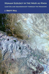
This book focuses on changing land-use patterns and their relationship to socio-political organization. Using a combination of archaeological and environmental data, Brett Hill examines the human ecology of agriculture and pastoralism from the beginnings of domestication through the rise and collapse of complex societies. Models of land use often consider political complexity as an important factor affecting mismanagement. Together with GIS erosion modeling and settlement pattern analysis, Hill evaluates the archaeological, historical, and environmental record spanning the Holocene to show how land use was affected by the rise of centralized authority. Yet populations in the Hasa maintained the ability to resist authority and return to a nomadic life when it became advantageous. This process emphasizes the power of local groups to pursue alternative strategies when their interests diverged from those of elites, creating a dynamic that reshapes the landscape each generation.
Hill’s analysis contributes significantly to our understanding of the history of human ecology in the southern Levant, wherein current debates are complicated by research at different scales and by a lack of consensus on the importance of localized phenomena. It not only complements existing research but also seeks to refine models of processes in human ecology to demonstrate the effect of political organization on land mismanagement.
In the Realm of Nachan Kan opens a window on Postclassic Maya patterns of cultural development and organization through a close examination of the small rural island of Laguna de On, a location that was distant from the governing political centers of the day. Using diachronic analysis of regional settlement patterns, ceramic traditions, household and ritual features, and artifacts from the site, Masson tracks developmental changes throughout the Postclassic period. These data suggest that affluent patterns of economic production and local and long-distance exchange were established within northern Belize by the eleventh century, and continued to develop, virtually uninterrupted, until the time of Spanish arrival.
In addition, Masson analyzes contemporary political and religious artistic traditions at the temples of Mayapan, Tulum, and Santa Rita to provide a regional context for the changes in community patterns at Laguna de On. These cultural changes, she maintains, are closely correlated with the rise of Mayapan to power and participation of sites like Laguna de On in a pan-lowland economic and ritual interaction sphere. Offering a thoroughly new interpretation of Postclassic Mayan civilization. In the Realm of Nachan Kan is a must for scholars of Mesoamerican history and culture.
This comprehensive study of the historical archaeology of the Caribbean provides sociopolitical context for the ongoing development of national identities.
Long before the founding of Jamestown in 1607, there were Spanish forts, bustling towns, sugar plantations, and sea trade flourishing in the Caribbean. While richer nations, particularly the United States, may view the Caribbean today as merely a place for sun and fun, the island colonies were at one time far more important and lucrative to their European empire countries than their North American counterparts. From the 15th to the 19th centuries, as competing colonial powers vied with each other for military and economic advantage in the Western Hemisphere, events in the Caribbean directly influenced the American mainland.
This is one rationale for the close study of historical archaeology in the Caribbean. Another is the growing recognition of how archaeological research can support the defining of national identities for the islands, many of them young independent states struggling to establish themselves economically and politically. By looking at cases in the French West Indies, specifically on Guadeloupe, in the Dutch Antilles and Aruba, in the British Bahamas, on Montserrat and St. Eustatius, on Barbados, and the within the U.S. Virgin Islands, the contributors to Island Lives have produced a broad overview of Caribbean historical archaeology.
Island Lives makes clear that historical archaeology in the Caribbean will continue to grow and diversify due to the interest Caribbean peoples have in recording, preserving, and promoting their culture and heritage; the value it adds to their "heritage tourism"; and the connection it has to African American history and archaeology. In addition, the contributors point to the future by suggesting different trajectories that historical archaeology and its practitioners may take in the Caribbean arena. In so doing, they elucidate the problems and issues faced worldwide by researchers working in colonial and post-colonial societies.
Paul Farnsworth is Associate Professor of Anthropology at Louisiana State University.
In Making the Heartland Quilt, Douglas K. Meyer reconstructs the settlement patterns of thirty-three immigrant groups and confirms the emergence of discrete culture regions and regional way stations. Meyer argues that midcontinental Illinois symbolizes a historic test strip of the diverse population origins that unfolded during the Great Migration. Basing his research on the 1850 U.S. manuscript schedules, Meyer dissects the geographical configurations of twenty-three native and ten foreign-born adult male immigrant groups who peopled Illinois. His historical geographical approach leads to the comprehension of a new and clearer map of settlement and migration history in the state.
Meyer finds that both cohesive and mixed immigrant settlements were established. Balkan-like immigrant enclaves or islands were interwoven into evolving local, regional, and national settlement networks. The midcontinental location of Illinois, its water and land linkages, and its lengthy north-south axis enhanced cultural diversity. The barrier effect of Lake Michigan contributed to the convergence and mixing of immigrants. Thus, Meyer demonstrates, Illinois epitomizes midwestern dichotomies: northern versus southern; native-born versus foreign-born; rural versus urban; and agricultural versus manufacturing.
Pampa Grande, the largest and most powerful city of the Mochica (Moche) culture on the north coast of Peru, was built, inhabited, and abandoned during the period A.D. 550-700. It is extremely important archaeologically as one of the few pre-Hispanic cities in South America for which there are enough reliable data to reconstruct a model of pre-Hispanic urbanism.
This book presents a "biography" of Pampa Grande that offers a reconstruction not only of the site itself but also of the sociocultural and economic environment in which it was built and abandoned. Izumi Shimada argues that Pampa Grande was established rapidly and without outside influence at a strategic position at the neck of the Lambayeque Valley that gave it control over intervalley canals and their agricultural potential and allowed it to gain political dominance over local populations. Study of the site itself leads him to posit a large resident population made up of transplanted Mochica and local non-Mochica groups with a social hierarchy of at least three tiers.
Because nearly all aspects of culture depend on the movement of bodies, objects, and ideas, mobility has been a primary topic during the past forty years of archaeological research on small-scale societies. Most studies have concentrated either on local moves related to subsistence within geographically bounded communities or on migrations between regions resulting from pan-regional social and environmental changes. Gregson Schachner, however, contends that a critical aspect of mobility is the transfer of people, goods, and information within regions. This type of movement, which geographers term "population circulation," is vitally important in defining how both regional social systems and local communities are constituted, maintained, and—most important—changed.
Schachner analyzes a population shift in the Zuni region of west-central New Mexico during the thirteenth century AD that led to the inception of major demographic changes, the founding of numerous settlements in frontier zones, and the initiation of radical transformations of community organization. Schachner argues that intraregional population circulation played a vital role in shaping social transformation in the region and that many notable changes during this period arose directly out of peoples' attempts to create new social mechanisms for coping with frequent and geographically extensive residential mobility. By examining multiple aspects of population circulation and comparing areas that were newly settled in the thirteenth century to some that had been continuously occupied for hundreds of years, Schachner illustrates the role of population circulation in the formation of social groups and the creation of contexts conducive to social change.
1. "The Great Period": The Pueblo World During the Pueblo III Period, A.D. 1150 to 1350, Michael A. Adler
2. Pueblo II-Pueblo III Change in Southwestern Utah, the Arizona Strip, and Southern Nevada, Margaret M. Lyneis
3. Kayenta Anasazi Settlement Transformations in Northeastern Arizona: A.D. 1150 to 1350, Jeffrey S. Dean
4. The Pueblo III-Pueblo IV Transition in the Hopi Area, Arizona, E. Charles Adams
5. The Pueblo III Period along the Mogollon Rim: The Honanki, Elden, and Turkey Hill Phases of the Sinagua, Peter J. Pilles, Jr.
6. A Demographic Overview of the Late Pueblo III Period in the Mountains of East-central Arizona, J. Jefferson Reid, John R. Welch, Barbara K. Montgomery, and María Nieves Zedeño
7. Southwestern Colorado and Southeastern Utah Settlement Patterns: A.D. 1100 to 1300, Mark D. Varien, William D. Lipe, Michael A. Adler, Ian M. Thompson, and Bruce A. Bradley
8. Looking beyond Chaco: The San Juan Basin and Its Peripheries, John R. Stein and Andrew P. Fowler
9. The Cibola Region in the Post-Chacoan Era, Keith W. Kintigh
10. The Pueblo III Period in the Eastern San Juan Basin and Acoma-Laguna Areas, John R. Roney
11. Southwestern New Mexico and Southeastern Arizona, A.D. 900 to 1300, Stephen H. Lekson
12. Impressions of Pueblo III Settlement Trends among the Rio Abajo and Eastern Border Pueblos, Katherine A. Spielman
13. Pueblo Cultures in Transition: The Northern Rio Grande, Patricia L. Crown, Janet D. Orcutt, and Timothy A. Kohler
14. The Role of Warfare in the Pueblo III Period, Jonathan Haas and Winifred Creamer
15. Agricultural Potential and Carrying Capacity in Southwestern Colorado, A.D. 901 to 1300, Carla R. Van West
16. Big Sites, Big Questions: Pueblos in Transition, Linda S. Cordell
17. Pueblo III People and Polity in Relational Context, David R. Wilcox
Appendix: Mapping the Puebloa

The continuing work of the Crow Canyon Archaeological Center has focused on community life in the northern Southwest during the Great Pueblo period (AD 1150– 1300). Researchers have been able to demonstrate that during the last Puebloan occupation of the area the majority of the population lived in dispersed communities and large villages of the Great Sage Plain, rather than at nearby Mesa Verde. The work at Sand Canyon Pueblo and more than sixty other large contemporary pueblos has examined reasons for population aggregation and why this strategy was ultimately forsaken in favor of a migration south of the San Juan River, leaving the area depopulated by 1290.
Contributors to this volume, many of whom are distinguished southwestern researchers, draw from a common database derived from extensive investigations at the 530-room Sand Canyon Pueblo, intensive test excavations at thirteen small sites and four large villages, a twenty-five square kilometer full-coverage survey, and an inventory of all known villages in the region. Topics include the context within which people moved into villages, how they dealt with climatic changes and increasing social conflict, and how they became increasingly isolated from the rest of the Southwest.
Seeking the Center Place is the most detailed view we have ever had of the last Pueblo communities in the Mesa Verde region and will provide a better understanding of the factors that precipitated the migration of thousands of people.
This book approaches the human settlement of the Americas from a biogeographical perspective in order to provide a better understanding of the mechanisms and consequences of this unique event. It considers many of the questions that continue to surround the peopling of the Western Hemisphere, focusing not on sites, dates, and artifacts but rather on theories and models that attempt to explain how the colonization occurred.
Unlike other studies, this book draws on a wide range of disciplines—archaeology, human genetics and osteology, linguistics, ethnology, and ecology—to present the big picture of this migration. Its wide-ranging content considers who the Pleistocene settlers were and where they came from, their likely routes of migration, and the ecological role of these pioneers and the consequences of colonization. Comprehensive in both geographic and topical coverage, the contributions include an explanation of how the first inhabitants could have spread across North America within several centuries, the most comprehensive review of new mitochondrial DNA and Y-chromosome data relating to the colonization, and a critique of recent linguistic theories.
Although the authors lean toward a conservative rather than an extreme chronology, this volume goes beyond the simplistic emphasis on dating that has dominated the debate so far to a concern with late Pleistocene forager adaptations and how foragers may have coped with a wide range of environmental and ecological factors. It offers researchers in this exciting field the most complete summary of current knowledge and provides non-specialists and general readers with new answers to the questions surrounding the origins of the first Americans.
Keith W. Kintigh demonstrates how changing agricultural strategies and developing mechanisms of social integration contributed to these population shifts. In particular, he argues that occupants of the earliest large pueblos relied on runoff agriculture, but that gradually spring-and river-fed irrigation systems were adopted. Resultant strengthening of the mechanisms of social integration allowed the increased occupational stability of the protohistorical Zuni towns.
The authors of this highly original book set out to remove the persistent boundary between the authors and readers of ethnography on one hand and the subjects of ethnography on the other – those who observe and those who are observed.
The authors use stories to reveal Siaya, the Luo-speaking area of Western Kenya down near the Lake but still surprisingly vulnerable to drought. There are the stories of survival by a woman with her carpenter husband in Nairobi, there is the launching of a boat as bride into the Lake and there is the great Boro Christmas disco riot. The book finishes with an Afterword on the burial of the lawyer S. M. Otiono that divided its whole of Kenya.
It is both written about and for the Luo. It brings together Luo ideas and debates about their own past and present with findings, arguments and questions produced about this “other people;” by outside scholars writing in their own disciplines. Among the Luo, what constitutes culture, what is correct behavior, what is history, are questions that are heavily fought over.
This is one of those rare books that makes students and other interested individuals question their own cultural preconceptions and what are the genuine concerns of academic disciplines.
This book develops and applies a GIS procedure to use legacy survey data in settlement pattern analysis. It consists of two parts. One part regards the assessment of biases that can affect the spatial patterns exhibited by survey data. The other part aims to shed light on the location preferences and settlement strategy of ancient communities underlying site patterns. In this book, a case-study shows how the method works in practice. As part of the research by the Landscapes of Early Roman Colonization project (NWO, Leiden University, KNIR) site-based datasets produced by survey projects in central-southern Italy are examined in a comparative framework to investigate settlement patterns in the early Roman colonial period (3rd century B.C.).
Employing numerous primary sources, West to Far Michigan traces changes and patterns of settlement crucial to documenting the large-scale development of southern Michigan as a region. Diaries, letters, memoirs, gazetteers, and legal documents serve to transform the more abstract elements of economic and social change into more human terms. Through the experiences of the early Agriculturists process, we can gain insight into how their triumphs played out in communities within the region to produce small-scale elements that comprise the fabric of the larger cultural landscape.
READERS
Browse our collection.
PUBLISHERS
See BiblioVault's publisher services.
STUDENT SERVICES
Files for college accessibility offices.
RECENTLY PUBLISHED


UChicago Accessibility Resources
home | accessibility | search | about | contact us
BiblioVault ® 2001 - 2025
The University of Chicago Press