Results by title
122 books match the query 'Maps' and 23 start with t
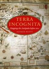
Terra Incognita
Mapping the Antipodes before 1600Alfred Hiatt
University of Chicago Press, 2008
In Terra Incognita, Alfred Hiatt draws on sources both literary and visual to understand the appeal of the antipodes. Examining maps and diagrams, as well as evidence contained in geographical and historical works, poetry, travel narratives, and legal documents, he challenges long-standing characterizations of medieval spatiality as exclusively symbolic and religious. Instead, Hiatt finds, the idea of people on the other side of the Earth provided a potent and malleable symbol for political theorists, satirists, scholars, and poets—as well as for map makers. Terra Incognita is, in the end, the history of a non-place, of lands conjured by the scientific imagination, which nevertheless drove exploration, and which continued to shape the world map, even as they slowly vanished from it.
Texas Takes Shape
A History in Maps from the General Land OfficeBy Mark Lambert, James Harkins, Brian A. Stauffer, and Patrick Walsh
University of Texas Press, 2025
2025 Second Place, Presidio La Bahía Award, Sons of the Republic of Texas
2026 Ron Tyler Award for Best Illustrated Book on Texas History and Culture, Texas State Historical Association (TSHA)
A comprehensive volume on historical mapping in Texas.
The Texas General Land Office’s map collection contains over 45,000 maps, some dating from the sixteenth century, making it one of the most important cartographic archives in Texas. As products and agents of history drawn by cartographers with motives and means as diverse as the places they document, maps provide a unique perspective on geopolitical, cultural, and economic processes. The maps of the GLO offer key insights into Texas’s sprawling history. They speak to issues of changing borders, social and political upheaval, and questions of sovereignty and power.
Texas Takes Shape offers an illuminating selection from the GLO archive: over one hundred maps that tell—and sometimes obscure—the stories of European colonization, Spanish and Mexican rule, the Republic of Texas, and the modern US state. There are maps here of every scale, from the hemispheric visions of European explorers to individual survey plats. Accompanying essays offer fascinating lessons on topics ranging from Indigenous cartography to military and railroad mapmaking and frontier surveys. Artful and informative, Texas Takes Shape examines a unique place through the eyes and imaginations of those who sought to govern it, profit from it, understand it, and call it home.
The Atlas of Boston History
Edited by Nancy S. Seasholes
University of Chicago Press, 2019
Edited by historian Nancy S. Seasholes, this landmark volume captures all aspects of Boston’s past in a series of fifty-seven stunning full-color spreads. Each section features newly created thematic maps that focus on moments and topics in that history. These maps are accompanied by hundreds of historical and contemporary illustrations and explanatory text from historians and other expert contributors. They illuminate a wide range of topics including Boston’s physical and economic development, changing demography, and social and cultural life. In lavishly produced detail, The Atlas of Boston History offers a vivid, refreshing perspective on the development of this iconic American city.
Contributors
Robert J. Allison, Robert Charles Anderson, John Avault, Joseph Bagley, Charles Bahne, Laurie Baise, J. L. Bell, Rebekah Bryer, Aubrey Butts, Benjamin L. Carp, Amy D. Finstein, Gerald Gamm, Richard Garver, Katherine Grandjean, Michelle Granshaw, James Green, Dean Grodzins, Karl Haglund, Ruth-Ann M. Harris, Arthur Krim, Stephanie Kruel, Kerima M. Lewis, Noam Maggor, Dane A. Morrison, James C. O’Connell, Mark Peterson, Marshall Pontrelli, Gayle Sawtelle, Nancy S. Seasholes, Reed Ueda, Lawrence J. Vale, Jim Vrabel, Sam Bass Warner, Jay Wickersham, and Susan Wilson
The Atlas of World Hunger
Thomas J. Bassett and Alex Winter-Nelson
University of Chicago Press, 2010
Earlier this year, President Obama declared one of his top priorities to be “making sure that people are able to get enough to eat.” The United States spends about five billion dollars on food aid and related programs each year, but still, both domestically and internationally, millions of people are hungry. In 2006, the Food and Agricultural Organization of the United Nations counted 850 million hungry people worldwide, but as food prices soared, an additional 100 million or more who were vulnerable succumbed to food insecurity.
If hunger were simply a matter of food production, no one would go without. There is more than enough food produced annually to provide every living person with a healthy diet, yet so many suffer from food shortages, unsafe water, and malnutrition every year. That’s because hunger is a complex political, economic, and ecological phenomenon. The interplay of these forces produces a geography of hunger that Thomas J. Bassett and Alex Winter-Nelson illuminate in this empowering book. The Atlas of World Hunger uses a conceptual framework informed by geography and agricultural economics to present a hunger index that combines food availability, household access, and nutritional outcomes into a single tool—one that delivers a fuller understanding of the scope of global hunger, its underlying mechanisms, and the ways in which the goals for ending hunger can be achieved. The first depiction of the geography of hunger worldwide, the Atlas will be an important resource for teachers, students, and anyone else interested in understanding the geography and causes of hunger. This knowledge, the authors argue, is a critical first step toward eliminating unnecessary suffering in a world of plenty.

The Cadastral Map in the Service of the State
A History of Property MappingRoger J. P. Kain and Elizabeth Baigent
University of Chicago Press, 1992
The Cadastral Map in the Service of the State, illustrated with 126 maps, traces the development and application of rural property mapping in Europe from the Renaissance through the nineteenth century. Beginning with a review of the roots of cadastral mapping in the Roman Empire, the authors concentrate on the use of cadastral maps in the Netherlands, France, England, the Nordic countries, the German lands, the territories of the Austrian Habsburgs, and the European colonies. During the sixteenth century government institutions began to use maps to secure economic and political bases; by the nineteenth century these maps had become tools for aggressive governmental control of land as tax bases, natural resources, and national territories. This work demonstrates how the seemingly neutral science of cartography became a political instrument for national
interests.
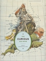
The Curious Map Book
Ashley Baynton-Williams
University of Chicago Press, 2015
Over the centuries, maps have served many varied purposes; far from mere guides for reaching a destination, they are unique artistic forms, aides in planning commercial routes, literary devices for illuminating a story. Accuracy—or inaccuracy—of maps has been the make-or-break factor in countless military battles throughout history. They have graced the walls of homes, bringing prestige and elegance to their owners. They track the mountains, oceans, and stars of our existence. Maps help us make sense of our worlds both real and imaginary—they bring order to the seeming chaos of our surroundings.
With The Curious Map Book, Ashley Baynton-Williams gathers an amazing, chronologically ordered variety of cartographic gems, mainly from the vast collection of the British Library. He has unearthed a wide array of the whimsical and fantastic, from maps of board games to political ones, maps of the Holy Land to maps of the human soul. In his illuminating introduction, Baynton-Williams also identifies and expounds upon key themes of map production, peculiar styles, and the commerce and collection of unique maps. This incredible volume offers a wealth of gorgeous illustrations for anyone who is cartographically curious.
The Darker Side of the Renaissance
Literacy, Territoriality, & Colonization, 2nd EditionWalter D. Mignolo
University of Michigan Press, 2003
Walter D. Mignolo is Professor in the Department of Romance Studies and the Program in Literature, Duke University.
The Darker Side of the Renaissance
Literacy, Territoriality, and ColonizationWalter D. Mignolo
University of Michigan Press, 1995
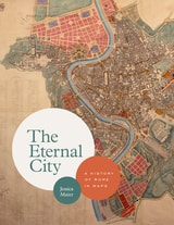
The Eternal City
A History of Rome in MapsJessica Maier
University of Chicago Press, 2020
In this unique and visually engaging book, Jessica Maier considers Rome through the eyes of mapmakers and artists who have managed to capture something of its essence over the centuries. Viewing the city as not one but ten “Romes,” she explores how the varying maps and art reflect each era’s key themes. Ranging from modest to magnificent, the images comprise singular aesthetic monuments like paintings and grand prints as well as more popular and practical items like mass-produced tourist plans, archaeological surveys, and digitizations. The most iconic and important images of the city appear alongside relatively obscure, unassuming items that have just as much to teach us about Rome’s past. Through 140 full-color images and thoughtful overviews of each era, Maier provides an accessible, comprehensive look at Rome’s many overlapping layers of history in this landmark volume.
The first English-language book to tell Rome’s rich story through its maps, The Eternal City beautifully captures the past, present, and future of one of the most famous and enduring places on the planet.
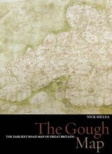
The Gough Map
The Earliest Road Map of Great BritainNick Millea
Bodleian Library Publishing, 2005
Recent digitization of the Gough Map has made it more legible than at any other time since its arrival at the Bodleian Library in 1809. This work utilizes new georectification technology to project a modern map of Britain over the Gough Map, revealing the incredible accuracy of the 700-year-old manuscript. In stunningly detailed reproduction, The Gough Map charts a vast array of cities, routes, and landmarks, including the principal medieval settlements of Bristol, Oxford and Norwich; the Severn, Thames, and Humber rivers; the loop of the Wear at Durham; and routes between towns with distances marked in Roman numerals.
The volume also features a color fold-out print of the Gough map, as well as numerous close-up images of each area. The Gough Map offers an unparalleled opportunity to examine this fascinating example of medieval mapmaking.
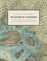
The History of a Periphery
Spanish Colonial Cartography from Colombia's Pacific LowlandsJuliet B. Wiersema
University of Texas Press, 2024
2025 ALAA Book Award, Association for Latin American Art/Arvey Foundation, College Art Association
An exploration of Colombian maps in New Granada.
During the late Spanish colonial period, the Pacific Lowlands, also called the Greater Chocó, was famed for its rich placer deposits. Gold mined here was central to New Granada’s economy yet this Pacific frontier in today’s Colombia was considered the “periphery of the periphery.” Infamous for its fierce, unconquered Indigenous inhabitants and its brutal tropical climate, it was rarely visited by Spanish administrators, engineers, or topographers and seldom appeared in detail on printed maps of the period.
In this lavishly illustrated and meticulously researched volume, Juliet Wiersema uncovers little-known manuscript cartography and makes visible an unexamined corner of the Spanish empire. In concert with thousands of archival documents from Colombia, Spain, and the United States, she reveals how a "periphery" was imagined and projected, largely for political or economic reasons. Along the way, she unearths untold narratives about ephemeral settlements, African adaptation and autonomy, Indigenous strategies of resistance, and tenuous colonialisms on the margins of a beleaguered viceroyalty.
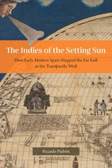
The Indies of the Setting Sun
How Early Modern Spain Mapped the Far East as the Transpacific WestRicardo Padrón
University of Chicago Press, 2020
Narratives of Europe’s westward expansion often tell of how the Americas came to be known as a distinct landmass, separate from Asia and uniquely positioned as new ground ripe for transatlantic colonialism. But this geographic vision of the Americas was not shared by all Europeans. While some imperialists imagined North and Central America as undiscovered land, the Spanish pushed to define the New World as part of a larger and eminently flexible geography that they called las Indias, and that by right, belonged to the Crown of Castile and León. Las Indias included all of the New World as well as East and Southeast Asia, although Spain’s understanding of the relationship between the two areas changed as the realities of the Pacific Rim came into sharper focus. At first, the Spanish insisted that North and Central America were an extension of the continent of Asia. Eventually, they came to understand East and Southeast Asia as a transpacific extension of their empire in America called las Indias del poniente, or the Indies of the Setting Sun.
The Indies of the Setting Sun charts the Spanish vision of a transpacific imperial expanse, beginning with Balboa’s discovery of the South Sea and ending almost a hundred years later with Spain’s final push for control of the Pacific. Padrón traces a series of attempts—both cartographic and discursive—to map the space from Mexico to Malacca, revealing the geopolitical imaginations at play in the quest for control of the New World and Asia.
The Invention of Order
On the Coloniality of SpaceDon Thomas Deere
Duke University Press, 2025
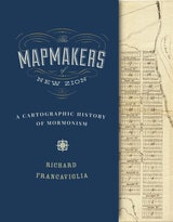
The Mapmakers of New Zion
A Cartographic History of MormonismRichard Francaviglia
University of Utah Press, 2015
From their earliest days on the American frontier through their growth into a worldwide church, the spatially expansive Mormons made maps to help them create idealized communities, migrate to and colonize large parts of the American West, visualize the stories in their sacred texts, and spread their message internationally through a well-organized missionary system. This book identifies many Mormon mapmakers who played an important but heretofore unsung role in charting the course of Latter-day Saint history. For Mormons, maps had and continue to have both practical and spiritual significance. In addition to using maps to help build their new Zion and to explore the Intermountain West, Latter-day Saint mapmakers used them to depict locations and events described in the Book of Mormon.
Featuring over one hundred historical maps reproduced in full color—many never before published—The Mapmakers of New Zion sheds new light on Mormonism and takes readers on a fascinating journey through maps as both historical documents and touchstones of faith.
Winner of the Southwest Book Design and Production Award from the New Mexico Book Association.
Selected as one of the American Library Association's Best of the Best from University Presses.
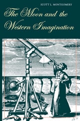
The Moon and the Western Imagination
Scott L. Montgomery
University of Arizona Press, 1999
Scott Montgomery has produced a richly detailed analysis of how the Moon has been visualized in Western culture through the ages, revealing the faces it has presented to philosophers, writers, artists, and scientists for nearly three millennia. To do this, he has drawn on a wide array of sources that illustrate mankind's changing concept of the nature and significance of heavenly bodies from classical antiquity to the dawn of modern science.
Montgomery especially focuses on the seventeenth century, when the Moon was first mapped and its features named. From literary explorations such as Francis Godwin's Man in the Moone and Cyrano de Bergerac's L'autre monde to Michael Van Langren's textual lunar map and Giambattista Riccioli's Almagestum novum, he shows how Renaissance man was moved by the lunar orb, how he battled to claim its surface, and how he in turn elevated the Moon to a new level in human awareness. The effect on human imagination has been cumulative: our idea of the Moon, and therefore the planets, is multilayered and complex, having been enriched by associations played out in increasingly complicated harmonies over time. We have shifted the way we think about the lunar face from a "perfect" body to an earthlike one, with corresponding changes in verbal and visual expression.
Ultimately, Montgomery suggests, our concept of the Moon has never wandered too far from the world we know best—the Earth itself. And when we finally establish lunar bases and take up some form of residence on the Moon's surface, we will not be conquering a New World, fresh and mostly unknown, but a much older one, ripe with history.
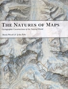
The Natures of Maps
Cartographic Constructions of the Natural WorldDenis Wood and John Fels
University of Chicago Press, 2008
To answer that question, the authors turn to a category of maps with a particularly strong reputation for objectivity: maps of nature. From depictions of species habitats and bird migrations to portrayals of the wilds of the Grand Canyon and the reaches of the Milky Way, such maps are usually presumed—even by users who should know better—to be strictly scientific. Yet by drawing our attention to every aspect of these maps’ self-presentation, from place names to titles and legends, the authors reveal the way that each piece of information collaborates in a disguised effort to mount an argument about reality. Without our realizing it, those arguments can then come to define our very relationship to the natural world—determining whether we see ourselves as humble hikers or rampaging despoilers, participants or observers, consumers or stewards.
Richly illustrated, and crafted in vivid and witty prose, The Natures of Maps will enlighten and entertain map aficionados, scholars, and armchair navigators alike. You’ll never be able to look at Google Maps quite the same way again.
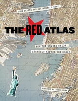
The Red Atlas
How the Soviet Union Secretly Mapped the WorldJohn Davies and Alexander J. Kent
University of Chicago Press, 2017
From 1950 to 1990, the Soviet Army conducted a global topographic mapping program, creating large-scale maps for much of the world that included a diversity of detail that would have supported a full range of military planning. For big cities like New York, DC, and London to towns like Pontiac, MI and Galveston, TX, the Soviets gathered enough information to create street-level maps. What they chose to include on these maps can seem obvious like locations of factories and ports, or more surprising, such as building heights, road widths, and bridge capacities. Some of the detail suggests early satellite technology, while other specifics, like detailed depictions of depths and channels around rivers and harbors, could only have been gained by actual Soviet feet on the ground. The Red Atlas includes over 350 extracts from these incredible Cold War maps, exploring their provenance and cartographic techniques as well as what they can tell us about their makers and the Soviet initiatives that were going on all around us.
A fantastic historical document of an era that sometimes seems less distant, The Red Atlas offers an uncanny view of the world through the eyes of Soviet strategists and spies.
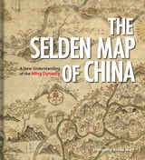
The Selden Map of China
A New Understanding of the Ming DynastyHongping Annie Nie
Bodleian Library Publishing, 2019
Exploring the commercial aims of the Ming Dynasty, the port city of Quanzhou and its connections with the voyages of the early traveler Zheng He, this book describes the historical background of the era in which the map was used. It also includes an analysis of the skills and techniques involved in Chinese map-making and the significance of the compass bearings, scale, and ratios found on the map, all of which combine to represent a breakthrough in cartographic techniques.
The enthralling story revealed by this extraordinary artifact sheds light on the long history of China’s relationship with the sea and with the wider world.
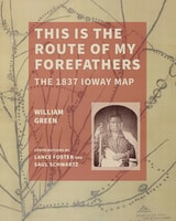
This Is the Route of My Forefathers
The 1837 Ioway MapWilliam Green
University of Iowa Press, 2025
Illustrating nearly 200 years of Ioway history, the 1837 Ioway map provides insights into the tribe’s political and diplomatic strategies, their relationships with neighboring nations, and how they resisted and negotiated in the face of dispossession. This Is the Route of My Forefathers uses an interdisciplinary approach to reveal how group accounts may fade over time, while accounts of origin—legendary histories—remain rich and vibrant.
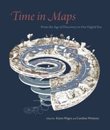
Time in Maps
From the Age of Discovery to Our Digital EraEdited by Kären Wigen and Caroline Winterer
University of Chicago Press, 2020
Focusing on maps created in Spanish America, Europe, the United States, and Asia, these essays take us from the Aztecs documenting the founding of Tenochtitlan, to early modern Japanese reconstructing nostalgic landscapes before Western encroachments, to nineteenth-century Americans grappling with the new concept of deep time. The book also features a defense of traditional paper maps by digital mapmaker William Rankin. With more than one hundred color maps and illustrations, Time in Maps will draw the attention of anyone interested in cartographic history.
Town
Prints & Drawings of Britain before 1800Bernard Nurse
Bodleian Library Publishing, 2020
Tracks on the Ocean
A History of Trailblazing, Maps, and Maritime TravelSara Caputo
University of Chicago Press, 2024
Sara Caputo’s Tracks on the Ocean is a sweeping history of how we have understood routes of travel over the ocean and how we came to represent that movement as a cartographical line. Focusing on the representation of sea journeys in the Western world from the early sixteenth century to the present, Caputo deftly argues that the depiction of these lines is inextricable from European imperialism, the rise of modernity, and attempts at mastery over nature. Caputo recounts the history of ocean tracks through an array of lively stories and characters, from the expeditions of Captain James Cook in the eighteenth century to tracks depicted in Moby Dick and popular culture of the nineteenth century to the use of navigational techniques by the British navy. She discusses how tracks evolved from tools of surveying into tools of surveillance and, eventually, into paths of environmental calamity. The impulse to record tracks on the ocean is, Caputo argues, reflective of an ongoing desire for order, schematization, and personal visibility, as well as occupation and permanent ownership—in this case over something that is unoccupiable and impossible to truly possess. Both beautifully written and deeply researched, Tracks on the Ocean shares how the lines drawn on maps tell the audacious and often tragic and violent stories of ocean voyages.
Traveling from New Spain to Mexico
Mapping Practices of Nineteenth-Century MexicoMagali M. Carrera
Duke University Press, 2011
From the sixteenth century until the early nineteenth, Europeans had envisioned New Spain (colonial Mexico) in texts, maps, and other images. In the first decades of the 1800s, ideas about Mexican, rather than Spanish, national character and identity began to cohere in written and illustrated narratives produced by foreign travelers. During the nineteenth century, technologies and processes of visual reproduction expanded to include lithography, daguerreotype, and photography. New methods of display—such as albums, museums, exhibitions, and world fairs—signaled new ideas about spectatorship. García Cubas participated in this emerging visual culture as he reconfigured geographic and cultural imagery culled from previous mapping practices and travel writing. In works such as the Atlas geográfico (1858) and the Atlas pintoresco é historico (1885), he presented independent Mexico to Mexican citizens and the world.