
 A SCHOLARLY BOOK REPOSITORY
48 start with M start with M
In Make It Rain, Kristine C. Harper tells the long and somewhat ludicrous history of state-funded attempts to manage, manipulate, and deploy the weather in America. Harper shows that governments from the federal to the local became helplessly captivated by the idea that weather control could promote agriculture, health, industrial output, and economic growth at home, or even be used as a military weapon and diplomatic tool abroad. Clear fog for landing aircraft? There’s a project for that. Gentle rain for strawberries? Let’s do it! Enhanced snowpacks for hydroelectric utilities? Check. The heyday of these weather control programs came during the Cold War, as the atmosphere came to be seen as something to be defended, weaponized, and manipulated. Yet Harper demonstrates that today there are clear implications for our attempts to solve the problems of climate change.
In Making the Mission, Ocean Howell tells the story of how residents of the Mission District organized to claim the right to plan their own neighborhood and how they mobilized a politics of place and ethnicity to create a strong, often racialized identity—a pattern that would repeat itself again and again throughout the twentieth century. Surveying the perspectives of formal and informal groups, city officials and district residents, local and federal agencies, Howell articulates how these actors worked with and against one another to establish the very ideas of the public and the public interest, as well as to negotiate and renegotiate what the neighborhood wanted. In the process, he shows that national narratives about how cities grow and change are fundamentally insufficient; everything is always shaped by local actors and concerns.
The volume is organized into three parts. Part 1 deals with man's rise to the status of ecological dominance, and includes discussions of such topics as the role of fire as the first great force harnessed by man, early food-producing populations, the clearing of Europe's woodlands, subsistence economies and commercial economies, and the natural history of urbanization.
Part 2 investigates environmental changes such as man's impact upon the seas and coastlines. The highly topical ecology of wastes is discussed, as well as urban-industrial demands and the depletion of natural resources.
Part 3 is concerned with the limits of the earth's resources. It includes papers dealing with the population spiral, possible limitations of raw-material consumption and energy use, and technological denudation.
Each part is accompanied by a report summarizing the ideas discussed at the conference by the participants.
Taking us deep into cartographical archives, Seegel re-creates the public and private worlds of these five mapmakers, who interacted with and influenced one another even as they played key roles in defining and redefining borders, territories, nations—and, ultimately, the interconnection of the world through two world wars. Throughout, he examines the transnational nature of these processes and addresses weighty questions about the causes and consequences of the world wars, the rise of Nazism and Stalinism, and the reasons East Central Europe became the fault line of these world-changing developments.
At a time when East Central Europe has surged back into geopolitical consciousness, Map Men offers a timely and important look at the historical origins of how the region was defined—and the key people who helped define it.
Explore the surprising connections between math and maps—and the myriad ways they’ve shaped our world and us.
Why are coastlines and borders so difficult to measure? How does a UPS driver deliver hundreds of packages in a single day? And where do elusive serial killers hide? The answers lie in the crucial connection between math and maps.
In Mapmatics, mathematician Paulina Rowińska leads us on a journey around the globe to discover how math and maps are deeply entwined, and always have been. From a sixteenth-century map, an indispensable navigation tool that exaggerates the size of northern countries, to public transport maps that both guide and confound passengers, to congressional maps that can empower or silence whole communities, maps and math have shaped not only our sense of space but our worldview. Rowińska shows that by understanding the math behind maps, we can recognize their biases. And we can appreciate the ingenious tools mathematicians are developing to resolve them.
Written with authority and compassion, wit and unforgettable storytelling, Mapmatics is math exposition at its best. By unpacking the math underlying the maps we depend on, this book illuminates how our world works, and, ultimately, how we can better look after it.
"There is much to be praised in this book. It is an excellent history of how India came to be painted red in the nineteenth century. But more importantly, Mapping an Empire sets a new standard for books that examine a fundamental problem in the history of European imperialism."—D. Graham Burnett, Times Literary Supplement
"Mapping an Empire is undoubtedly a major contribution to the rapidly growing literature on science and empire, and a work which deserves to stimulate a great deal of fresh thinking and informed research."—David Arnold, Journal of Imperial and Commonwealth History
"This case study offers broadly applicable insights into the relationship between ideology, technology and politics. . . . Carefully read, this is a tale of irony about wishful thinking and the limits of knowledge."—Publishers Weekly
From the sixteenth through the mid-nineteenth centuries, Spain, then Mexico, and finally the United States took ownership of the land from the Gulf Coast of Texas and Mexico to the Pacific Coast of Alta and Baja California—today's American Southwest. Each country faced the challenge of holding on to territory that was poorly known and sparsely settled, and each responded by sending out military mapping expeditions to set boundaries and chart topographical features. All three countries recognized that turning terra incognita into clearly delineated political units was a key step in empire building, as vital to their national interest as the activities of the missionaries, civilian officials, settlers, and adventurers who followed in the footsteps of the soldier-engineers.
With essays by eight leading historians, this book offers the most current and comprehensive overview of the processes by which Spanish, Mexican, and U.S. soldier-engineers mapped the southwestern frontier, as well as the local and even geopolitical consequences of their mapping. Three essays focus on Spanish efforts to map the Gulf and Pacific Coasts, to chart the inland Southwest, and to define and defend its boundaries against English, French, Russian, and American incursions. Subsequent essays investigate the role that mapping played both in Mexico's attempts to maintain control of its northern territory and in the United States' push to expand its political boundary to the Pacific Ocean. The concluding essay draws connections between mapping in the Southwest and the geopolitical history of the Americas and Europe.
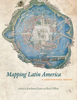
For many, a map is nothing more than a tool used to determine the location or distribution of something—a country, a city, or a natural resource. But maps reveal much more: to really read a map means to examine what it shows and what it doesn’t, and to ask who made it, why, and for whom. The contributors to this new volume ask these sorts of questions about maps of Latin America, and in doing so illuminate the ways cartography has helped to shape this region from the Rio Grande to Patagonia.
In Mapping Latin America,Jordana Dym and Karl Offen bring together scholars from a wide range of disciplines to examine and interpret more than five centuries of Latin American maps.Individual chapters take on maps of every size and scale and from a wide variety of mapmakers—from the hand-drawn maps of Native Americans, to those by famed explorers such as Alexander von Humboldt, to those produced in today’s newspapers and magazines for the general public. The maps collected here, and the interpretations that accompany them, provide an excellent source to help readers better understand how Latin American countries, regions, provinces, and municipalities came to be defined, measured, organized, occupied, settled, disputed, and understood—that is, how they came to have specific meanings to specific people at specific moments in time.
The first book to deal with the broad sweep of mapping activities across Latin America, this lavishly illustrated volume will be required reading for students and scholars of geography and Latin American history, and anyone interested in understanding the significance of maps in human cultures and societies.
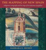
"Its contribution to its specific field is both significant and original. . . . It is a pure pleasure to read." —Sabine MacCormack, Isis
"Mundy has done a fine job of balancing the artistic interpretation of the maps with the larger historical context within which they were drawn. . . . This is an important work." —John F. Schwaller, Sixteenth Century Journal
"This beautiful book opens a Pandora's box in the most positive sense, for it provokes the reconsideration of several long-held opinions about Spanish colonialism and its effects on Native American culture." —Susan Schroeder, American Historical Review
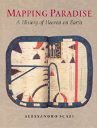
Mapping Paradise is a history of the cartography of paradise that journeys from the beginning of Christianity to the present day. Instead of dismissing the medieval belief in a paradise on earth as a picturesque legend and the cartography of paradise as an example of the period’s many superstitions, Alessandro Scafi explores the intellectual conditions that made the medieval mapping of paradise possible. The challenge for mapmakers, Scafi argues, was to make visible a place that was geographically inaccessible and yet real, remote in time and yet still the scene of an essential episode of the history of salvation. Mapping Paradise also accounts for the transformations, in both theological doctrine and cartographical practice, that brought about the decline of the belief in a terrestrial paradise and the emergence of the new historical and regional mapping of the Garden of Eden that began at the time of the Reformation and still continues today.
The first book to show how paradise has been expressed in cartographic form throughout two millennia, Mapping Paradise reveals how the most deeply reflective thoughts about the ultimate destiny of all human life have been molded and remolded, generation by generation.
In the nineteenth century, Americans began to use maps in radically new ways. For the first time, medical men mapped diseases to understand and prevent epidemics, natural scientists mapped climate and rainfall to uncover weather patterns, educators mapped the past to foster national loyalty among students, and Northerners mapped slavery to assess the power of the South. After the Civil War, federal agencies embraced statistical and thematic mapping in order to profile the ethnic, racial, economic, moral, and physical attributes of a reunified nation. By the end of the century, Congress had authorized a national archive of maps, an explicit recognition that old maps were not relics to be discarded but unique records of the nation’s past.
All of these experiments involved the realization that maps were not just illustrations of data, but visual tools that were uniquely equipped to convey complex ideas and information. In Mapping the Nation, Susan Schulten charts how maps of epidemic disease, slavery, census statistics, the environment, and the past demonstrated the analytical potential of cartography, and in the process transformed the very meaning of a map.
Today, statistical and thematic maps are so ubiquitous that we take for granted that data will be arranged cartographically. Whether for urban planning, public health, marketing, or political strategy, maps have become everyday tools of social organization, governance, and economics. The world we inhabit—saturated with maps and graphic information—grew out of this sea change in spatial thought and representation in the nineteenth century, when Americans learned to see themselves and their nation in new dimensions.
The third edition of Maps and Civilization incorporates numerous revisions, features new material throughout the book, and includes a new alphabetized bibliography.
Praise for previous editions of Maps and Civilization:
“A marvelous compendium of map lore. Anyone truly interested in the development of cartography will want to have his or her own copy to annotate, underline, and index for handy referencing.”—L. M. Sebert, Geomatica
The book begins by examining the use of maps for wayfinding, revealing that even maps as common and widely used as these are the product of historical circumstances and cultural differences. The second chapter considers maps whose makers employed the smallest of scales to envision the broadest of human stages—the world, the heavens, even the act of creation itself. The next chapter looks at maps that are, literally, at the opposite end of the scale from cosmological and world maps—maps that represent specific parts of the world and provide a close-up view of areas in which their makers lived, worked, and moved.
Having shown how maps help us get around and make sense of our greater and lesser worlds, Maps then turns to the ways in which certain maps can be linked to particular events in history, exploring how they have helped Americans, for instance, to understand their past, cope with current events, and plan their national future. The fifth chapter considers maps that represent data from scientific instruments, population censuses, and historical records. These maps illustrate, for example, how diseases spread, what the ocean floor looks like, and how the weather is tracked and predicted. Next comes a turn to the imaginary, featuring maps that depict entire fictional worlds, from Hell to Utopia and from Middle Earth to the fantasy game World of Warcraft. The final chapter traces the origins of map consumption throughout history and ponders the impact of cartography on modern society.
A companion volume to the most ambitious exhibition on the history of maps ever mounted in North America, Maps will challenge readers to stretch conventional thought about what constitutes a map and how many different ways we can understand graphically the environment in which we live. Collectors, historians, mapmakers and users, and anyone who has ever “gotten lost” in the lines and symbols of a map will find much to love and learn from in this book.
In Maps in Tudor England, P. D. A. Harvey traces this revolution of production, understanding, and use of maps in England from 1485 to 1603. By the mid-sixteenth century, mapmapers had begun to draw maps to a consistent scale, reproducing the results of measured survey. By the end of the century, maps drawn to scale and showing features by conventional signs were commonly used throughout England.
In this survey Harvey focuses on maps of small areas, up to the size of a county, exploring their impact on the political and social life of England in the spheres of the military, government, towns, landed estates, buildings, and the law. Richly illustrated with thirty color and fifty black and white reproductions of rare maps, his account is an informative and accessible introduction to this revolutionary period in the history of cartography, as well as a unique visual history of Tudor England.
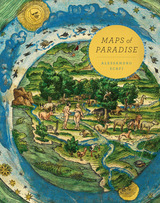
Maps of Paradise charts the diverse ways in which scholars and mapmakers from the eighth to the twenty-first century rose to the challenge of identifying the location of paradise on a map, despite the certain knowledge that it was beyond human reach. Over one hundred illustrations celebrate this history of a paradox: the mapping of the unmappable. It is also a mirror to the universal dream of perfection and happiness, and the yearning to discover heaven on earth.
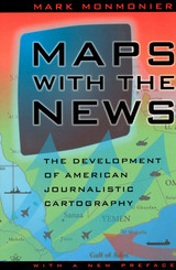
"A most welcome and thorough investigation of a neglected aspect of both the history of cartography and modern cartographic practice."—Mapline
"A well-written, scholarly treatment of journalistic cartography. . . . It is well researched, thoroughly indexed and referenced . . . amply illustrated."—Judith A. Tyner, Imago Mundi
"There is little doubt that Maps with the News should be part of the training and on the desks of all those concerned with producing maps for mass consumption, and also on the bookshelves of all journalists, graphic artists, historians of cartography, and geographic educators."—W. G. V. Balchin, Geographical Journal
"A definitive work on journalistic cartography."—Virginia Chipperfield, Society of University Cartographers Bulletin
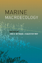
Pioneered in the late 1980s, the concept of macroecology—a framework for studying ecological communities with a focus on patterns and processes—revolutionized the field. Although this approach has been applied mainly to terrestrial ecosystems, there is increasing interest in quantifying macroecological patterns in the sea and understanding the processes that generate them. Taking stock of the current work in the field and advocating a research agenda for the decades ahead, Marine Macroecology draws together insights and approaches from a diverse group of scientists to show how marine ecology can benefit from the adoption of macroecological approaches.
Divided into three parts, Marine Macroecology first provides an overview of marine diversity patterns and offers case studies of specific habitats and taxonomic groups. In the second part, contributors focus on process-based explanations for marine ecological patterns. The third part presents new approaches to understanding processes driving the macroecolgical patterns in the sea. Uniting unique insights from different perspectives with the common goal of identifying and understanding large-scale biodiversity patterns, Marine Macroecology will inspire the next wave of marine ecologists to approach their research from a macroecological perspective.
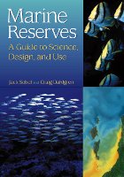
Conventional fishery management practices have failed to prevent the collapse of numerous fish stocks around the world. Amid growing concern about our ability to protect marine biodiversity and ecosystem integrity, scientists and managers alike are seeking alternative management tools. One of the most promising of those is no-take marine reserves -- areas of the sea where all consumptive use of natural resources is prohibited.
Marine Reserves is the first guidebook on no-take marine reserves, providing a synthesis of information on the underlying science, as well as design and implementation issues. The book, by Jack Sobel and Craig Dahlgren, describes the need for marine reserves and their potential benefits, examines how reserves can be designed to achieve specific objectives, and considers gaps in our knowledge and the research needed to address those gaps. Chapters examine: marine biological and geophysical issues relevant to reserve design; potential economic and biological benefits of marine reserves, and the likelihood of achieving them; influence of social and economic factors on reserve design and implementation; lessons learned from past efforts to establish marine reserves.
Also included are three case studies from California, Belize, and the Bahamas, as well as a review of experiences globally across a broad range of geographical locations, socioeconomic conditions, and marine environments. Case studies provide background on the history of marine reserves in each location, the process by which reserves were created, and the effect of the reserves on marine populations and communities as well as on human communities.
Marine Reserves represents an invaluable guide for fishery managers and marine protected area managers in creating and implementing effective marine reserves, and an accessible reference for environmentalists and others concerned with the conservation of marine resources. It will also be useful in undergraduate and graduate courses in marine ecology, fisheries, marine policy, and related fields.

In answering these questions, D. Graham Burnett brings to light the work of several such explorers, particularly Sir Robert H. Schomburgk, the man who claimed to be the first to reach the site of Ralegh's El Dorado. Commissioned by the Royal Geographical Society and later by the British Crown, Schomburgk explored and mapped regions in modern Brazil, Venezuela, and Guyana, always in close contact with Amerindian communities. Drawing heavily on the maps, reports, and letters that Schomburgk sent back to England, and especially on the luxuriant images of survey landmarks in his Twelve Views in the Interior of Guiana (reproduced in color in this book), Burnett shows how a vast network of traverse surveys, illustrations, and travel narratives not only laid out the official boundaries of British Guiana but also marked out a symbolic landscape that fired the British imperial imagination.
Engagingly written and beautifully illustrated, Masters of All They Surveyed will interest anyone who wants to understand the histories of colonialism and science.
In Masters of Uncertainty, Phaedra Daipha develops a new conceptual framework for the process of decision making, after spending years immersed in the life of a northeastern office of the National Weather Service. Arguing that predicting the weather will always be more craft than science, Daipha shows how forecasters have made a virtue of the unpredictability of the weather. Impressive data infrastructures and powerful computer models are still only a substitute for the real thing outside, and so forecasters also enlist improvisational collage techniques and an omnivorous appetite for information to create a locally meaningful forecast on their computer screens. Intent on capturing decision making in action, Daipha takes the reader through engrossing firsthand accounts of several forecasting episodes (hits and misses) and offers a rare fly-on-the-wall insight into the process and challenges of producing meteorological predictions come rain or come shine. Combining rich detail with lucid argument, Masters of Uncertainty advances a theory of decision making that foregrounds the pragmatic and situated nature of expert cognition and casts into new light how we make decisions in the digital age.
In Maxwell Street, Cresswell advocates approaching the study of place as an “assemblage” of things, meanings, and practices. He models this innovative approach through a montage format that exposes the different types of texts—primary, secondary, and photographic sources—that have attempted to capture the essence of the area. Cresswell studies his historical sources just as he explores the different elements of Maxwell Street—exposing them layer by layer. Brilliantly interweaving words and images, Maxwell Street sheds light on a historic Chicago neighborhood and offers a new model for how to write about place that will interest anyone in the fields of geography, urban studies, or cultural history.
Pinto focuses on the distinct tradition of maps known collectively as the Book of Roads and Kingdoms (Kitab al-Masalik wa al-Mamalik, or KMMS), examining them from three distinct angles—iconography, context, and patronage. She untangles the history of the KMMS maps, traces their inception and evolution, and analyzes them to reveal the identities of their creators, painters, and patrons, as well as the vivid realities of the social and physical world they depicted. In doing so, Pinto develops innovative techniques for approaching the visual record of Islamic history, explores how medieval Muslims perceived themselves and their world, and brings Middle Eastern maps into the forefront of the study of the history of cartography.
Upper-middle-class Americans are moving into larger homes in greater numbers, which leads Knox to explore the relationship between built form and material culture in contemporary society. He covers changes in home design, real estate, the work of developers, and the changing wishes of consumers. Knox shows that contemporary suburban landscapes are a product of consumer demand, combined with the logic of real estate development, mediated by design and policy professionals and institutions of governance. Suburban landscapes not only echo the fortunes of successive generations of inhabitants, Knox argues, they also reflect the country's changing core values.
Knox addresses key areas of concern and importance to today's urban planners and suburban residents including McMansions, traffic disasters, house design, homeowner's associations, exclusionary politics, and big box stores. Through the inclusion of examples and photos, Metroburbia, USA creates an accessible portrait of today's suburbs supported by data, anecdotes, and social theory. It is a broad interpretation of the American metropolitan form that looks carefully at the different influences that contribute to where and how we live today.
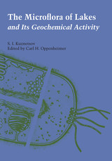
The geochemical processes that take place in water bodies do not stem entirely from the activity of bacteria, but are also determined by the biological activity of higher plants and animals. The Microflora of Lakes and Its Geochemical Activity, the first English translation of the work of S. I. Kuznetsov, renowned Soviet microbiologist, is a detailed description of these processes.
The Microflora of Lakes opens with a complete outline of the ecology and physical and chemical properties of water bodies and a discussion of the entire complex of hydrobionts, since these factors exert tremendous influence on the microbial population. The work then focuses on the principles of the morphology and physiology of the living cell, background knowledge essential to the understanding of the role of microorganisms in the chemical cycle. Having laid the groundwork for the discussion, Kuznetsov follows with chapters on the distribution of bacteria and transformations of organic matter in lakes. He then examines the role of bacteria in the oxygen regime, and the cycles of organic matter, nitrogen, sulfur, iron, manganese and phosphorus. The last chapter describes the role of microorganisms in sediments of calcium carbonate waters.
The Microflora of Lakes and Its Geochemical Activity provides a wealth of information on the microbial limnology of fresh-water lakes throughout the world, particularly in the Soviet Union. As a summary of the geochemical activities as related to the geographic, geological, and physical relationships of fresh-water lakes, it is a monumental study.
The Microflora of Lakes was translated for the National Science Foundation, Washington, D.C., by the Israel Program for Scientific Translations in Jerusalem.
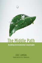
In The Middle Path, noted geographer Eric Lambin provides a concise, readable summary of the present state of the environment and considers what must be done if environmental catastrophe is to be avoided. Finding merit in the arguments of both optimists and pessimists, Lambin argues that it is not too late to exploit the inherent tendency toward equilibrium of large-scale systems such as the earth’s environment. By relying upon a combination of remedies as global as international cap-and-trade emission treaties and as local as municipal programs promoting the use of bicycles rather than cars, it may yet be possible to rescue humanity from a potentially fatal crisis of its own making.
Based on rigorous scientific analysis, and strikingly free of ideological prejudice, The Middle Path presents a fresh view of our troubled future, brilliantly balancing tough-minded realism with humanitarian ideals of cooperation and ingenuity.
The past decade has been characterized by remarkable advances in meteorological observation, computing techniques, and data-visualization technology. However, the benefit of these advances can only be fully realized with the introduction of a systematic, applied approach to meteorological education that allows well-established theoretical concepts to be applied to modernized observational and numerical datasets.
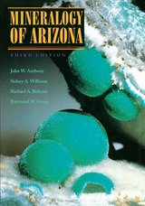
For nearly 20 years,Mineralogy of Arizona has been respected as the definitive reference on Arizona minerals. Now completely revised and greatly expanded with breathtaking new color photographs, the third edition covers 232 minerals discovered in Arizona since the first edition, including 28 first identified in the state.
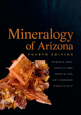
Chapters in this fourth edition of Mineralogy of Arizona cover gemstones and lapidary materials, fluorescent minerals, and an impressive catalog of mineral species. The authors also discuss mineral districts, including information about the geology, mineralogy, and age of mineral occurrences throughout the state. The book includes detailed maps of each county, showing the boundaries and characteristics of the mineral districts present in the state.
Arizona’s rich mineral history is well illustrated by the more than 300 color photographs of minerals, gemstones, and fluorescent minerals that help the reader identify and understand the rich and diverse mineralogy of Arizona. Anyone interested in the mineralogy and geology of the state will find this the most up-to-date compilation of the minerals known to occur in Arizona.
Nevada has an extraordinary diversity of minerals, some of them unique to the state and some the focus of human exploitation for millennia. Minerals of Nevada is the first synoptic catalog of Nevada minerals, listing every mineral found in the state along with the places where they occur. The book includes the geologic history of the state, the history of mining in Nevada, descriptions of significant mineral deposits and mining districts, maps, and an album of striking color photographs of rare and important minerals.
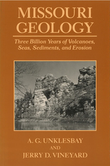
Intended for the general reader, Missouri Geology is a well-illustrated introduction to the fascinating geology of Missouri.
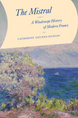
Every year, the chilly mistral wind blows through the Rhône valley of southern France, across the Camargue wetlands, and into the Mediterranean Sea. Most forceful when winter turns to spring, the wind knocks over trees, sweeps trains off their tracks, and destroys crops. Yet the mistral turns the sky clear and blue, as it often appears in depictions of Provence. The legendary wind is central to the area’s regional identity and has inspired artists and writers near and far for centuries.
This force of nature is the focus of Catherine Dunlop’s The Mistral, a wonderfully written examination of the power of the mistral wind, and in particular, the ways it challenged central tenets of nineteenth-century European society: order, mastery, and predictability. As Dunlop shows, while the modernizing state sought liberation from environmental realities through scientific advances, land modification, and other technological solutions, the wind blew on, literally crushing attempts at control, and becoming increasingly integral to regional feelings of place and community.
The essays in this volume argue for a theorizing of both urban policymaking and place-making that understands them as groups of territorial and relational geographies. It broadens our comprehension of agents of transference, reconceiving how policies are made mobile, and acknowledging the importance of interlocal policy mobility. Through the richness of its empirical examples from Europe, North America, South America, Africa, Asia, and Australia, contributors bring to light the significant methodological challenges that researchers face in the study of an urban–global, territorial–relational conceptualization of cities and suggest productive new approaches to understanding urbanism in a networked world.
Contributors: S. Harris Ali, York U, Toronto; Allan Cochrane, Open U; Roger Keil , York U, Toronto; Doreen Massey, Open U; Donald McNeill, U of Western Sydney; Jamie Peck, U of British Columbia; Jennifer Robinson, University College London.
consolidate their power realized that better knowledge of
their lands would strengthen their control over them. By
1550, the cartographer's art had already become an important
instrument for bringing territories under the control of
centralized government; increasing governmental reliance on
maps stimulated the refinement of cartographic techniques
throughout the following century.
This volume, a detailed survey of the political uses of
cartography between 1400 and 1700 in Italy, France, England,
Poland, Austria, and Spain, answers these questions: When
did monarchs and ministers begin to perceive that maps could
be useful in government? For what purposes were maps
commissioned? How accurate and useful were they? How did
cartographic knowledge strengthen the hand of government?
The chapters offer new insights into the development of
cartography and its role in European history.
Contributors to the volume are John Marino, Peter
Barber, David Buisseret, Geoffrey Parker, James Vann, and
Michael J. Mikòs.
Described by William Morris as “most unimaginably strange,” the landscape of Iceland has fascinated and inspired travelers, scientists, artists, and writers throughout history. This book provides a contemporary understanding of the landscape as a whole, not only its iconic glaciers and volcanoes, but also its deserts, canyons, plants, and animals. The book examines historic and modern scientific studies of the landscape and animals, as well as accounts of early visitors to the land. These were captivating people, some eccentric but most drawn to Iceland by an enthrallment with all things northern, a desire to experience the land of the sagas, or plain scientific and touristic curiosity. Featuring many spectacular illustrations, this is a fine exploration of a most singular landscape.
In The Mountain, geographers Bernard Debarbieux and Gilles Rudaz trace the origins of the very concept of a mountain, showing how it is not a mere geographic feature but ultimately an idea, one that has evolved over time, influenced by changes in political climates and cultural attitudes. To truly understand mountains, they argue, we must view them not only as material realities but as social constructs, ones that can mean radically different things to different people in different settings.
From the Enlightenment to the present day, and using a variety of case studies from all the continents, the authors show us how our ideas of and about mountains have changed with the times and how a wide range of policies, from border delineation to forestry as well as nature protection and social programs, have been shaped according to them. A rich hybrid analysis of geography, history, culture, and politics, the book promises to forever change the way we look at mountains.
In Mountains of Fire, Clive Oppenheimer invites readers to stand with him in the shadow of an active volcano. Whether he is scaling majestic summits, listening to hissing lava at the crater’s edge, or hunting for the far-flung ashes from Earth’s greatest eruptions, Oppenheimer is an ideal guide, offering readers the chance to tag along on the daring, seemingly-impossible journeys of a volcanologist.
In his eventful career as a volcanologist and filmmaker, Oppenheimer has studied volcanoes around the world. He has worked with scientists in North Korea to study Mount Paektu, a volcano name sung in national anthems on both sides of the Demilitarized Zone. He has crossed the Sahara to reach the fabled Tiéroko volcano in the Tibesti Mountains of Chad. He spent months camped atop Antarctica’s most active volcano, Mount Erebus, to record the pulse of its lava lake.
Mountains of Fire reveals how volcanic activity is entangled with our climate and environment, as well as our economy, politics, culture, and beliefs. These adventures and investigations make clear the dual purpose of volcanology—both to understand volcanoes for science’s sake and to serve the communities endangered and entranced by these mountains of fire.
In The Mysteries of the Marco Polo Maps, historian of cartography Benjamin B. Olshin offers the first credible book-length analysis of these artifacts, charting their course from obscure origins in the private collection of Italian-American immigrant Marcian Rossi in the 1930s; to investigations of their authenticity by the Library of Congress, J. Edgar Hoover, and the FBI; to the work of the late cartographic scholar Leo Bagrow; to Olshin’s own efforts to track down and study the Rossi maps, all but one of which are in the possession of Rossi’s great-grandson Jeffrey Pendergraft. Are the maps forgeries, facsimiles, or modernized copies? Did Marco Polo’s daughters—whose names appear on several of the artifacts—preserve in them geographic information about Asia first recorded by their father? Or did they inherit maps created by him? Did Marco Polo entrust the maps to Admiral Ruggero Sanseverino, who has links to Rossi’s family line? Or, if the maps have no connection to Marco Polo, who made them, when, and why?
Regardless of the maps’ provenance, Olshin’s tale—stretching from the remote reaches of the northern Pacific to early Chinese legends—takes readers on a journey confounding yet fascinating, offering insights into Italian history, the age of exploration, and the wonders of cartography.
READERS
Browse our collection.
PUBLISHERS
See BiblioVault's publisher services.
STUDENT SERVICES
Files for college accessibility offices.
RECENTLY PUBLISHED


UChicago Accessibility Resources
home | accessibility | search | about | contact us
BiblioVault ® 2001 - 2024
The University of Chicago Press